Bank nearby Brac lanka Finance P L C
Sri Lanka
Bank nearby Brac lanka Finance P L C
Brac lanka Finance P L C
Beliatta, Sri Lanka
contacts phone
:
+94
Latitude:
6.0474393
, Longitude:
80.7336461
larger map & directions
read more
nearest Bank
70 m
Peoples' Bank
Beliatta - Tangalle Road, Beliatta
Bank
read more
140 m
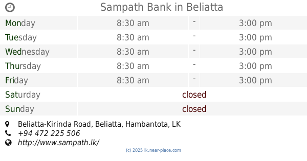
Sampath Bank
Beliatta-Kirinda Road, Beliatta
Bank
read more
238 m
Commercial Bank Beliatta Branch
No.50, Walasmulla Road, Beliatta
Bank
read more
255 m
NSB ATM
Beliatta - Walasmulla Road, Beliatta
Bank
read more
264 m
National Savings Bank
No. 56, Beliatta - Walasmulla Road, Beliatta
Bank
read more
295 m
Seylan Bank PLC
# 73, Tangalle Road Hakmana - Beliatte - Tangalle Road, Beliatta
Bank
read more
305 m
Bimputh Finance PLC
Beliatta - Walasmulla Road, Beliatta
Bank
read more
366 m
HDC Co-op Bank
Beliatta - Walasmulla Road, Beliatta
Bank
read more
4.345 km
Co-operative Rural Bank, Nihiluwa
Hambantota
Bank
read more
7.089 km
HDC Bank
Matara Road, Tangalle
Bank
read more
7.145 km
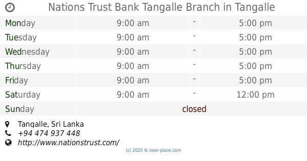
Nations Trust Bank Tangalle Branch
Tangalle
Bank
read more
7.191 km
Bank Of Ceylon
Kudawella
Bank
read more
8.226 km
Sanasa Bank Gammedapitiya
Matara
Bank
read more
9.967 km
Sampath Bank
Mahawela road Dickwella
Bank
read more
10.071 km
Regional Development Bank
Dikwella
Bank
read more
10.136 km
Co-Operative Rural Bank
B101, Dikwella
Bank
read more
11.494 km
People's Bank
B275
Bank
read more
11.863 km
Sanasa Bank Galkanda
Matara
Bank
read more
12.434 km
Bank of Ceylon Walasmulla Branch
Walasmulla
Bank
read more
12.436 km
Bank of Ceylon
Walasmulla
Bank
read more
12.504 km
Hatton National Bank හැටන් නැෂනල් බැංකුව
Beliatta - Walasmulla Road, Walasmulla
Bank
read more
14.287 km
DFCC Bank
Godauda
Bank
read more
15.856 km
Parawahera Naotunna Sanasa
Sanasa Mandiraya, Rathmale Road, parawahera, Kekanadura, Rathmale Road, Kekanadura
Bank
read more
17.244 km
National Savings Bank
No. 06, Meddewatte-Kekanadure-Yatiyana Road, Kekanadura
Bank
read more
18.668 km
Sanasa Development Bank
Hakmana Mulatiyana Rd, Deiyandara
Bank
read more
📑
all categories
Accounting
Administrative area level 1
Administrative area level 2
Airport
Amusement park
Aquarium
Art gallery
Atm
Bakery
Bank
Bar
Beauty salon
Bicycle store
Book store
Bowling alley
Bus station
Cafe
Campground
Car dealer
Car rental
Car repair
Car wash
Casino
Cemetery
Church
City hall
Clothing store
Colloquial area
Convenience store
Country
Courthouse
Dentist
Department store
Doctor
Electrician
Electronics store
Embassy
Finance
Fire station
Florist
Food
Funeral home
Furniture store
Gas station
General contractor
Grocery or supermarket
Gym
Hair care
Hardware store
Health
Hindu Temple
Home goods store
Hospital
Insurance agency
Intersection
Jewelry store
Laundry
Lawyer
Library
Light rail station
Liquor store
Local government office
Locality
Locksmith
Lodging
Meal delivery
Meal takeaway
Mosque
Movie rental
Movie theater
Moving company
Museum
Natural feature
Neighborhood
Night club
Painter
Park
Parking
Pet store
Pharmacy
Physiotherapist
Place of worship
Plumber
Point of interest
Police
Political
Post office
Premise
Real estate agency
Restaurant
Roofing contractor
Route
Rv park, camping
School
Shoe store
Shopping mall
Spa
Stadium
Storage
Store
Subpremise
Supermarket
Synagogue
Taxi stand
Train station
Transit station
Travel agency
University
Veterinary care
Zoo
administrative area level 3
sublocality level 1
sublocality level 2
↑