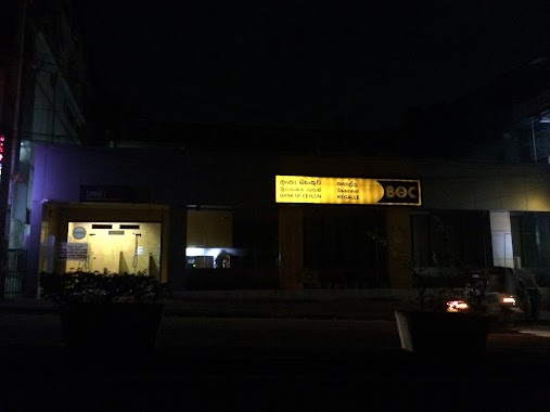
Bank nearby Samurdhi Bank
Coronavirus disease (COVID-19) Situation
confirmed cases
672754
deaths
16897
Sri Lanka
Bank nearby Samurdhi Bank
Samurdhi Bank
Maharachchimulla Sri Lanka
contacts phone
:
+94
Latitude:
7.3492846
, Longitude:
80.2047448
read more
nearest Bank
106 m
co-op bank
Maharachchimulla
Bank
read more
3.526 km
Rural Bank
Alawwa-Maharagama Road, Boyawalana
Bank
read more
3.527 km
People's Bank
Alawwa-Maharagama Road, Boyawalana
Bank
read more
3.729 km
Samurdhi Bank
Sri Lanka
Bank
read more
3.879 km
SANASA Godakuruwa
Kurunegala
Bank
read more
3.953 km
Cooperative Rural Bank
Kurunegala
Bank
read more
4.154 km
ග්රාමීය බැංකුව - පඹදෙණිය
Pambadeniya
Bank
read more
4.866 km
Divinaguma Prajamula Bank
Waduwawa
Bank
read more
6.651 km
F.I.C.Bank
Sri Lanka
Bank
read more
7.285 km
Sampath Bank
B9, Alawwa
Bank
read more
8.479 km
Bujjomuwa Co-op Bank
Bujjomuwa Station Road, Thummulla
Bank
read more
8.852 km
Regional Rural Bank - Wadakada
Wadakada
Bank
read more
8.954 km
Seylan Bank PLC - Giriulla Branch
No 27, Maha Veediya, Negombo Road, Giriulla
Bank
read more
9.355 km
Sanasa Development Bank
Giriulla
Bank
read more
9.453 km
CDB
Negombo-Kurunegala Road, Giriulla
Bank
read more
9.774 km
Lak Jaya Micro Finance Ltd Narammala
Kurunegala-Narammala-Madampe Road, Narammala
Bank
read more
10.874 km
Commercial Bank Polgahawela Branch
No 2/32, Kurunegala Road, Polgahawela.
Bank
read more
11.003 km
Sanasa Bank
Godawela, Polgahawela
Bank
read more
13.254 km
D.K.L Team (Pvt) Ltd
A1, Warakapola
Bank
read more
14.124 km
Berendina Micro Finance Institute
Nelundeniya-Alawwa Road, Nelundeniya
Bank
read more
14.273 km
Rajapakse Pawning Centre
Mirigama
Bank
read more
14.75 km
Peoples Bank
Devalegama
Bank
read more
15.772 km
Pothuhera Co op Ru Bank ATM
A6, Pothuhera
Bank
read more
17.134 km
Bank of Ceylon
No 7, A1, Galigamuwa
Bank
read more
18.405 km
BOC Super Grade Branch
Kegalle
Bank
read more
📑
all categories
Accounting
Administrative area level 1
Administrative area level 2
Airport
Amusement park
Aquarium
Art gallery
Atm
Bakery
Bank
Bar
Beauty salon
Bicycle store
Book store
Bowling alley
Bus station
Cafe
Campground
Car dealer
Car rental
Car repair
Car wash
Casino
Cemetery
Church
City hall
Clothing store
Colloquial area
Convenience store
Country
Courthouse
Dentist
Department store
Doctor
Electrician
Electronics store
Embassy
Finance
Fire station
Florist
Food
Funeral home
Furniture store
Gas station
General contractor
Grocery or supermarket
Gym
Hair care
Hardware store
Health
Hindu Temple
Home goods store
Hospital
Insurance agency
Intersection
Jewelry store
Laundry
Lawyer
Library
Light rail station
Liquor store
Local government office
Locality
Locksmith
Lodging
Meal delivery
Meal takeaway
Mosque
Movie rental
Movie theater
Moving company
Museum
Natural feature
Neighborhood
Night club
Painter
Park
Parking
Pet store
Pharmacy
Physiotherapist
Place of worship
Plumber
Point of interest
Police
Political
Post office
Premise
Real estate agency
Restaurant
Roofing contractor
Route
Rv park, camping
School
Shoe store
Shopping mall
Spa
Stadium
Storage
Store
Subpremise
Supermarket
Synagogue
Taxi stand
Train station
Transit station
Travel agency
University
Veterinary care
Zoo
administrative area level 3
sublocality level 1
sublocality level 2
↑