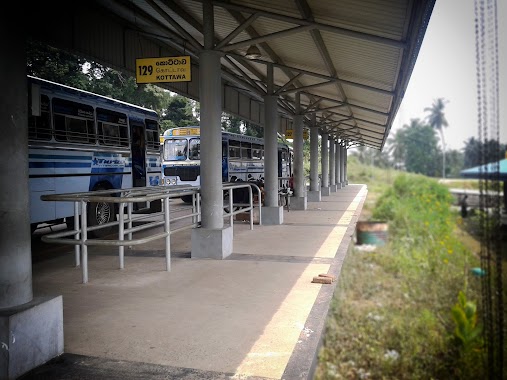
Bus station nearby Perengiyawala Junction Bus Stop
Coronavirus disease (COVID-19) Situation
confirmed cases
672754
deaths
16897
Sri Lanka
Bus station nearby Perengiyawala Junction Bus Stop
Perengiyawala Junction Bus Stop
Galagedera - Horana Road, Kalutara, Western Province, LK Sri Lanka
contacts phone
:
+94
Latitude:
6.7652353
, Longitude:
80.0573178
larger map & directions
read more
nearest Bus station
356 m
Wele Kade Bus Stop
Bus station
read more
2.228 km
Moragahahena Bus Stand
Galagedera - Horana Road, Talagala
Bus station
read more
2.732 km
Thalgahawila Junction Bus Stop
Galagedera - Horana Road, Millewa
Bus station
read more
2.953 km
Meepagala Bus Stop
Gonapola - Thalagala Road, Talagala
Bus station
read more
3.026 km
Welipillewa Bus Stop
Thalgahavila Road
Bus station
read more
3.639 km
Millewa Bus Station
Galagedera - Horana Road, Millewa
Bus station
read more
3.961 km
Thalagala Bus Stop
Kottawa - Talagala Road
Bus station
read more
3.992 km
Yakahaluwa-Kottawa Bus Station
yakahaluwa wiwekarama rod
Bus station
read more
5.044 km
Horana Rd Bus Depot
A8, Horana
Bus station
read more
5.335 km
Meewanapalana Junction Bus Stop
Gurugoda-Malagala-Padukka Road
Bus station
read more
5.41 km
Ambagas Junction Bus Stop
Gurugoda-Malagala-Padukka Road
Bus station
read more
5.567 km
Koswatta Road Bus Stop
Kottawa - Talagala Road
Bus station
read more
5.591 km
Punchi Iridapola Bus Stop
Ankuttawala Road
Bus station
read more
5.8 km
Bo Gaha Bus Stop
Kottawa - Talagala Road
Bus station
read more
5.878 km
Ilimba Junction
A8, Horana
Bus station
read more
5.994 km
Gurugoda Junction Bus Stop
A8, Horana
Bus station
read more
6.017 km
Mr.sarath kaththriachchige
Kottawa - Talagala Road
Bus station
read more
6.309 km
Moonamale Handiya Bus Stop
Kottawa - Talagala Road
Bus station
read more
11.212 km
Mattegoda Sathosa Bus Stop
Salgaha Approach Road, Polgasowita
Bus station
read more
11.809 km
Blooming Buds Bus Stop
510,kitulahena,Mattefoda
Bus station
read more
12.058 km
Bakeriya Junction Bus Stop
Makandana Road, Piliyandala
Bus station
read more
13.126 km
Imbuliha Bus Stop
Panadura
Bus station
read more
14.694 km
Rubberwatte Bus Stop
Kaduwela - Athurugiriya Road
Bus station
read more
17.746 km
Daladawaththa Bus Stop
A2, Wadduwa
Bus station
read more
18.143 km
Wadduwa Central College Bus Stop
A2, Wadduwa
Bus station
read more
📑
all categories
Accounting
Administrative area level 1
Administrative area level 2
Airport
Amusement park
Aquarium
Art gallery
Atm
Bakery
Bank
Bar
Beauty salon
Bicycle store
Book store
Bowling alley
Bus station
Cafe
Campground
Car dealer
Car rental
Car repair
Car wash
Casino
Cemetery
Church
City hall
Clothing store
Colloquial area
Convenience store
Country
Courthouse
Dentist
Department store
Doctor
Electrician
Electronics store
Embassy
Finance
Fire station
Florist
Food
Funeral home
Furniture store
Gas station
General contractor
Grocery or supermarket
Gym
Hair care
Hardware store
Health
Hindu Temple
Home goods store
Hospital
Insurance agency
Intersection
Jewelry store
Laundry
Lawyer
Library
Light rail station
Liquor store
Local government office
Locality
Locksmith
Lodging
Meal delivery
Meal takeaway
Mosque
Movie rental
Movie theater
Moving company
Museum
Natural feature
Neighborhood
Night club
Painter
Park
Parking
Pet store
Pharmacy
Physiotherapist
Place of worship
Plumber
Point of interest
Police
Political
Post office
Premise
Real estate agency
Restaurant
Roofing contractor
Route
Rv park, camping
School
Shoe store
Shopping mall
Spa
Stadium
Storage
Store
Subpremise
Supermarket
Synagogue
Taxi stand
Train station
Transit station
Travel agency
University
Veterinary care
Zoo
administrative area level 3
sublocality level 1
sublocality level 2
↑