Cafe nearby Raa Kade
Coronavirus disease (COVID-19) Situation
confirmed cases
672754
deaths
16897
Sri Lanka
Cafe nearby Raa Kade
Raa Kade
A8, Panadura, Kalutara, LK Sri Lanka
contacts phone
:
+94 382 241 052
Latitude:
6.7065443
, Longitude:
79.9337203
larger map & directions
read more
nearest Cafe
2.267 km
AMN Intimate Lanka (Pvt) Ltd
No.26, Sri Lanka., Modarawila Industrial Zone, පානදුර
Cafe
read more
2.582 km
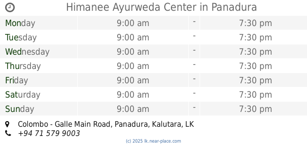
Himanee Ayurweda Center
Colombo - Galle Main Road, Panadura
Cafe
read more
2.719 km
Bread Line
Panadura
Cafe
read more
2.862 km
Bakers World
Sri Mahavihara Road, Panadura
Cafe
read more
2.931 km
URBAN TASTE by Pavithri Godahewa
118 /A Janapriya Mawatha, Panadura
Cafe
read more
2.956 km
Kiri Icecream Parlour
Uyankele, Panadura
Cafe
read more
3.022 km
Perera & Sons
Galle Road, Panadura
Cafe
read more
3.047 km
The Fab
Galle Road, Panadura
Cafe
read more
3.063 km
Salgado Bakers - Panadura Factory outlet
Sri Gunananda Mawatha, Panadura
Cafe
read more
3.165 km
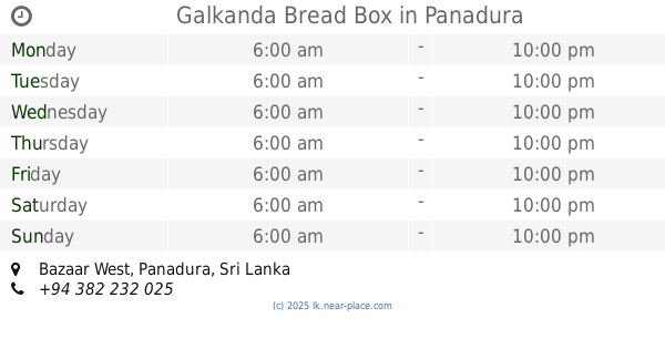
Galkanda Bread Box
Bazaar West, Panadura
Cafe
read more
3.312 km
Sahana seva Cafe
Bazaar North, Panadura
Cafe
read more
3.557 km
Agri Firm (Fruit Juice And Vegetables)
Panadura
Cafe
read more
3.693 km
Manaram Foods (Nescafe Machine Rent Place)
Colombo - Galle Main Road, Panadura
Cafe
read more
3.802 km
Scoops N' Smiles Yummy Treats
Walana, Panadura
Cafe
read more
4.008 km
Hopper Shop Evening
Walana, Panadura
Cafe
read more
4.141 km
Nishan Pastry Shop
no 95, Old Galle Road, Panadura
Cafe
read more
4.46 km
Rathna Cafe
107 Old Galle Road, Panadura
Cafe
read more
4.761 km
Karunarthan Cafe
128 Wadduwa
Cafe
read more
4.961 km
Snow Suger
Wadduwa East, Wadduwa
Cafe
read more
5.909 km
Maams Foods
Panadura
Cafe
read more
6.032 km
Naflan Travels
Panadura
Cafe
read more
6.04 km
Perera and Sons
B216
Cafe
read more
6.278 km
Prabasa Enterprises
230a, B216, Welmilla
Cafe
read more
6.39 km
Kings bakers
Moronthuduwa
Cafe
read more
6.683 km
Strings Food Outlet
Koralawella South, Moratuwa
Cafe
read more
📑
all categories
Accounting
Administrative area level 1
Administrative area level 2
Airport
Amusement park
Aquarium
Art gallery
Atm
Bakery
Bank
Bar
Beauty salon
Bicycle store
Book store
Bowling alley
Bus station
Cafe
Campground
Car dealer
Car rental
Car repair
Car wash
Casino
Cemetery
Church
City hall
Clothing store
Colloquial area
Convenience store
Country
Courthouse
Dentist
Department store
Doctor
Electrician
Electronics store
Embassy
Finance
Fire station
Florist
Food
Funeral home
Furniture store
Gas station
General contractor
Grocery or supermarket
Gym
Hair care
Hardware store
Health
Hindu Temple
Home goods store
Hospital
Insurance agency
Intersection
Jewelry store
Laundry
Lawyer
Library
Light rail station
Liquor store
Local government office
Locality
Locksmith
Lodging
Meal delivery
Meal takeaway
Mosque
Movie rental
Movie theater
Moving company
Museum
Natural feature
Neighborhood
Night club
Painter
Park
Parking
Pet store
Pharmacy
Physiotherapist
Place of worship
Plumber
Point of interest
Police
Political
Post office
Premise
Real estate agency
Restaurant
Roofing contractor
Route
Rv park, camping
School
Shoe store
Shopping mall
Spa
Stadium
Storage
Store
Subpremise
Supermarket
Synagogue
Taxi stand
Train station
Transit station
Travel agency
University
Veterinary care
Zoo
administrative area level 3
sublocality level 1
sublocality level 2
↑