Cafe nearby S&S Bakers
Coronavirus disease (COVID-19) Situation
confirmed cases
672754
deaths
16897
Sri Lanka
Cafe nearby S&S Bakers
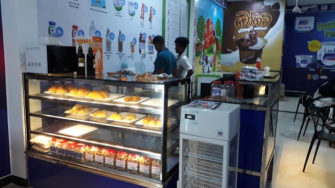
S&S Bakers
61 A, Waskaduwa - Bandaragama Road, Bandaragama, Kalutara, LK Sri Lanka
contacts phone
:
+94 382 288 022
Latitude:
6.7128025
, Longitude:
79.990181
larger map & directions
read more
nearest Cafe
338 m
Perera & Sons
Bandaragama East, Bandaragama
Cafe
read more
1.528 km
Fresh and Fast
Gelanigama, Bandaragama
Cafe
read more
3.017 km
Perera and Sons
B216
Cafe
read more
3.358 km
Muthu Network
280E,Maithree Mawatha,Walgama,Welmille Junction
Cafe
read more
4.377 km
Prabasa Enterprises
230a, B216, Welmilla
Cafe
read more
6.548 km
Vision Com
Wadduwa
Cafe
read more
8.851 km
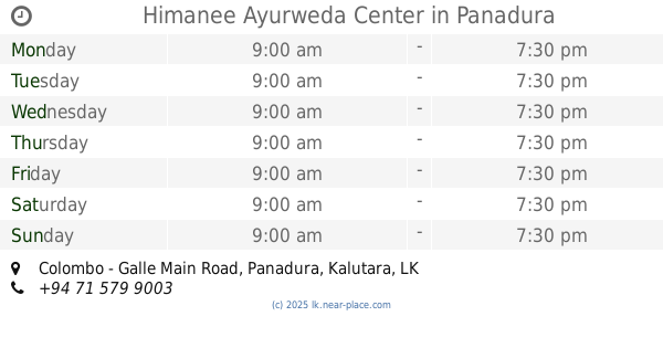
Himanee Ayurweda Center
Colombo - Galle Main Road, Panadura
Cafe
read more
9.32 km
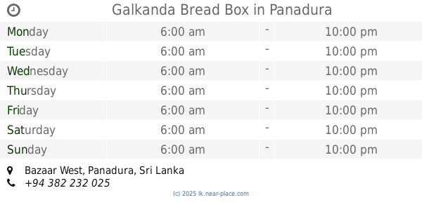
Galkanda Bread Box
Bazaar West, Panadura
Cafe
read more
10.154 km
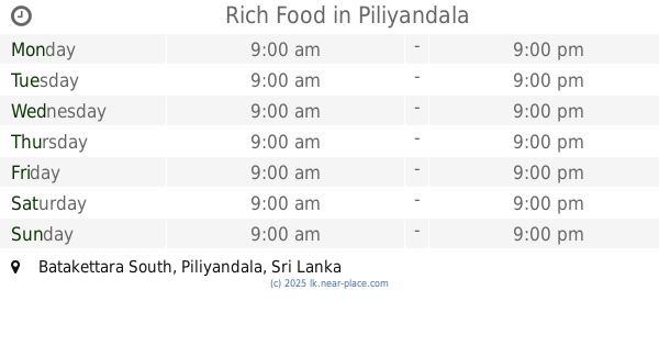
Rich Food
Batakettara South, Piliyandala
Cafe
read more
10.966 km
Dinidu Internet Cafe
Mattegoda West, Polgasowita
Cafe
read more
11.617 km
Hot Pot
Piliyandala Bypass Road, Piliyandala
Cafe
read more
12.498 km
Amarawardana Residency
148/2 Moratuwa - Piliyandala Road, Piliyandala
Cafe
read more
13.117 km
Abeyrathna Groceries
Moratuwa
Cafe
read more
13.584 km
Milk Bar කිරිහල
Moratuwa
Cafe
read more
14.408 km
Lucky Kiri Katha - Bokundara
Bokundara, Piliyandala
Cafe
read more
15.528 km
Vinula’s
South
Cafe
read more
15.963 km
Public Canteen
NEW OPD Building, 3rd Floor, Room 335 New OPD Building To Linac Building Path, Maharagama
Cafe
read more
16.366 km
Janatha Bake House
110 High Level Road, Maharagama
Cafe
read more
17.707 km
Daily Bread Cafe’
No. 391, Dehiwala Road, Boralesgamuwa
Cafe
read more
18.241 km
Reliance
Padukka
Cafe
read more
19.069 km
Milk Bar
Mount Lavinia
Cafe
read more
19.194 km
Gold Star Hotel
Dehiwala-Mount Lavinia
Cafe
read more
19.327 km
Toby's Estate Colombo
A2, Dehiwala-Mount Lavinia
Cafe
read more
19.389 km
Flavour
No.35, Hotel Road, Dehiwala-Mount Lavinia
Cafe
read more
19.943 km
Tharaka foods
Mount Lavinia
Cafe
read more
📑
all categories
Accounting
Administrative area level 1
Administrative area level 2
Airport
Amusement park
Aquarium
Art gallery
Atm
Bakery
Bank
Bar
Beauty salon
Bicycle store
Book store
Bowling alley
Bus station
Cafe
Campground
Car dealer
Car rental
Car repair
Car wash
Casino
Cemetery
Church
City hall
Clothing store
Colloquial area
Convenience store
Country
Courthouse
Dentist
Department store
Doctor
Electrician
Electronics store
Embassy
Finance
Fire station
Florist
Food
Funeral home
Furniture store
Gas station
General contractor
Grocery or supermarket
Gym
Hair care
Hardware store
Health
Hindu Temple
Home goods store
Hospital
Insurance agency
Intersection
Jewelry store
Laundry
Lawyer
Library
Light rail station
Liquor store
Local government office
Locality
Locksmith
Lodging
Meal delivery
Meal takeaway
Mosque
Movie rental
Movie theater
Moving company
Museum
Natural feature
Neighborhood
Night club
Painter
Park
Parking
Pet store
Pharmacy
Physiotherapist
Place of worship
Plumber
Point of interest
Police
Political
Post office
Premise
Real estate agency
Restaurant
Roofing contractor
Route
Rv park, camping
School
Shoe store
Shopping mall
Spa
Stadium
Storage
Store
Subpremise
Supermarket
Synagogue
Taxi stand
Train station
Transit station
Travel agency
University
Veterinary care
Zoo
administrative area level 3
sublocality level 1
sublocality level 2
↑