Florist nearby Malshan Flora
Coronavirus disease (COVID-19) Situation
confirmed cases
672754
deaths
16897
Sri Lanka
Florist nearby Malshan Flora
Malshan Flora
Matara, Sri Lanka
contacts phone
:
+94
Latitude:
5.9417757
, Longitude:
80.5132232
larger map & directions
read more
nearest Florist
741 m
Sesatha Creation
Kamburugamuwa
Florist
read more
2.599 km
Pubudu Flora
Matara
Florist
read more
2.628 km
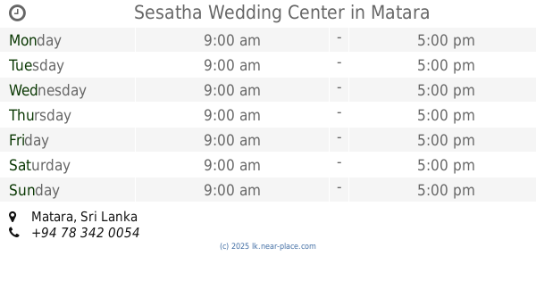
Sesatha Wedding Center
Matara
Florist
read more
2.629 km
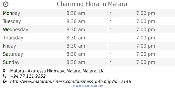
Charming Flora
Matara - Akuressa Highway, Matara
Florist
read more
2.63 km
Flower Key Nature
Godagama - Sulthanagoda Road, Matara
Florist
read more
3.359 km
Regal Florists
Matara
Florist
read more
3.494 km
Rayland Florist
Railway Station Road, Matara
Florist
read more
3.867 km
Supipi Flora
B275, Matara
Florist
read more
4.066 km
Sarasi Flora
18, New Shopping Complex, Old Tangalle Road, Matara
Florist
read more
4.07 km
Sarasi Flora
Old Tangalle Road, Matara
Florist
read more
10.255 km
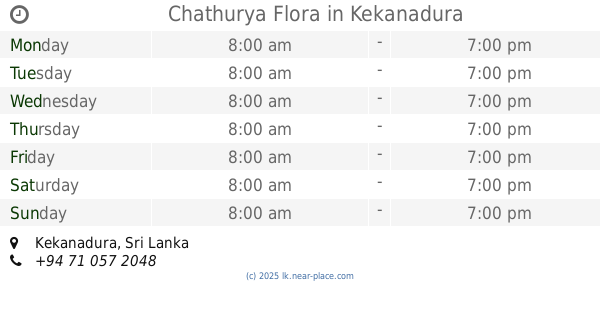
Chathurya Flora
Kekanadura
Florist
read more
18.238 km
Suhada Flowers
Tangalle Road, Batigama
Florist
read more
29.362 km
Hello Flowers event
Pitabeddara
Florist
read more
32.836 km
New Jayasiri Florists
Thissa Road, Tangalle
Florist
read more
34.151 km
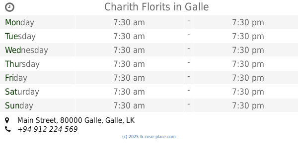
Charith Florits
9, Main Street, Galle
Florist
read more
34.155 km
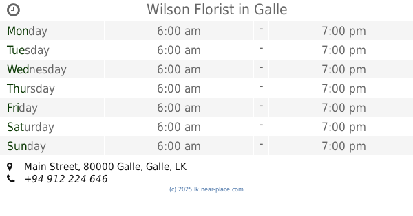
Wilson Florist
Main Street, Galle
Florist
read more
35.427 km
Kmal
Wakwella Road, Galle
Florist
read more
36.617 km
Prabath Flora
Ananda Mawatha, Galle
Florist
read more
36.991 km
සමුකිරණ සහන අවමංගල්ය සේවය
Bengamuwa,Sothern Province
Florist
read more
44.213 km
Wishmitha Flora
Galle - Baddegama Road, Baddegama
Florist
read more
47.107 km
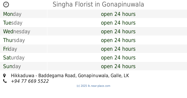
Singha Florist
Hikkaduwa - Baddegama Road, Gonapinuwala
Florist
read more
50.72 km
Lakmini Flora
Hikkaduwa
Florist
read more
54.609 km
Nimal Florist
B14, Pitigala
Florist
read more
57.312 km
Lassana Flora (Pvt) Ltd - Embilipitiya Branch
A18, Embilipitiya
Florist
read more
59.324 km
Anura Flowerist
rathnanapura road, Udawalawa
Florist
read more
📑
all categories
Accounting
Administrative area level 1
Administrative area level 2
Airport
Amusement park
Aquarium
Art gallery
Atm
Bakery
Bank
Bar
Beauty salon
Bicycle store
Book store
Bowling alley
Bus station
Cafe
Campground
Car dealer
Car rental
Car repair
Car wash
Casino
Cemetery
Church
City hall
Clothing store
Colloquial area
Convenience store
Country
Courthouse
Dentist
Department store
Doctor
Electrician
Electronics store
Embassy
Finance
Fire station
Florist
Food
Funeral home
Furniture store
Gas station
General contractor
Grocery or supermarket
Gym
Hair care
Hardware store
Health
Hindu Temple
Home goods store
Hospital
Insurance agency
Intersection
Jewelry store
Laundry
Lawyer
Library
Light rail station
Liquor store
Local government office
Locality
Locksmith
Lodging
Meal delivery
Meal takeaway
Mosque
Movie rental
Movie theater
Moving company
Museum
Natural feature
Neighborhood
Night club
Painter
Park
Parking
Pet store
Pharmacy
Physiotherapist
Place of worship
Plumber
Point of interest
Police
Political
Post office
Premise
Real estate agency
Restaurant
Roofing contractor
Route
Rv park, camping
School
Shoe store
Shopping mall
Spa
Stadium
Storage
Store
Subpremise
Supermarket
Synagogue
Taxi stand
Train station
Transit station
Travel agency
University
Veterinary care
Zoo
administrative area level 3
sublocality level 1
sublocality level 2
↑