Food nearby Hot Pot
Coronavirus disease (COVID-19) Situation
confirmed cases
672754
deaths
16897
Sri Lanka
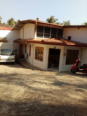
Food nearby Hot Pot
Hot Pot
Arangala, Malabe, Sri Lanka
contacts phone
:
+94
Latitude:
6.8910341
, Longitude:
79.9642488
larger map & directions
read more
nearest Food
1.277 km
Oliya Water Mart
Hokandara East, Hokandara
Food
read more
1.61 km
Asian foods and catering services
329/8 new kandy road malabe, Malabe
Food
read more
1.682 km
Pan Kendiya Wedding Caterers
877/2 Athurugiriya Road, Malabe
Food
read more
1.736 km
Premero (Pvt) Limited
141/4/1 Bakmeegaha Road, Pore Athurugiriya, Athurugiriya
Food
read more
1.764 km
Rathu kaju
No 211, Malabe
Food
read more
1.764 km
Rathu kaju Online Shop
No 211, Malabe
Food
read more
1.803 km
Asiri gram center
Thalangama North, B
Food
read more
1.863 km
Suchithe
Robert Gunawardena Mawatha, Malabe
Food
read more
2.008 km
Sanjeewa Rice Mills
Kahanthota Road, Malabe
Food
read more
2.353 km
Purple Pine Juice Bar
Thalangama North, B
Food
read more
2.367 km
Sudu Hamine Foods
Thalangama North, B
Food
read more
2.762 km
Chill Hut Juice Bar
Malabe
Food
read more
2.842 km
Dilanka Food
B263, Malabe
Food
read more
2.842 km
Dilanka Food and Catering
B263, Malabe
Food
read more
2.842 km
Dilanka Food and Catering
New Kandy Road, Malabe
Food
read more
2.868 km
greenO
8/A/2 , Pore, Athurugiriya, 10150, Athurugiriya
Food
read more
2.948 km
Roshan Catering
Malabe
Food
read more
3.082 km
Sweet Hub
Muttettugoda
Food
read more
3.091 km
Bojunka Food
B240
Food
read more
3.172 km
Samudra Catering Services
Kalalgoda, 63/66, Fortune Terrace, Pannipitiya
Food
read more
3.213 km
Kanthi Super Center
685 A Warakanaththa korathota kaduwela
Food
read more
3.264 km
Asiri Gram Center
Kotte - Bope Road
Food
read more
3.504 km
Dulani Food Center
205 B47, Sri Jayawardenepura Kotte
Food
read more
3.523 km
Fruit Shop
Thalawathugoda East
Food
read more
5.005 km
Spice Land (Pvt) Ltd
Athurugiriya South
Food
read more
📑
all categories
Accounting
Administrative area level 1
Administrative area level 2
Airport
Amusement park
Aquarium
Art gallery
Atm
Bakery
Bank
Bar
Beauty salon
Bicycle store
Book store
Bowling alley
Bus station
Cafe
Campground
Car dealer
Car rental
Car repair
Car wash
Casino
Cemetery
Church
City hall
Clothing store
Colloquial area
Convenience store
Country
Courthouse
Dentist
Department store
Doctor
Electrician
Electronics store
Embassy
Finance
Fire station
Florist
Food
Funeral home
Furniture store
Gas station
General contractor
Grocery or supermarket
Gym
Hair care
Hardware store
Health
Hindu Temple
Home goods store
Hospital
Insurance agency
Intersection
Jewelry store
Laundry
Lawyer
Library
Light rail station
Liquor store
Local government office
Locality
Locksmith
Lodging
Meal delivery
Meal takeaway
Mosque
Movie rental
Movie theater
Moving company
Museum
Natural feature
Neighborhood
Night club
Painter
Park
Parking
Pet store
Pharmacy
Physiotherapist
Place of worship
Plumber
Point of interest
Police
Political
Post office
Premise
Real estate agency
Restaurant
Roofing contractor
Route
Rv park, camping
School
Shoe store
Shopping mall
Spa
Stadium
Storage
Store
Subpremise
Supermarket
Synagogue
Taxi stand
Train station
Transit station
Travel agency
University
Veterinary care
Zoo
administrative area level 3
sublocality level 1
sublocality level 2
↑