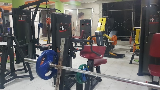
Gym nearby HardRock Fitness Club
Coronavirus disease (COVID-19) Situation
confirmed cases
672754
deaths
16897
Sri Lanka
Gym nearby HardRock Fitness Club
HardRock Fitness Club
Old Matale Road, Kandy, Kandy, LK Sri Lanka
contacts phone
:
+94 72 265 5555
Latitude:
7.3189163
, Longitude:
80.629157
larger map & directions
read more
nearest Gym
46 m
Zee's Gym
Old matale Road, Kandy
Gym
read more
328 m
Solid Fitness Gym
Katugastota Rd, Kandy
Gym
read more
328 m
Solid Fitness Gym
Katugastota Road, Kandy
Gym
read more
584 m
Mans World Gym
Katugastota
Gym
read more
917 m
Brian's Gym
Katugastota
Gym
read more
1.066 km
Feul Plus Gents And Ladies Gym
Katugastota
Gym
read more
1.182 km
Vaaj Fitness Centre Kandy
20000, 202 Katugastota Road, මහනුවර
Gym
read more
1.481 km
The Gym
Dharmashoka Mawatha, Kandy
Gym
read more
1.82 km
Yoga Noyel Dharamjith
Lady Torrington Road, Kandy
Gym
read more
2.159 km
Induwara Spa
Wariyapola Sri Sumangala Mawatha, Kandy
Gym
read more
2.522 km
Commercial Leasing & Finance PLC Kandy
E, 137 කොටුගොඩැල්ල වීදිය, මහනුවර
Gym
read more
2.561 km
Supliment Factory
25/1 Cross Street, Kandy
Gym
read more
2.646 km
YMCA
116A, East L Senanayake Veediya, Kandy
Gym
read more
2.861 km
Jmj Farm Shop 202 Colombo Street Kandy
Colombo Street, Kandy
Gym
read more
2.889 km
Samkaralliyadde Foundation
Peradeniya - Halloluwa - Katugastota, Katugastota
Gym
read more
2.906 km
Power Re Create Fitness Center
Colombo - Kandy Road, Kandy
Gym
read more
3.051 km
Nlf. Nadeera
219/A Peradeniya Road, Kandy
Gym
read more
3.082 km
Wickramarathna Furniture
Road Ambatanna, Matale
Gym
read more
4.23 km
Nuware Wela Playground
Ampitiya Road, Kandy
Gym
read more
4.419 km
Solid fitness centre
Katugastota
Gym
read more
4.518 km
LifeStyle Yoga Center
14 Mulgampola Road, Kandy
Gym
read more
4.54 km
Combat Fitness
Kandy
Gym
read more
4.544 km
Devon Gym
Ampitiya Road, Kandy
Gym
read more
5.712 km
Ranabima Sports Club Ground
no 20, Gannoruwa Road
Gym
read more
6.178 km
Cuts and Curves Fitness Center
Kundasale
Gym
read more
📑
all categories
Accounting
Administrative area level 1
Administrative area level 2
Airport
Amusement park
Aquarium
Art gallery
Atm
Bakery
Bank
Bar
Beauty salon
Bicycle store
Book store
Bowling alley
Bus station
Cafe
Campground
Car dealer
Car rental
Car repair
Car wash
Casino
Cemetery
Church
City hall
Clothing store
Colloquial area
Convenience store
Country
Courthouse
Dentist
Department store
Doctor
Electrician
Electronics store
Embassy
Finance
Fire station
Florist
Food
Funeral home
Furniture store
Gas station
General contractor
Grocery or supermarket
Gym
Hair care
Hardware store
Health
Hindu Temple
Home goods store
Hospital
Insurance agency
Intersection
Jewelry store
Laundry
Lawyer
Library
Light rail station
Liquor store
Local government office
Locality
Locksmith
Lodging
Meal delivery
Meal takeaway
Mosque
Movie rental
Movie theater
Moving company
Museum
Natural feature
Neighborhood
Night club
Painter
Park
Parking
Pet store
Pharmacy
Physiotherapist
Place of worship
Plumber
Point of interest
Police
Political
Post office
Premise
Real estate agency
Restaurant
Roofing contractor
Route
Rv park, camping
School
Shoe store
Shopping mall
Spa
Stadium
Storage
Store
Subpremise
Supermarket
Synagogue
Taxi stand
Train station
Transit station
Travel agency
University
Veterinary care
Zoo
administrative area level 3
sublocality level 1
sublocality level 2
↑