Gym nearby Quick Silver Gym
Coronavirus disease (COVID-19) Situation
confirmed cases
672754
deaths
16897
Sri Lanka
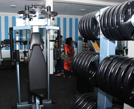
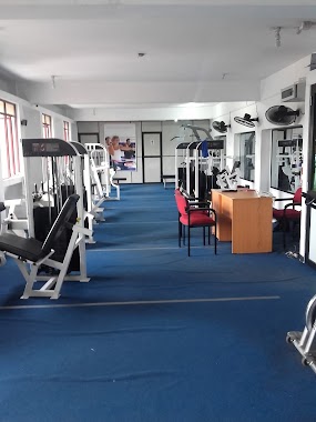
Gym nearby Quick Silver Gym
Quick Silver Gym
Colombo, Sri Lanka
contacts phone
:
+94
Latitude:
6.9303269
, Longitude:
79.8801726
larger map & directions
read more
nearest Gym
209 m
NSJ FITNESS CENTER
Wanathamulla, Colombo
Gym
read more
960 m
Fireball Gym
79 Maligawatte Road, Colombo
Gym
read more
971 m
Bin Hassan Playgrounds
Keera Kotuwa Road, Colombo
Gym
read more
1.051 km
Nalanda College Sports Complex
Vidyalaya Place, Colombo
Gym
read more
1.056 km
Hero Industries (Pvt) LTD
Sri Saddharma Mawatha, Colombo
Gym
read more
1.123 km
Virtusa Gym
Kopiawatta, Colombo
Gym
read more
1.25 km
Bellatrix Fitness Center
Mahawela Gardens, Colombo
Gym
read more
1.449 km
Fitness Niche
0800, 301 Leslie Ranagala Mawatha, Colombo
Gym
read more
1.46 km
Multifit Gym
P De S Kularatne Mawatha, Colombo
Gym
read more
1.711 km
UFO
75 A Kynsey Road, Colombo
Gym
read more
1.726 km
UrFO
75a Kynsey Road, Colombo
Gym
read more
1.753 km
Power World Gym
Power World, 271,1/1 Ward Place, Colombo
Gym
read more
1.929 km
Fitness Kingdom
Colombo
Gym
read more
1.948 km
O-Tone
96 Rosmead Place, Colombo
Gym
read more
1.978 km
Barressential
647, 4 Cotta Road, Colombo
Gym
read more
2.002 km
Railway Badminton stadium
Colombo
Gym
read more
2.12 km
Sugathadasa
AC6, Colombo
Gym
read more
2.173 km
Infas Lebbe
Sri Lanka
Gym
read more
2.211 km
Chandra silva playground
Sri Jayawardenepura Mawatha, Sri Jayawardenepura Kotte
Gym
read more
2.262 km
CLOSED The Kiss Fitness
338, T B Jayah Mawatha, Colombo
Gym
read more
2.438 km
Eser Marketing (Pvt) Ltd
No 310/2, George R. De Silva Mawatha, Colombo 13
Gym
read more
2.541 km
Power World Gym
Colombo
Gym
read more
3.18 km
Sadhana Yoga Shrushti
73 Alwis Place, Colombo
Gym
read more
3.221 km
Fitness Kiosk
Colombo
Gym
read more
3.255 km
Fitness Connection
GS 09 & 10 Racecourse Grand Stand, Rajakeeya Mawatha, Colombo
Gym
read more
📑
all categories
Accounting
Administrative area level 1
Administrative area level 2
Airport
Amusement park
Aquarium
Art gallery
Atm
Bakery
Bank
Bar
Beauty salon
Bicycle store
Book store
Bowling alley
Bus station
Cafe
Campground
Car dealer
Car rental
Car repair
Car wash
Casino
Cemetery
Church
City hall
Clothing store
Colloquial area
Convenience store
Country
Courthouse
Dentist
Department store
Doctor
Electrician
Electronics store
Embassy
Finance
Fire station
Florist
Food
Funeral home
Furniture store
Gas station
General contractor
Grocery or supermarket
Gym
Hair care
Hardware store
Health
Hindu Temple
Home goods store
Hospital
Insurance agency
Intersection
Jewelry store
Laundry
Lawyer
Library
Light rail station
Liquor store
Local government office
Locality
Locksmith
Lodging
Meal delivery
Meal takeaway
Mosque
Movie rental
Movie theater
Moving company
Museum
Natural feature
Neighborhood
Night club
Painter
Park
Parking
Pet store
Pharmacy
Physiotherapist
Place of worship
Plumber
Point of interest
Police
Political
Post office
Premise
Real estate agency
Restaurant
Roofing contractor
Route
Rv park, camping
School
Shoe store
Shopping mall
Spa
Stadium
Storage
Store
Subpremise
Supermarket
Synagogue
Taxi stand
Train station
Transit station
Travel agency
University
Veterinary care
Zoo
administrative area level 3
sublocality level 1
sublocality level 2
↑