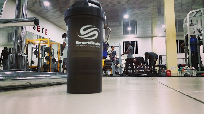
Gym nearby Zumba Studio.
Coronavirus disease (COVID-19) Situation
confirmed cases
672754
deaths
16897
Sri Lanka
Gym nearby Zumba Studio.
Zumba Studio.
178 D rilaulla juntion,negombo road,kandana, Ja-Ela, Sri Lanka
contacts phone
:
+94 77 837 8162
Latitude:
7.0564515
, Longitude:
79.8970802
larger map & directions
read more
nearest Gym
3 m
Danzo Fitness
Kandana
Gym
read more
65 m
Workout Fitness Center
68 Negombo-Colombo Main Road, Ja-Ela
Gym
read more
390 m
Super Sports Gym
Kandana
Gym
read more
421 m
Power Gym
Kandana
Gym
read more
455 m
Yoga Studio LK
689/9 Lancore Mawatha, Ja-Ela
Gym
read more
469 m
Fitnes First
K-Zone, Chilaw - Colombo Main Road, Ja-Ela
Gym
read more
507 m
Revolution Fitness
Kandana
Gym
read more
939 m
Fitness Gym
Chilaw - Colombo Main Road, Ja-Ela
Gym
read more
950 m
Tharanga Beauty Salon
Station Road, Kandana
Gym
read more
2.101 km
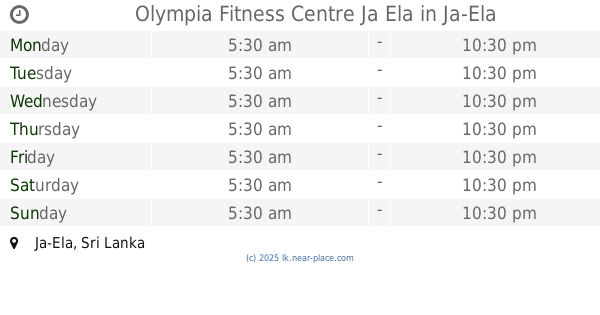
Olympia Fitness Centre Ja Ela
Ja-Ela
Gym
read more
2.244 km
Shakthi Gym
Nagoda Kandana, Ragama
Gym
read more
2.315 km
Renil Fernando Matrial Art Dojo
Linton Road, Ragama
Gym
read more
2.502 km
Kondale Gymnasium
No 183/1, Lake City, Ja-Ela
Gym
read more
2.524 km
SM Fitness
550 Kandana - Ganemulla Road, Ja-Ela
Gym
read more
2.777 km
Geshela Spa
4/3.no 48, Negombo Rd, Kandana
Gym
read more
2.795 km
Power Zone Gym
Alehiwatte Road, Welisara
Gym
read more
2.978 km
Cats Eye Gym & Fitness Centre
No,27,, Main Negombo Road,, Ja-Ela
Gym
read more
3.55 km
Missaka Mahasen Yoga Studio
Ja-Ela
Gym
read more
3.792 km
Lakpriya Edirisinghe Badminton Court
Araliya Uyana, Ragama
Gym
read more
3.901 km
R.k Fitness center
Ragama
Gym
read more
4.086 km
Fitness Kingdom ragama
saninro residencies hotel : no.07, Katage Watta Road, Ragama
Gym
read more
4.157 km
Milinda Lahiru (Mila93)
458/C, Neegrodharama Road,, Niwandama South Sama Mawatha, Ja-Ela
Gym
read more
4.305 km
Saku Fitness
Ragama Batuwatta Road, Narangoda Paluwa
Gym
read more
4.712 km
Faculty of Medicine Ragama Sports Complex
Annasihena Road, Ragama
Gym
read more
6.946 km
Fitness Pro Gym
Mabima
Gym
read more
📑
all categories
Accounting
Administrative area level 1
Administrative area level 2
Airport
Amusement park
Aquarium
Art gallery
Atm
Bakery
Bank
Bar
Beauty salon
Bicycle store
Book store
Bowling alley
Bus station
Cafe
Campground
Car dealer
Car rental
Car repair
Car wash
Casino
Cemetery
Church
City hall
Clothing store
Colloquial area
Convenience store
Country
Courthouse
Dentist
Department store
Doctor
Electrician
Electronics store
Embassy
Finance
Fire station
Florist
Food
Funeral home
Furniture store
Gas station
General contractor
Grocery or supermarket
Gym
Hair care
Hardware store
Health
Hindu Temple
Home goods store
Hospital
Insurance agency
Intersection
Jewelry store
Laundry
Lawyer
Library
Light rail station
Liquor store
Local government office
Locality
Locksmith
Lodging
Meal delivery
Meal takeaway
Mosque
Movie rental
Movie theater
Moving company
Museum
Natural feature
Neighborhood
Night club
Painter
Park
Parking
Pet store
Pharmacy
Physiotherapist
Place of worship
Plumber
Point of interest
Police
Political
Post office
Premise
Real estate agency
Restaurant
Roofing contractor
Route
Rv park, camping
School
Shoe store
Shopping mall
Spa
Stadium
Storage
Store
Subpremise
Supermarket
Synagogue
Taxi stand
Train station
Transit station
Travel agency
University
Veterinary care
Zoo
administrative area level 3
sublocality level 1
sublocality level 2
↑