Health nearby Ukuwela Government Dispensary
Coronavirus disease (COVID-19) Situation
confirmed cases
672754
deaths
16897
Sri Lanka
Health nearby Ukuwela Government Dispensary
Ukuwela Government Dispensary
33, B462, 21300, Downtown Marukona, Matale, LK Sri Lanka
contacts phone
:
+94
Latitude:
7.4207464
, Longitude:
80.6341861
larger map & directions
read more
nearest Health
48 m
Ukuwela Pharmacy
Ukuwela
Health
read more
70 m
Ukuwela Medical
328/F Elkaduwa Road, Paragahawela
Health
read more
595 m
Sanda Asapuwa
No 6, Manaboda, Ukuwela, Ukuwela
Health
read more
600 m
Sanda Asapuwa
No 6, Manaboda, Ukuwela
Health
read more
2.204 km
Syston Estate Nature Resort
Alawathugda - Malgamandeniaya Road, Alawatugoda
Health
read more
2.974 km
Ayurveda Clinic
Kandy - Jaffna Highway, Alawatugoda
Health
read more
2.986 km
MOH
Kandy - Jaffna Highway, Alawatugoda
Health
read more
3.683 km
Kaduwela Public Clinic
Kaduwela,Ukuwela
Health
read more
3.86 km
Chatura Pharmacy
Matale-Udupihilla Road, Matale
Health
read more
4.108 km
Pitikada Dispensary
Kurugoda - Pangolamada Road, Pangollamada
Health
read more
4.905 km
Asiri Laboratory
Matale Road, Kandy
Health
read more
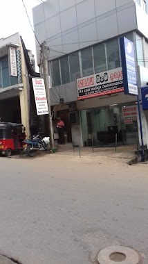
4.954 km
OSHADHI MEDICAL LABORATORY
NO.44,Kandy Jaffna Hwy, Matale
Health
read more
4.957 km
Eye Planet
Matale
Health
read more
5.031 km
Ayurveda Medical Clinic
Kandy - Jaffna Highway, Kurugoda
Health
read more
5.031 km
Ayurveda Medical Clinic
A9, Kurugoda
Health
read more
5.056 km
NexaVision Eye Care
71 Kandy Road, Matale
Health
read more
5.148 km
Medi Care
Kandy - Jaffna Highway, Kurugoda
Health
read more
5.148 km
Medi Care
A9, Kurugoda
Health
read more
5.519 km
Western Pharmacy Inc.
Kings Street, Matale
Health
read more
6.678 km
Samadhi Ashramaya
Doragamuwa
Health
read more
10.55 km
Janasuwa Dispensary
Katugastota
Health
read more
11.103 km
Dr. Wickramaarchchi
Watapuluwa Estate Road, Kandy
Health
read more
12.234 km
RAKNAI MEDI LAB
Palapathwela
Health
read more
14.548 km
Somasiri pharmacy
20000, Hunnasgiriya - Meemure Road
Health
read more
14.689 km
Oshadhi Laboratory-Kandy Branch
Kandy
Health
read more
📑
all categories
Accounting
Administrative area level 1
Administrative area level 2
Airport
Amusement park
Aquarium
Art gallery
Atm
Bakery
Bank
Bar
Beauty salon
Bicycle store
Book store
Bowling alley
Bus station
Cafe
Campground
Car dealer
Car rental
Car repair
Car wash
Casino
Cemetery
Church
City hall
Clothing store
Colloquial area
Convenience store
Country
Courthouse
Dentist
Department store
Doctor
Electrician
Electronics store
Embassy
Finance
Fire station
Florist
Food
Funeral home
Furniture store
Gas station
General contractor
Grocery or supermarket
Gym
Hair care
Hardware store
Health
Hindu Temple
Home goods store
Hospital
Insurance agency
Intersection
Jewelry store
Laundry
Lawyer
Library
Light rail station
Liquor store
Local government office
Locality
Locksmith
Lodging
Meal delivery
Meal takeaway
Mosque
Movie rental
Movie theater
Moving company
Museum
Natural feature
Neighborhood
Night club
Painter
Park
Parking
Pet store
Pharmacy
Physiotherapist
Place of worship
Plumber
Point of interest
Police
Political
Post office
Premise
Real estate agency
Restaurant
Roofing contractor
Route
Rv park, camping
School
Shoe store
Shopping mall
Spa
Stadium
Storage
Store
Subpremise
Supermarket
Synagogue
Taxi stand
Train station
Transit station
Travel agency
University
Veterinary care
Zoo
administrative area level 3
sublocality level 1
sublocality level 2
↑