Hospital nearby Government Ayurveda Medical Center
Coronavirus disease (COVID-19) Situation
confirmed cases
672754
deaths
16897
Sri Lanka
Hospital nearby Government Ayurveda Medical Center
Government Ayurveda Medical Center
Tuttiripitiya, Sri Lanka
contacts phone
:
+94
Latitude:
6.6843454
, Longitude:
80.0383609
larger map & directions
read more
nearest Hospital
938 m
Government Hospital - Halthota
Panadura - Anguruwatota Road, Tuttiripitiya
Hospital
read more
965 m
Kennanthudawa Medical Center (Dr. Manjula's Dispensary/ Dr. Saddharma's Dispensary)
Tuttiripitiya
Hospital
read more
1.128 km
Dr. Indika's Dispensary (Dr. Indika Dharmarathne)
Morontuduwa Horana Road
Hospital
read more
2.471 km
Suwa Sevana Medical Centre
No 25, Welikala Road, Horana
Hospital
read more
2.867 km
Cinnamon Grove
Kuruduwatte, Bandaragama.
Hospital
read more
3.894 km
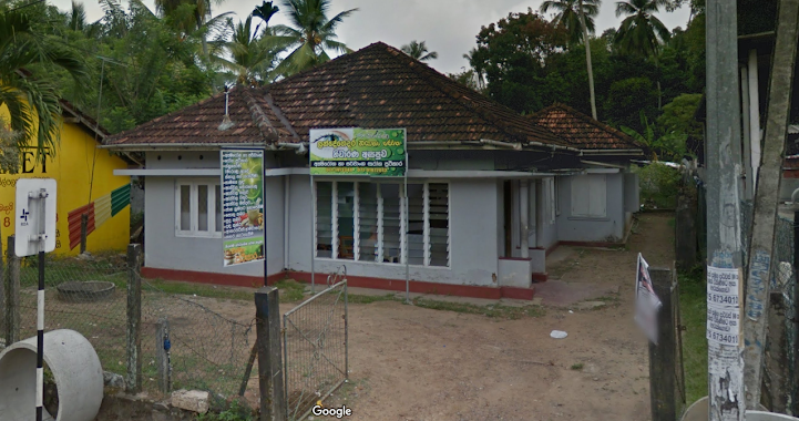
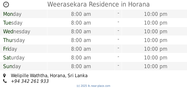
Weerasekara Residence
Welipille Waththa, Horana
Hospital
read more
4.122 km
Dr. Ginigaddara Medical Center
Horana
Hospital
read more
4.145 km
Ari Sithum Suwasetha
Horana
Hospital
read more
4.224 km
Dr Vajira Perera Dispensary
Horana
Hospital
read more
4.264 km
Dr.P Dasanayake
Ballapitiya
Hospital
read more
4.274 km
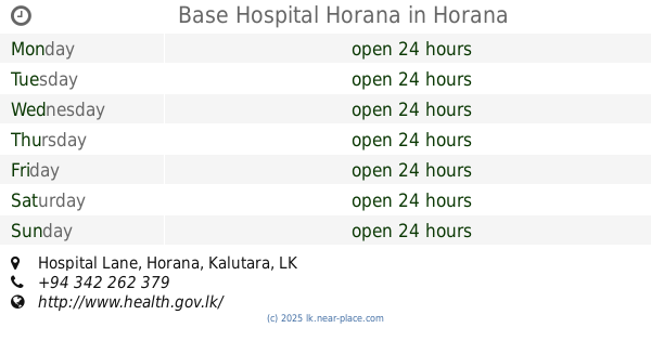
Base Hospital Horana
Hospital Lane, Horana
Hospital
read more
4.349 km
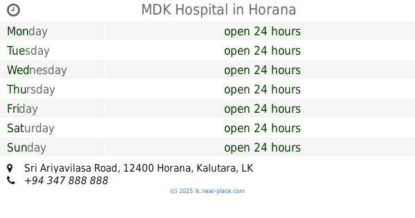
MDK Hospital
No 149, Sri Ariyavilasa Road, Horana
Hospital
read more
4.378 km
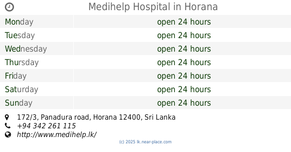
Medihelp Hospital
172/3, Panadura road, Horana
Hospital
read more
4.388 km
Suwasetha Dispensary
Horana - Anguruwatota - Mathugama - Aluthgama Road, Horana
Hospital
read more
4.435 km
Dr.Pallage Medical Centre
Horana
Hospital
read more
4.469 km
Gov. Dental Clinic
492 Atulugama Road, Bandaragama
Hospital
read more
4.527 km
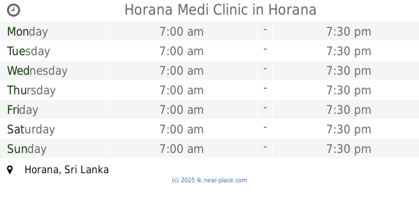
Horana Medi Clinic
Horana
Hospital
read more
4.562 km
Central Dispensary & Surgery
No:106 Sri Somananda Road, Horana
Hospital
read more
4.594 km
Udana Channeling center
37 Galagedera - Horana Road, Horana
Hospital
read more
4.695 km
Dr. Illangasinghe medical center
A8, Pokunuwita
Hospital
read more
4.841 km
Ayurveda Medical Center
125/C,Koskolawatta Road,, හොරණ
Hospital
read more
4.932 km
Aurveda Millaniya
Delkada Road
Hospital
read more
5.44 km
Medical Center
450 Ratnapura - Horana - Panadura Highway, Horana
Hospital
read more
5.604 km
Lande Gedara WedhaMahaththaya NayanaRoga
11, Rerukana Road Ratnapura - Horana - Panadura Highway, Bandaragama
Hospital
read more
5.992 km
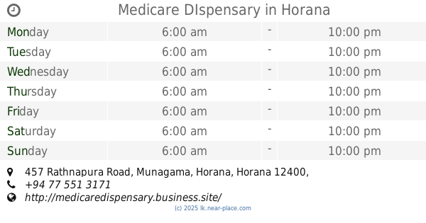
Medicare DIspensary
457 Rathnapura Road, Munagama, Horana, Horana
Hospital
read more
📑
all categories
Accounting
Administrative area level 1
Administrative area level 2
Airport
Amusement park
Aquarium
Art gallery
Atm
Bakery
Bank
Bar
Beauty salon
Bicycle store
Book store
Bowling alley
Bus station
Cafe
Campground
Car dealer
Car rental
Car repair
Car wash
Casino
Cemetery
Church
City hall
Clothing store
Colloquial area
Convenience store
Country
Courthouse
Dentist
Department store
Doctor
Electrician
Electronics store
Embassy
Finance
Fire station
Florist
Food
Funeral home
Furniture store
Gas station
General contractor
Grocery or supermarket
Gym
Hair care
Hardware store
Health
Hindu Temple
Home goods store
Hospital
Insurance agency
Intersection
Jewelry store
Laundry
Lawyer
Library
Light rail station
Liquor store
Local government office
Locality
Locksmith
Lodging
Meal delivery
Meal takeaway
Mosque
Movie rental
Movie theater
Moving company
Museum
Natural feature
Neighborhood
Night club
Painter
Park
Parking
Pet store
Pharmacy
Physiotherapist
Place of worship
Plumber
Point of interest
Police
Political
Post office
Premise
Real estate agency
Restaurant
Roofing contractor
Route
Rv park, camping
School
Shoe store
Shopping mall
Spa
Stadium
Storage
Store
Subpremise
Supermarket
Synagogue
Taxi stand
Train station
Transit station
Travel agency
University
Veterinary care
Zoo
administrative area level 3
sublocality level 1
sublocality level 2
↑