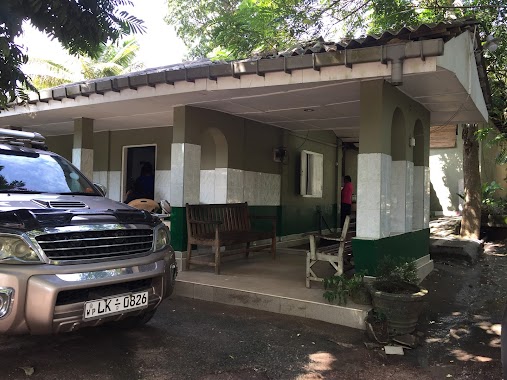
Hospital nearby Medical Centre
Coronavirus disease (COVID-19) Situation
confirmed cases
672754
deaths
16897
Sri Lanka
Hospital nearby Medical Centre
Medical Centre
Divulapitiya, Sri Lanka
contacts phone
:
+94
Latitude:
7.2243533
, Longitude:
80.0201225
larger map & directions
read more
nearest Hospital
213 m
Suwasawiya Medical Center
Divulapitiya
Hospital
read more
223 m
Suwasaviya Medical Center
Divulapitiya
Hospital
read more
826 m
Dispensury & Surgery
Divulapitiya
Hospital
read more
1.126 km
District Hospital Divulapitiya /horagasmulla hospital
Divulapitiya, B 13
Hospital
read more
1.126 km
District Hospital Divulapitiya
Divulapitiya, B 13
Hospital
read more
1.213 km
Clinipath
B111
Hospital
read more
1.22 km
MOH Office, Divulapitiya
Divulapitiya
Hospital
read more
2.495 km
Kadum bidum maradagahamula hospital
Gampaha
Hospital
read more
2.512 km
Pallewela Medical Centre
vilfred estate Maradagahamula
Hospital
read more
2.553 km
Wennappuwa Ayurwedic Medical Center
Negombo - Mirigama Road
Hospital
read more
3.202 km
Dr E.M.D.U De Saram
Gampaha
Hospital
read more
3.211 km
Hunumulla Kennel
Gampaha
Hospital
read more
3.785 km
Dunagaha Orthopedic surgeon
Marandagahamula
Hospital
read more
4.274 km
Thammita Kadum Bidum Beheth Shalawa
Nelligahamula
Hospital
read more
4.518 km
central government dispensary muddaragama
Muddaragama
Hospital
read more
12.872 km
Ayurvedic Medical Center
Pasyala - Giriulla Road, Mirigama
Hospital
read more
13.004 km
Theath Health Care Center
Aluthgama-Bogamuwa, Kalagedihena
Hospital
read more
13.801 km
Gampaha Hart/ගම්පහ හෘද
Gampaha
Hospital
read more
14.315 km
Hospital Nambulwa
Nabuluwa
Hospital
read more
14.914 km
Tusitha Hewamanna Medical Center
Ananda Mawatha, Gampaha
Hospital
read more
15.066 km
Seth Meditech & Diagnostic
Nittambuwa - Ruwanwella Road, Wathupitiwala
Hospital
read more
16.144 km
mahajana dispancery
Negombo-Kurunegala Road, Giriulla
Hospital
read more
16.303 km
Matrnal and Child Health Clinic - Makewita
80 A33
Hospital
read more
16.624 km
Dankotuwa Hospital
Dankotuwa
Hospital
read more
19.504 km
Dr. Anura
Ja-Ela
Hospital
read more
📑
all categories
Accounting
Administrative area level 1
Administrative area level 2
Airport
Amusement park
Aquarium
Art gallery
Atm
Bakery
Bank
Bar
Beauty salon
Bicycle store
Book store
Bowling alley
Bus station
Cafe
Campground
Car dealer
Car rental
Car repair
Car wash
Casino
Cemetery
Church
City hall
Clothing store
Colloquial area
Convenience store
Country
Courthouse
Dentist
Department store
Doctor
Electrician
Electronics store
Embassy
Finance
Fire station
Florist
Food
Funeral home
Furniture store
Gas station
General contractor
Grocery or supermarket
Gym
Hair care
Hardware store
Health
Hindu Temple
Home goods store
Hospital
Insurance agency
Intersection
Jewelry store
Laundry
Lawyer
Library
Light rail station
Liquor store
Local government office
Locality
Locksmith
Lodging
Meal delivery
Meal takeaway
Mosque
Movie rental
Movie theater
Moving company
Museum
Natural feature
Neighborhood
Night club
Painter
Park
Parking
Pet store
Pharmacy
Physiotherapist
Place of worship
Plumber
Point of interest
Police
Political
Post office
Premise
Real estate agency
Restaurant
Roofing contractor
Route
Rv park, camping
School
Shoe store
Shopping mall
Spa
Stadium
Storage
Store
Subpremise
Supermarket
Synagogue
Taxi stand
Train station
Transit station
Travel agency
University
Veterinary care
Zoo
administrative area level 3
sublocality level 1
sublocality level 2
↑