Hospital nearby Pamunugama Hospital
Coronavirus disease (COVID-19) Situation
confirmed cases
672754
deaths
16897
Sri Lanka
Hospital nearby Pamunugama Hospital
Pamunugama Hospital
Sri Lanka
contacts phone
:
+94
Latitude:
7.0935427
, Longitude:
79.8501911
larger map & directions
read more
nearest Hospital
21 m
Govt: Hospital - Pamunugama
Negombo
Hospital
read more
34 m
Gov: Peripheral Hospital
Our Lady Of Peace Road
Hospital
read more
37 m
Pamunugama Hospital
Pamunugama
Hospital
read more
1.772 km
Ayurvedic Medical Center
Alen Egoda, no:29, Pamunugama
Hospital
read more
1.788 km
Seth Arana Pamunugama
Pamunugama Road, Negombo
Hospital
read more
1.8 km
Ayurvedic Dispensary
Alen Egoda, No29, Pamunugama, Colombo
Hospital
read more
1.902 km
Jeewya Medical Center
No. 7, Colombo Road, Negombo
Hospital
read more
2.842 km
Kepungoda Medical Centre
Negombo
Hospital
read more
3.851 km
Radiant Eye Hospital
269, Negombo Road, Dandugama
Hospital
read more
4.061 km
Medical Center (Dr. Thivanka De Silva)
460 D, Dandugam Thotupola, Jaela
Hospital
read more
4.746 km
Dispensary
Ja-Ela
Hospital
read more
4.748 km
Medical Center
Minuwangoda Road,, Ja-Ela
Hospital
read more
4.75 km
Wijaya Kumaratunga Memorial Hospital
Negombo-Colombo Main Road, Seeduwa
Hospital
read more
4.771 km
Maternity and Child Clinic
Kudahakapola
Hospital
read more
4.903 km
Jaela Ragama Private Hospital
Ja-Ela
Hospital
read more
4.929 km
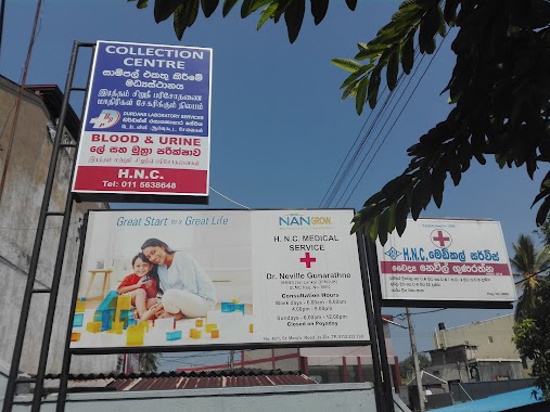
H.N.C. Medical service
Ja-Ela
Hospital
read more
4.938 km
St.Anns Medical Center
Ja-Ela
Hospital
read more
4.982 km
ISI SUWA MEDICAL CENTER
Ja-Ela
Hospital
read more
4.987 km
ISI-SUVA Medical Center
61/3 St.Mary's Road, Ja-Ela
Hospital
read more
5.041 km
Jude Medicare
401, Negombo-Colombo Main Road, Negombo
Hospital
read more
5.095 km
Sandeepani Home
103/A, St.Marys Road, Uswetakeiyawa
Hospital
read more
5.213 km
AUK Medical Center
Uswetakeiyawa
Hospital
read more
5.258 km
Dental Surgery Divisional Hospital
Ja-Ela
Hospital
read more
5.387 km
MOH Office Seeduwa
Negombo
Hospital
read more
6.004 km
Central Dispensary
Seeduwa
Hospital
read more
📑
all categories
Accounting
Administrative area level 1
Administrative area level 2
Airport
Amusement park
Aquarium
Art gallery
Atm
Bakery
Bank
Bar
Beauty salon
Bicycle store
Book store
Bowling alley
Bus station
Cafe
Campground
Car dealer
Car rental
Car repair
Car wash
Casino
Cemetery
Church
City hall
Clothing store
Colloquial area
Convenience store
Country
Courthouse
Dentist
Department store
Doctor
Electrician
Electronics store
Embassy
Finance
Fire station
Florist
Food
Funeral home
Furniture store
Gas station
General contractor
Grocery or supermarket
Gym
Hair care
Hardware store
Health
Hindu Temple
Home goods store
Hospital
Insurance agency
Intersection
Jewelry store
Laundry
Lawyer
Library
Light rail station
Liquor store
Local government office
Locality
Locksmith
Lodging
Meal delivery
Meal takeaway
Mosque
Movie rental
Movie theater
Moving company
Museum
Natural feature
Neighborhood
Night club
Painter
Park
Parking
Pet store
Pharmacy
Physiotherapist
Place of worship
Plumber
Point of interest
Police
Political
Post office
Premise
Real estate agency
Restaurant
Roofing contractor
Route
Rv park, camping
School
Shoe store
Shopping mall
Spa
Stadium
Storage
Store
Subpremise
Supermarket
Synagogue
Taxi stand
Train station
Transit station
Travel agency
University
Veterinary care
Zoo
administrative area level 3
sublocality level 1
sublocality level 2
↑