Hospital nearby Pinnawala Dispensary
Coronavirus disease (COVID-19) Situation
confirmed cases
672754
deaths
16897
Sri Lanka
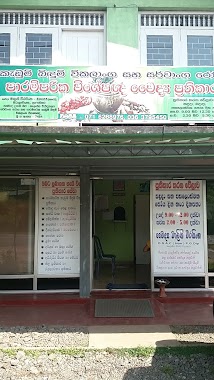
Hospital nearby Pinnawala Dispensary
Pinnawala Dispensary
Wewalpanawa - Waga Road, Pinnawala, Colombo, LK Sri Lanka
contacts phone
:
+94
website:
www.health.gov.lk
Latitude:
6.8702286
, Longitude:
80.1202065
larger map & directions
read more
nearest Hospital
3.586 km
Medical Center
Kahahena
Hospital
read more
3.99 km
SISETHRA AYURVEDIC MEDICAL CENTER
High Level Road, Hanwella
Hospital
read more
4.442 km
Jeewaka Private Hospital
Horana Road, Padukka
Hospital
read more
4.449 km
Jeewaka Dental Surgery
Padukka
Hospital
read more
4.472 km
Medical office of Health
Galagedera - Horana Road, Padukka
Hospital
read more
4.472 km
Medical office of Health
Galagedera - Horana Rd, Padukka
Hospital
read more
4.561 km
Hewage Ayurveda Medical Center
Padukka
Hospital
read more
4.678 km
Medical Centre
Padukka
Hospital
read more
4.767 km
Padukka Divisional Hospital
Colombo Rd, Padukka
Hospital
read more
4.938 km
Swabha Osu Wedamedura
Padukka
Hospital
read more
5.153 km
Arunaloka Medical Center
High Level Road, Hanwella
Hospital
read more
5.153 km
Wealth Medicare
Town, Hanwella
Hospital
read more
5.503 km
Thummodara Central Dispensary
Thummodara, Labugama
Hospital
read more
5.789 km
Suwahasa Ayurwadic Medical Centre
Hanwella Junction Road, Hanwella
Hospital
read more
6.009 km
Government Ayurvedic Medical Centre
Colombo-Hanwella Road, Hanwella
Hospital
read more
6.16 km
Suwaya Medical Centre
Hanwella
Hospital
read more
9.58 km
කැඩුම් බිදුම් උපෙක්ෂා වෙද මැදුර
Embilladeniya
Hospital
read more
9.874 km
Wadiyarathna Ayurwedha Medical Center
B240, Godagama
Hospital
read more
10.454 km
Goverment Dispansary
Embilladeniya
Hospital
read more
11.312 km
Nalani Osusala
Delgoda-Pugoda-Giridara Road, Giridara Junction
Hospital
read more
14.246 km
Kiriporuwa Rural Hospital
Mitipola Road
Hospital
read more
14.553 km
Life Line Medical Center And Laboratory.
Thaldiyawala
Hospital
read more
16.362 km
Siri Weda Madura
Ingiriya Road, Ingiriya
Hospital
read more
16.652 km
Madagoda Dispensary
Kegalle
Hospital
read more
17.047 km
Zone Health Care
Zone Road, Waduwegama, Malwana., Mosque Road
Hospital
read more
📑
all categories
Accounting
Administrative area level 1
Administrative area level 2
Airport
Amusement park
Aquarium
Art gallery
Atm
Bakery
Bank
Bar
Beauty salon
Bicycle store
Book store
Bowling alley
Bus station
Cafe
Campground
Car dealer
Car rental
Car repair
Car wash
Casino
Cemetery
Church
City hall
Clothing store
Colloquial area
Convenience store
Country
Courthouse
Dentist
Department store
Doctor
Electrician
Electronics store
Embassy
Finance
Fire station
Florist
Food
Funeral home
Furniture store
Gas station
General contractor
Grocery or supermarket
Gym
Hair care
Hardware store
Health
Hindu Temple
Home goods store
Hospital
Insurance agency
Intersection
Jewelry store
Laundry
Lawyer
Library
Light rail station
Liquor store
Local government office
Locality
Locksmith
Lodging
Meal delivery
Meal takeaway
Mosque
Movie rental
Movie theater
Moving company
Museum
Natural feature
Neighborhood
Night club
Painter
Park
Parking
Pet store
Pharmacy
Physiotherapist
Place of worship
Plumber
Point of interest
Police
Political
Post office
Premise
Real estate agency
Restaurant
Roofing contractor
Route
Rv park, camping
School
Shoe store
Shopping mall
Spa
Stadium
Storage
Store
Subpremise
Supermarket
Synagogue
Taxi stand
Train station
Transit station
Travel agency
University
Veterinary care
Zoo
administrative area level 3
sublocality level 1
sublocality level 2
↑