Lodging nearby Legacy Lanka
Sri Lanka
Lodging nearby Legacy Lanka
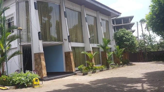
Legacy Lanka
405/4, Diyaaddara, Attanagalla, Attanagalla 11120, Sri Lanka
contacts phone
:
+94 71 174 1929
website:
touch.facebook.com
Latitude:
7.111247
, Longitude:
80.1447058
larger map & directions
read more
nearest Lodging
1.194 km
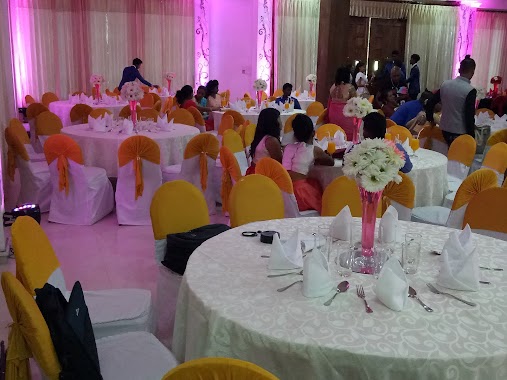
Hotel Dinara & Reception Hall
No:295/B/2,Nittambuwa- Ruwanwella Road, Urapola ,Nittambuwa ,Srilanaka.
Lodging
read more
1.954 km
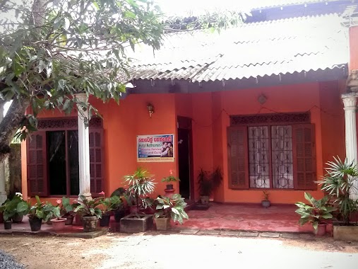
Royal Dream Palace
Gampaha
Lodging
read more
2.137 km
Kaluarachchi's Resident
7°05'36. 80°08'13., 7 8th Lane
Lodging
read more
2.234 km
Haggalla Nisindu Food
B361, Pasyala
Lodging
read more
2.934 km
Hotel Omik
Lodging
read more
2.934 km
Hotel Omik
Sri Lanka
Lodging
read more
3.327 km
Paradise Inn
Gampaha
Lodging
read more
3.391 km
Rossie Tourist Guest
B361, Allalamulla
Lodging
read more
3.464 km
Saubhagya Hotel
Veyangoda Nittambuwa - Ruwanwella Road
Lodging
read more
3.482 km
Ellakkala Motel
B361
Lodging
read more
3.751 km
SC Bubula
Hanwella Road, Madakotuwa, Urapola
Lodging
read more
4.051 km
M.M.A.ALEEM
Kadawatha Central College, Ganemulla Road,, Ganemulla Road, Kadawatha
Lodging
read more
4.408 km
Disini Reception Hall
Algama Haggalla Road -, Bogahamula
Lodging
read more
4.477 km
abu leena's sweet home
A.C.M.Thasleem Road, Kahatowita
Lodging
read more
5.24 km
Tharushi Reception Hall
Algama
Lodging
read more
5.499 km
Gayani Hotel
Ruwanpura Rukmale Road
Lodging
read more
5.648 km
Chalet's Hotel
Gampaha
Lodging
read more
6.012 km
Hotel Nethsarani
Nittambuwa
Lodging
read more
6.388 km
Tuwice Hottel
Colombo - Kandy Road, Nittambuwa
Lodging
read more
7.4 km
Lebba Hotel
Lodging
read more
10.178 km
Hotel Star Garden
15th KM Post, Meddegama, Hanwella Road
Lodging
read more
10.618 km
Linrose Hotel
Bemmulla
Lodging
read more
13.024 km
Lakma Holidays
Pilanduwa Road, Warakapola
Lodging
read more
16.403 km
Apple Green Hotel & Bakers
Ambepussa
Lodging
read more
19.831 km
Hotel Villows.
Kegalle
Lodging
read more
📑
all categories
Accounting
Administrative area level 1
Administrative area level 2
Airport
Amusement park
Aquarium
Art gallery
Atm
Bakery
Bank
Bar
Beauty salon
Bicycle store
Book store
Bowling alley
Bus station
Cafe
Campground
Car dealer
Car rental
Car repair
Car wash
Casino
Cemetery
Church
City hall
Clothing store
Colloquial area
Convenience store
Country
Courthouse
Dentist
Department store
Doctor
Electrician
Electronics store
Embassy
Finance
Fire station
Florist
Food
Funeral home
Furniture store
Gas station
General contractor
Grocery or supermarket
Gym
Hair care
Hardware store
Health
Hindu Temple
Home goods store
Hospital
Insurance agency
Intersection
Jewelry store
Laundry
Lawyer
Library
Light rail station
Liquor store
Local government office
Locality
Locksmith
Lodging
Meal delivery
Meal takeaway
Mosque
Movie rental
Movie theater
Moving company
Museum
Natural feature
Neighborhood
Night club
Painter
Park
Parking
Pet store
Pharmacy
Physiotherapist
Place of worship
Plumber
Point of interest
Police
Political
Post office
Premise
Real estate agency
Restaurant
Roofing contractor
Route
Rv park, camping
School
Shoe store
Shopping mall
Spa
Stadium
Storage
Store
Subpremise
Supermarket
Synagogue
Taxi stand
Train station
Transit station
Travel agency
University
Veterinary care
Zoo
administrative area level 3
sublocality level 1
sublocality level 2
↑