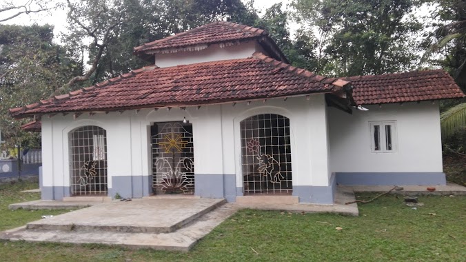
Place of worship nearby Sri Lankaramaya
Coronavirus disease (COVID-19) Situation
confirmed cases
672754
deaths
16897
Sri Lanka
Place of worship nearby Sri Lankaramaya
Sri Lankaramaya
Katukurunda Sri Lanka
contacts phone
:
+94
Latitude:
6.5540503
, Longitude:
79.988219
read more
nearest Place of worship
682 m
Siri Sadaham Viharaya
Katukurunda
Place of worship
read more
718 m
Shylarama Viharaya
Vijitha Mawatha Road, Kalutara
Place of worship
read more
936 m
Thapowanaya Temple
Katukurunda
Place of worship
read more
946 m
සු.දු.ත.නි.ල.
Nagoda West, Katukurunda
Place of worship
read more
1.073 km
Jayawardhana Gilan Bhikshu Aramaya
Kalutara-Matugama Road
Place of worship
read more
1.118 km
Sri Vijayaramaya
Katukurunda
Place of worship
read more
1.175 km
Buddhist Temple
Air Force Road, Kalutara
Place of worship
read more
1.391 km
Sumanarama Maha Wiharaya
Sri Sumanarama Road, Katukurunda
Place of worship
read more
1.414 km
Sri Sobhitharamaya Temple
Sri Sobhitharama Rd, Nagoda, Kalutara
Place of worship
read more
1.472 km
Sri Pushparamaya Temple
payagala malegoda
Place of worship
read more
1.716 km
Sri Sandharshanaramaya
Alubogahalanda
Place of worship
read more
1.75 km
Sri Sudharshanaramaya
Kalutara
Place of worship
read more
2.135 km
Kalamulla Convent
Katukurunda
Place of worship
read more
2.18 km
Sri Pushparamya
Matiyalamulla, Katukurunda
Place of worship
read more
2.195 km
Bhikshu Nikethanaya
Kalutara
Place of worship
read more
2.234 km
Vealuvanaramaya Unagakanatha
Kalutara
Place of worship
read more
2.425 km
Suseemarama Viharaya
Sri Dharmarama Mawatha, Kalutara
Place of worship
read more
2.45 km
Swarnaramaya
Suwarnarama Rd, Katukurunda
Place of worship
read more
2.5 km
Buddha Statue
Nagoda - Kalawellawa - Bellapitiya Road, Gan-Ima
Place of worship
read more
2.904 km
Sri Anandarama Temple
Maha Heenatiyangala, Kalutara
Place of worship
read more
2.994 km
Alabada Sri Indrajothiaramaya
Kalutara
Place of worship
read more
2.999 km
Sri Yasodhara Dhaham Pasala
Sri Lanka
Place of worship
read more
3.213 km
Ketharama Temple
Mahawatta, Kalutara
Place of worship
read more
3.732 km
Parish House
Hill Street, Kalutara
Place of worship
read more
3.822 km
Bhodhiraja Maha Viharaya
Galle Road, Kalutara
Place of worship
read more
📑
all categories
Accounting
Administrative area level 1
Administrative area level 2
Airport
Amusement park
Aquarium
Art gallery
Atm
Bakery
Bank
Bar
Beauty salon
Bicycle store
Book store
Bowling alley
Bus station
Cafe
Campground
Car dealer
Car rental
Car repair
Car wash
Casino
Cemetery
Church
City hall
Clothing store
Colloquial area
Convenience store
Country
Courthouse
Dentist
Department store
Doctor
Electrician
Electronics store
Embassy
Finance
Fire station
Florist
Food
Funeral home
Furniture store
Gas station
General contractor
Grocery or supermarket
Gym
Hair care
Hardware store
Health
Hindu Temple
Home goods store
Hospital
Insurance agency
Intersection
Jewelry store
Laundry
Lawyer
Library
Light rail station
Liquor store
Local government office
Locality
Locksmith
Lodging
Meal delivery
Meal takeaway
Mosque
Movie rental
Movie theater
Moving company
Museum
Natural feature
Neighborhood
Night club
Painter
Park
Parking
Pet store
Pharmacy
Physiotherapist
Place of worship
Plumber
Point of interest
Police
Political
Post office
Premise
Real estate agency
Restaurant
Roofing contractor
Route
Rv park, camping
School
Shoe store
Shopping mall
Spa
Stadium
Storage
Store
Subpremise
Supermarket
Synagogue
Taxi stand
Train station
Transit station
Travel agency
University
Veterinary care
Zoo
administrative area level 3
sublocality level 1
sublocality level 2
↑