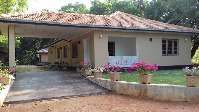
Premise nearby Eliya Diwulwewa Tank
Sri Lanka
Premise nearby Eliya Diwulwewa Tank
Eliya Diwulwewa Tank
Talawa Road, Eppawala Sri Lanka
contacts phone
:
+94
Latitude:
8.1602405
, Longitude:
80.3945804
read more
nearest Premise
690 m
Ground Eliyadiwulwewe
Eppawala
Premise
read more
9.151 km
Paddy Marketing Board - Talawa Storage Facility
Talawa
Premise
read more
9.721 km
New City
Talawa
Premise
read more
10.194 km
Divisional Survey Office - Thambuttegama
Tambuttegama
Premise
read more
10.424 km
Thambuththegama Rajani Junction Clock Tower
Tambuttegama
Premise
read more
10.647 km
Mahaveli Authority
Tambuttegama
Premise
read more
10.652 km
Divisional Secretariat Office
Tambuttegama
Premise
read more
10.704 km
Zonal Education Office
Tambuttegama
Premise
read more
11.088 km
Kaluwila Tank
Sri Lanka
Premise
read more
11.296 km
Weheragala Viharaya
Tambuttegama
Premise
read more
11.374 km
Meegalewa Wewa
Meegalewa
Premise
read more
11.424 km
Senapura Aluwiharagama Temple
Sri Lanka
Premise
read more
12.305 km
Sri Namalu Rajamaha Viharaya
Sri Lanka
Premise
read more
12.89 km
Sri Shanthi Nikethanaramaya
Meegalewa
Premise
read more
13.016 km
4S5SIE
Meegalewa
Premise
read more
14.488 km
Vihara Maha Devi Temple
Tirappane
Premise
read more
14.903 km
Irrigation Circuit Bungalow
Nachchaduwa
Premise
read more
16.126 km
Galnewa Mahaweli Public Ground
Galnewa
Premise
read more
16.649 km
Siyabalangamuwa Forest
Sri Lanka
Premise
read more
16.699 km
Galnewa Sri Lanka Telecom
Galnewa
Premise
read more
16.794 km
Galnewa Divisional Secretariat Office
Galnewa
Premise
read more
17.012 km
Rasika Garden
Sri Lanka
Premise
read more
17.186 km
Galkulama Clock Tower
Galkulama
Premise
read more
17.697 km
Water Tower
Kala Karambewa
Premise
read more
17.712 km
Hiripitiyagama Junction Clock Tower
Sri Lanka
Premise
read more
📑
all categories
Accounting
Administrative area level 1
Administrative area level 2
Airport
Amusement park
Aquarium
Art gallery
Atm
Bakery
Bank
Bar
Beauty salon
Bicycle store
Book store
Bowling alley
Bus station
Cafe
Campground
Car dealer
Car rental
Car repair
Car wash
Casino
Cemetery
Church
City hall
Clothing store
Colloquial area
Convenience store
Country
Courthouse
Dentist
Department store
Doctor
Electrician
Electronics store
Embassy
Finance
Fire station
Florist
Food
Funeral home
Furniture store
Gas station
General contractor
Grocery or supermarket
Gym
Hair care
Hardware store
Health
Hindu Temple
Home goods store
Hospital
Insurance agency
Intersection
Jewelry store
Laundry
Lawyer
Library
Light rail station
Liquor store
Local government office
Locality
Locksmith
Lodging
Meal delivery
Meal takeaway
Mosque
Movie rental
Movie theater
Moving company
Museum
Natural feature
Neighborhood
Night club
Painter
Park
Parking
Pet store
Pharmacy
Physiotherapist
Place of worship
Plumber
Point of interest
Police
Political
Post office
Premise
Real estate agency
Restaurant
Roofing contractor
Route
Rv park, camping
School
Shoe store
Shopping mall
Spa
Stadium
Storage
Store
Subpremise
Supermarket
Synagogue
Taxi stand
Train station
Transit station
Travel agency
University
Veterinary care
Zoo
administrative area level 3
sublocality level 1
sublocality level 2
↑