Premise nearby Grace
Coronavirus disease (COVID-19) Situation
confirmed cases
672754
deaths
16897
Sri Lanka
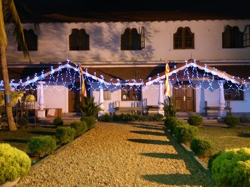
Premise nearby Grace
Grace
1st Lane, Negombo, Gampaha, LK Sri Lanka
contacts phone
:
+94
Latitude:
7.2005256
, Longitude:
79.8792302
larger map & directions
read more
nearest Premise
272 m
Jeyaraj Fernandopulle Memorial Hall
Negombo
Premise
read more
1.068 km
Heritage Grove
Negombo
Premise
read more
1.092 km
Mihiri
Negombo
Premise
read more
1.748 km
Parama Bodhi Viharaya
Kimbulapitiya
Premise
read more
1.773 km
Kadirana Sri Vijayarama Temple
Negombo
Premise
read more
1.831 km
Polgala Estate
Katunayake
Premise
read more
2.025 km
Kimbulapitiya Junction
Kimbulapitiya
Premise
read more
2.228 km
Major Raj Fernando Ground
Negombo
Premise
read more
2.245 km
West Dene Villa
Negombo
Premise
read more
2.491 km
Bertels Niwas
Negombo
Premise
read more
2.528 km
Control Tower
Katunayake
Premise
read more
2.541 km
BIA Control Tower
Katunayake
Premise
read more
2.795 km
AASL Administration Building
Katunayake
Premise
read more
2.858 km
Andiambalama Safety Swimming School
Katunayake
Premise
read more
2.917 km
Parking Vehículos de Alquiler
Katunayake
Premise
read more
2.917 km
Remote Car Park
Katunayake
Premise
read more
2.922 km
Solero Canyon Apartments
Angurukaramulla
Premise
read more
2.948 km
Terminal Parkplatz
Katunayake
Premise
read more
2.948 km
Terminal Parking
Katunayake
Premise
read more
3.057 km
BIA Arrival Terminal
Katunayake
Premise
read more
3.071 km
Ankunft Terminal
Katunayake
Premise
read more
3.238 km
Katunayake Grid Substation
Katunayake
Premise
read more
3.327 km
Institute of Virtue
Negombo
Premise
read more
3.435 km
Kovinna Gangarama Temple
Katunayake
Premise
read more
3.442 km
37A
Katunayake
Premise
read more
📑
all categories
Accounting
Administrative area level 1
Administrative area level 2
Airport
Amusement park
Aquarium
Art gallery
Atm
Bakery
Bank
Bar
Beauty salon
Bicycle store
Book store
Bowling alley
Bus station
Cafe
Campground
Car dealer
Car rental
Car repair
Car wash
Casino
Cemetery
Church
City hall
Clothing store
Colloquial area
Convenience store
Country
Courthouse
Dentist
Department store
Doctor
Electrician
Electronics store
Embassy
Finance
Fire station
Florist
Food
Funeral home
Furniture store
Gas station
General contractor
Grocery or supermarket
Gym
Hair care
Hardware store
Health
Hindu Temple
Home goods store
Hospital
Insurance agency
Intersection
Jewelry store
Laundry
Lawyer
Library
Light rail station
Liquor store
Local government office
Locality
Locksmith
Lodging
Meal delivery
Meal takeaway
Mosque
Movie rental
Movie theater
Moving company
Museum
Natural feature
Neighborhood
Night club
Painter
Park
Parking
Pet store
Pharmacy
Physiotherapist
Place of worship
Plumber
Point of interest
Police
Political
Post office
Premise
Real estate agency
Restaurant
Roofing contractor
Route
Rv park, camping
School
Shoe store
Shopping mall
Spa
Stadium
Storage
Store
Subpremise
Supermarket
Synagogue
Taxi stand
Train station
Transit station
Travel agency
University
Veterinary care
Zoo
administrative area level 3
sublocality level 1
sublocality level 2
↑