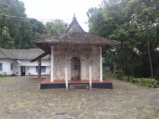
Premise nearby Pusulpitiya Raja Maha Viharaya
Sri Lanka
Premise nearby Pusulpitiya Raja Maha Viharaya
Pusulpitiya Raja Maha Viharaya
Harangala - Kalapitiya - Kumbaloluwa Road, Kalapitiya, Nuwara Eliya, LK Sri Lanka
contacts phone
:
+94
Latitude:
7.0555142
, Longitude:
80.6484726
larger map & directions
read more
nearest Premise
298 m
Hadunuwewa Central College
Kalapitiya
Premise
read more
720 m
Nilapiyasapura
Kalapitiya
Premise
read more
1.816 km
Niyamgamdora Raja Maha Viharaya
Nuwara Eliya
Premise
read more
2.98 km
Rogersangama Sri Vardhanaramaya
Sri Lanka
Premise
read more
4.072 km
new town
Kothmale New Town
Premise
read more
5.106 km
Mahaweli Maha Seya
Sri Lanka
Premise
read more
5.219 km
Dehedu Kadulla
Sri Lanka
Premise
read more
7.077 km
Pussellawa Playground
Pussellawa
Premise
read more
9.217 km
Sri Ananda Mula Maha Viharaya
Udapalatha
Premise
read more
10.237 km
Tea Factory
Udapalatha
Premise
read more
10.396 km
TUAN SADDAM SAMAHON
Udapalatha
Premise
read more
10.611 km
Panvilatenna
Doluwa
Premise
read more
12.63 km
Siri Dhammarathana Pirivena
Nawalapitiya
Premise
read more
13.599 km
Mapakanda Play Ground
Pasbage Korale
Premise
read more
14.319 km
Deputy Manager's Bungalow
Kotagala
Premise
read more
14.603 km
Galboda Tunnel No. 13
Galboda
Premise
read more
14.976 km
Gami Sewa Sevana
Doluwa
Premise
read more
15.75 km
Ceybank Holiday Home
Nuwara Eliya
Premise
read more
16.236 km
Ambuluwawa Multi Religious Centre
Ambuluwaawa ICC Road
Premise
read more
16.404 km
Ceybank Rest Parking Lot
Nuwara Eliya
Premise
read more
17.045 km
Sarvodaya
Hawa Eliya
Premise
read more
17.079 km
Poramadulla Primary School
Rikillagaskada
Premise
read more
17.093 km
Main Hall
Hawa Eliya
Premise
read more
18.838 km
Damunumeya Temple
Hanguranketa
Premise
read more
19.489 km
Hanguranketha Pothgul Rajamaha Viharaya
Hanguranketa
Premise
read more
📑
all categories
Accounting
Administrative area level 1
Administrative area level 2
Airport
Amusement park
Aquarium
Art gallery
Atm
Bakery
Bank
Bar
Beauty salon
Bicycle store
Book store
Bowling alley
Bus station
Cafe
Campground
Car dealer
Car rental
Car repair
Car wash
Casino
Cemetery
Church
City hall
Clothing store
Colloquial area
Convenience store
Country
Courthouse
Dentist
Department store
Doctor
Electrician
Electronics store
Embassy
Finance
Fire station
Florist
Food
Funeral home
Furniture store
Gas station
General contractor
Grocery or supermarket
Gym
Hair care
Hardware store
Health
Hindu Temple
Home goods store
Hospital
Insurance agency
Intersection
Jewelry store
Laundry
Lawyer
Library
Light rail station
Liquor store
Local government office
Locality
Locksmith
Lodging
Meal delivery
Meal takeaway
Mosque
Movie rental
Movie theater
Moving company
Museum
Natural feature
Neighborhood
Night club
Painter
Park
Parking
Pet store
Pharmacy
Physiotherapist
Place of worship
Plumber
Point of interest
Police
Political
Post office
Premise
Real estate agency
Restaurant
Roofing contractor
Route
Rv park, camping
School
Shoe store
Shopping mall
Spa
Stadium
Storage
Store
Subpremise
Supermarket
Synagogue
Taxi stand
Train station
Transit station
Travel agency
University
Veterinary care
Zoo
administrative area level 3
sublocality level 1
sublocality level 2
↑