Restaurant nearby ගමේ කඩේ Gamee Kade
Sri Lanka
Restaurant nearby ගමේ කඩේ Gamee Kade
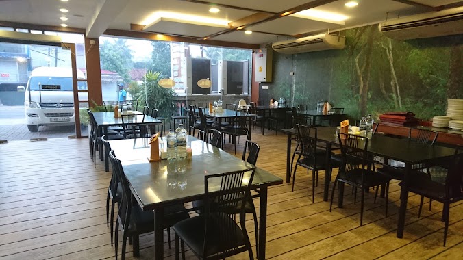
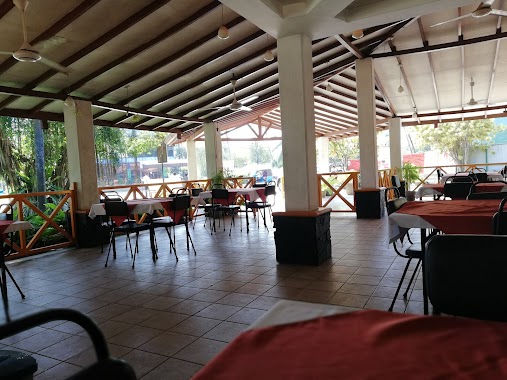
ගමේ කඩේ Gamee Kade
Gampaha, Sri Lanka
contacts phone
:
+94
Latitude:
7.1765794
, Longitude:
80.1201968
larger map & directions
read more
nearest Restaurant
377 m
Ruhunu Hotel
AB29, Pasyala
Restaurant
read more
448 m
Oyisis Restaurant
Pasyala - Giriulla Road, Veyangoda
Restaurant
read more
790 m
Kaju Gedara Restaurant
No.302, Kandy Road, Bataleeya, Pasyala
Restaurant
read more
813 m
Ranjana Restaurant
Sri Lanka
Restaurant
read more
959 m
Hotel Prasada
A1, Pasyala
Restaurant
read more
1.049 km
Nihal Family Restuarant
173/B Colombo-Kandy Hwy, Pasyala
Restaurant
read more
1.289 km
Priyachandra Hotel
Pasyala
Restaurant
read more
1.381 km
Kajugedara Restaurant
Kajugama
Restaurant
read more
1.624 km
පොල් අතු බත් කඩේ
Colombo - Kandy Road, Kajugama
Restaurant
read more
1.675 km
Nihla & Hotel
Nabuluwa
Restaurant
read more
2.08 km
P&S Pasyala
A1
Restaurant
read more
2.409 km
Sarathchandra Bakers & Hotel
Henepola Road, Radawadunna
Restaurant
read more
3.005 km
Wela Mada Kade
Kandy Road, Nittambuwa
Restaurant
read more
3.005 km
Wela Meda Kade
Kandy Road, Nittambuwa
Restaurant
read more
3.094 km
Twins Hotel
Nittambuwa
Restaurant
read more
3.218 km
Aruna Caters
Kaleliya - Medagampitiya Road
Restaurant
read more
3.983 km
New Mega Chille Restaurant
No 583/4, A1, Nittambuwa
Restaurant
read more
4.192 km
Ranathisara Reception Hall
A1, Nittambuwa
Restaurant
read more
4.86 km
Imara Chinese food
Nittambuwa
Restaurant
read more
4.991 km
Farvin Hotel
No 134, A1, Weweldeniya
Restaurant
read more
5.117 km
Hopper Shop
Gampaha
Restaurant
read more
5.221 km
Mountain Ray Restaurent
Nittambuwa
Restaurant
read more
5.226 km
Ambula
A1, Weweldeniya
Restaurant
read more
6.206 km
Pol Athu Bath Kade
A1
Restaurant
read more
6.938 km
Sena's Family Restaurant
Malwatta Junction, Nittambuwa
Restaurant
read more
📑
all categories
Accounting
Administrative area level 1
Administrative area level 2
Airport
Amusement park
Aquarium
Art gallery
Atm
Bakery
Bank
Bar
Beauty salon
Bicycle store
Book store
Bowling alley
Bus station
Cafe
Campground
Car dealer
Car rental
Car repair
Car wash
Casino
Cemetery
Church
City hall
Clothing store
Colloquial area
Convenience store
Country
Courthouse
Dentist
Department store
Doctor
Electrician
Electronics store
Embassy
Finance
Fire station
Florist
Food
Funeral home
Furniture store
Gas station
General contractor
Grocery or supermarket
Gym
Hair care
Hardware store
Health
Hindu Temple
Home goods store
Hospital
Insurance agency
Intersection
Jewelry store
Laundry
Lawyer
Library
Light rail station
Liquor store
Local government office
Locality
Locksmith
Lodging
Meal delivery
Meal takeaway
Mosque
Movie rental
Movie theater
Moving company
Museum
Natural feature
Neighborhood
Night club
Painter
Park
Parking
Pet store
Pharmacy
Physiotherapist
Place of worship
Plumber
Point of interest
Police
Political
Post office
Premise
Real estate agency
Restaurant
Roofing contractor
Route
Rv park, camping
School
Shoe store
Shopping mall
Spa
Stadium
Storage
Store
Subpremise
Supermarket
Synagogue
Taxi stand
Train station
Transit station
Travel agency
University
Veterinary care
Zoo
administrative area level 3
sublocality level 1
sublocality level 2
↑