Restaurant nearby Cafe J
Coronavirus disease (COVID-19) Situation
confirmed cases
672754
deaths
16897
Sri Lanka
Restaurant nearby Cafe J
Cafe J
Jaffna, Sri Lanka
contacts phone
:
+94
Latitude:
9.6653738
, Longitude:
80.013755
larger map & directions
read more
nearest Restaurant
4 m
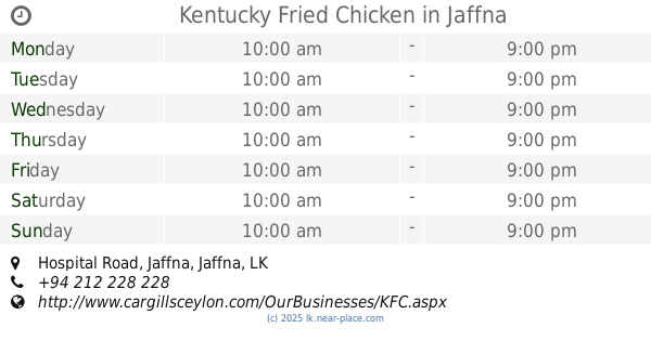
Kentucky Fried Chicken
Hospital Road, Jaffna
Restaurant
read more
225 m
Vijaya Cool bar
bus stand, Jaffna
Restaurant
read more
297 m
Pizza Hut
Hospital Road, Jaffna
Restaurant
read more
332 m
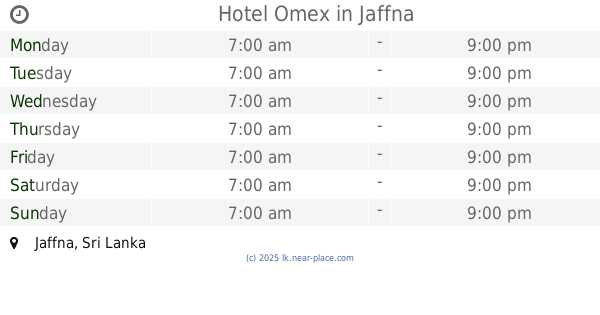
Hotel Omex
Jaffna
Restaurant
read more
337 m
Subhas Hotel
49, Victoria Road, Jaffna
Restaurant
read more
384 m
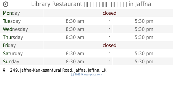
Library Restaurant පුස්තකාල හෝටලය
249 Jaffna-Kankesanturai Road, Jaffna
Restaurant
read more
402 m
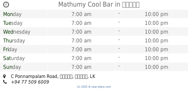
Mathumy Cool Bar
133, C Ponnampalam Road, யாழ்ப்பாணம்
Restaurant
read more
460 m
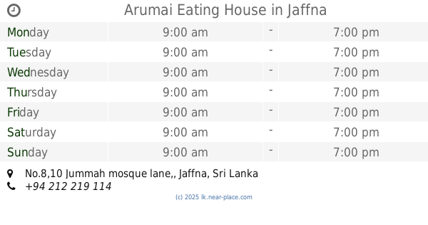
Arumai Eating House
No.8,10 Jummah mosque lane,, Jaffna
Restaurant
read more
469 m
Lingan Ice Cream
213 Stanley road, යාපනය
Restaurant
read more
472 m
Amul Non Vegetarian Restaurant
266/1 Stanly Road, Jaffna
Restaurant
read more
504 m
Nila Exclusive Veg. Treat
Stanly Road, Jaffna
Restaurant
read more
510 m
Akshathai
60, Stanly Road, Jaffna
Restaurant
read more
513 m
அக்ஷதை
Stanly Road, Jaffna
Restaurant
read more
548 m
Jo Hotel
jo hotel
Restaurant
read more
553 m
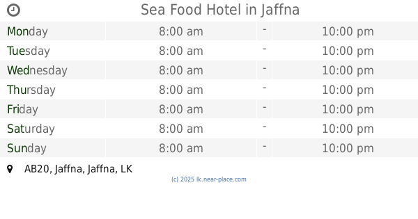
Sea Food Hotel
AB20, Jaffna
Restaurant
read more
563 m
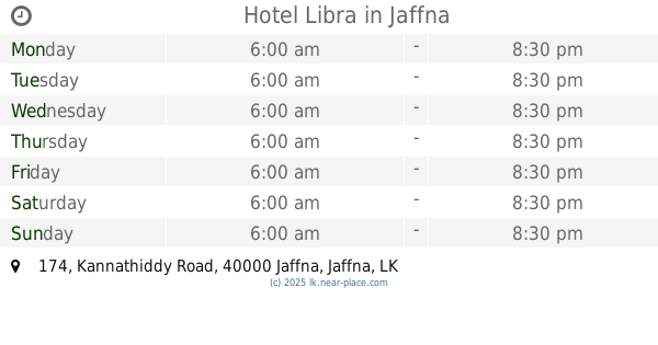
Hotel Libra
174 Kannathiddy Road, Jaffna
Restaurant
read more
575 m
Sri Palm Beach hotel
Kasthuriyar Road, Jaffna
Restaurant
read more
604 m
Greedy's Pizza & Restaurant
Kasthuriyar Road, Jaffna
Restaurant
read more
628 m
Gem Hotel
260, Jaffna-Kankesanturai Road, Jaffna
Restaurant
read more
667 m
The Kottu Lanka (Pvt) Ltd
271 Jaffna-Kankesanturai Road, Jaffna
Restaurant
read more
668 m
Welcome Hotel
16 2nd Cross Street, Jaffna
Restaurant
read more
727 m
Thaj Hotel
Kandy - Jaffna Hwy, Jaffna
Restaurant
read more
741 m
Rolexkitchen
212, Kasthuriyar road, Jaffna
Restaurant
read more
797 m
Ganga Rest
Hospital Street, Jaffna
Restaurant
read more
1.017 km
Vikey Farm (Chicken and Egg)
Jaffna
Restaurant
read more
📑
all categories
Accounting
Administrative area level 1
Administrative area level 2
Airport
Amusement park
Aquarium
Art gallery
Atm
Bakery
Bank
Bar
Beauty salon
Bicycle store
Book store
Bowling alley
Bus station
Cafe
Campground
Car dealer
Car rental
Car repair
Car wash
Casino
Cemetery
Church
City hall
Clothing store
Colloquial area
Convenience store
Country
Courthouse
Dentist
Department store
Doctor
Electrician
Electronics store
Embassy
Finance
Fire station
Florist
Food
Funeral home
Furniture store
Gas station
General contractor
Grocery or supermarket
Gym
Hair care
Hardware store
Health
Hindu Temple
Home goods store
Hospital
Insurance agency
Intersection
Jewelry store
Laundry
Lawyer
Library
Light rail station
Liquor store
Local government office
Locality
Locksmith
Lodging
Meal delivery
Meal takeaway
Mosque
Movie rental
Movie theater
Moving company
Museum
Natural feature
Neighborhood
Night club
Painter
Park
Parking
Pet store
Pharmacy
Physiotherapist
Place of worship
Plumber
Point of interest
Police
Political
Post office
Premise
Real estate agency
Restaurant
Roofing contractor
Route
Rv park, camping
School
Shoe store
Shopping mall
Spa
Stadium
Storage
Store
Subpremise
Supermarket
Synagogue
Taxi stand
Train station
Transit station
Travel agency
University
Veterinary care
Zoo
administrative area level 3
sublocality level 1
sublocality level 2
↑