Restaurant nearby Panorama Chinese Restaurant
Sri Lanka
Restaurant nearby Panorama Chinese Restaurant
Panorama Chinese Restaurant
Jayabima, Nattarampota 20168, Sri Lanka
contacts phone
:
+94
Latitude:
7.2799886
, Longitude:
80.6763287
larger map & directions
read more
nearest Restaurant
23 m
Tiffin's
Nattarampota
Restaurant
read more
29 m
Foodwoks
Nattarampota
Restaurant
read more
34 m
Wok Foodzz
Nattarampota
Restaurant
read more
115 m
Gourmet Resturent
Nattarampota
Restaurant
read more
396 m
kalapura brasswear
Kalapura Road
Restaurant
read more
618 m
Game Kade
A26, Kundasale
Restaurant
read more
634 m
Cafetaria - Police Hospital
Kundasale
Restaurant
read more
683 m
Seven Eleven 7eleven
Nattarampota
Restaurant
read more
684 m
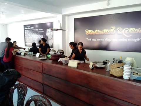
අපේ ගාම්මානය-මහසොහොන් බලකාය
Nattarampota
Restaurant
read more
760 m
New Excellent City Resturant & Bar
Kundasale
Restaurant
read more
792 m
Bensees Resturant
Ilukmodara
Restaurant
read more
837 m
Sakura Foods
Kundasale
Restaurant
read more
925 m
Matheesha Food Food Centre
Haragama Road, Tennekumbura
Restaurant
read more
1.087 km
Isuru Inn
No.250,Haragama Road, Pichchamalwatta, kandy, Haragama Road, Ilukmodara
Restaurant
read more
1.2 km
Hela Bojun Hala
Warapitiya, Kandy-Mahiyangane-Padiyatalawa Highway, Kundasale
Restaurant
read more
1.266 km
Kiyara Food
Old Kandy Road, Gurudeniya
Restaurant
read more
1.531 km
Kangaroo Villa
46/1, Rockview Gardens, Tennekumbura
Restaurant
read more
1.705 km
Hot Food Bakery And Grocery Store
A26, Tennekumbura
Restaurant
read more
2.023 km
Castle Hotel
Pallekele
Restaurant
read more
2.356 km
Hotel cristal gate
Ampitiya
Restaurant
read more
2.367 km
218 Holiday Resort
No , 218 Thalathuoya Road , Ketawala , Lewula, Ampitiya-Talatuoya Road, Ampitiya
Restaurant
read more
2.372 km
Avanhala by Royal Mall
288/2 Thalwatha Kandy
Restaurant
read more
2.449 km
Perera & Sons
Kandy
Restaurant
read more
2.496 km
Salubrious Guest House
A26, Kandy
Restaurant
read more
3.322 km
Time 2 Taste Hotel
Kandy
Restaurant
read more
📑
all categories
Accounting
Administrative area level 1
Administrative area level 2
Airport
Amusement park
Aquarium
Art gallery
Atm
Bakery
Bank
Bar
Beauty salon
Bicycle store
Book store
Bowling alley
Bus station
Cafe
Campground
Car dealer
Car rental
Car repair
Car wash
Casino
Cemetery
Church
City hall
Clothing store
Colloquial area
Convenience store
Country
Courthouse
Dentist
Department store
Doctor
Electrician
Electronics store
Embassy
Finance
Fire station
Florist
Food
Funeral home
Furniture store
Gas station
General contractor
Grocery or supermarket
Gym
Hair care
Hardware store
Health
Hindu Temple
Home goods store
Hospital
Insurance agency
Intersection
Jewelry store
Laundry
Lawyer
Library
Light rail station
Liquor store
Local government office
Locality
Locksmith
Lodging
Meal delivery
Meal takeaway
Mosque
Movie rental
Movie theater
Moving company
Museum
Natural feature
Neighborhood
Night club
Painter
Park
Parking
Pet store
Pharmacy
Physiotherapist
Place of worship
Plumber
Point of interest
Police
Political
Post office
Premise
Real estate agency
Restaurant
Roofing contractor
Route
Rv park, camping
School
Shoe store
Shopping mall
Spa
Stadium
Storage
Store
Subpremise
Supermarket
Synagogue
Taxi stand
Train station
Transit station
Travel agency
University
Veterinary care
Zoo
administrative area level 3
sublocality level 1
sublocality level 2
↑