Restaurant nearby Sujanee Food Center
Sri Lanka
Restaurant nearby Sujanee Food Center
Sujanee Food Center
Athurugiriya Road, Colombo, Western Province, LK Sri Lanka
contacts phone
:
+94 112 078 517
Latitude:
6.8780057
, Longitude:
79.9885999
larger map & directions
read more
nearest Restaurant
122 m
Ceylon Fisheries Corporation
Athurugiriya
Restaurant
read more
124 m
New Santha Foods
Thaldiyawala
Restaurant
read more
145 m
Machan Athurugiriya
Kotte - Bope Road
Restaurant
read more
210 m
Neluma Athurugiriya
No: 13, Borella Road, Athurugiriya
Restaurant
read more
248 m
Samanala Cafe
51,main street,godakama road,athurugiriya
Restaurant
read more
259 m
Dragon Chinese Food
Sri Lanka
Restaurant
read more
324 m
Domino's Pizza
Kotte - Bope Road
Restaurant
read more
510 m
Millennium Tyre
Sri Lanka
Restaurant
read more
560 m
Millennium Park Inn
No: 98, Zone 06, Kaduwela Road, Athurugiriya.
Restaurant
read more
933 m
King's Super
Boralugoda
Restaurant
read more
1.004 km
Chennai Express Cafe
Athurugiriya Road
Restaurant
read more
1.159 km
Yalu yalu restuarant
Athurugiriya
Restaurant
read more
1.376 km
මිලේනියම් කැෆේ
B174, Kaduwela
Restaurant
read more
1.38 km
Wickrama Hotel
Athurugiriya
Restaurant
read more
1.416 km
Sense food and juice bar
Shanthalokagama
Restaurant
read more
1.495 km
sahan Hotel
Oruwala
Restaurant
read more
1.515 km
Visula Nidahasa
Hokandara
Restaurant
read more
1.539 km
Sappayama restaurant
Kaduwela - Athurugiriya Road, Kaduwela
Restaurant
read more
1.758 km
Windy Food Cabin And Catering
339/3,Old gidagama road,Hokandara north,Hokandara
Restaurant
read more
2 km
Kumbuka Resturent
Hokandara
Restaurant
read more
2.253 km
Nilu's Tasty Hoppers
Station Road, Homagama
Restaurant
read more
2.26 km
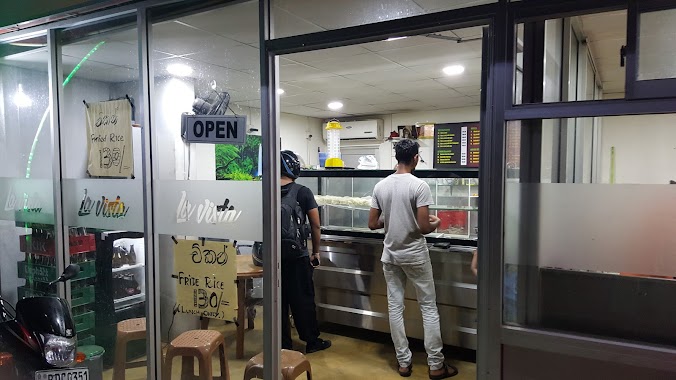
La Vista Takeaway & Catering Services
Athurugiriya Road, Sri Jayawardenepura Kotte
Restaurant
read more
2.978 km
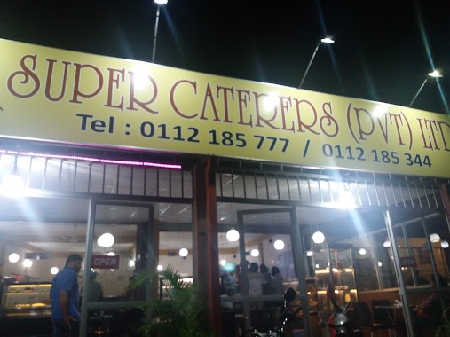
Super Caters
Arangala
Restaurant
read more
3.104 km
Sunseal's Restaurant & Caterers
Habarakada
Restaurant
read more
4.191 km
Ransiri Hotel
328/4 Kaduwela Road, Malabe
Restaurant
read more
📑
all categories
Accounting
Administrative area level 1
Administrative area level 2
Airport
Amusement park
Aquarium
Art gallery
Atm
Bakery
Bank
Bar
Beauty salon
Bicycle store
Book store
Bowling alley
Bus station
Cafe
Campground
Car dealer
Car rental
Car repair
Car wash
Casino
Cemetery
Church
City hall
Clothing store
Colloquial area
Convenience store
Country
Courthouse
Dentist
Department store
Doctor
Electrician
Electronics store
Embassy
Finance
Fire station
Florist
Food
Funeral home
Furniture store
Gas station
General contractor
Grocery or supermarket
Gym
Hair care
Hardware store
Health
Hindu Temple
Home goods store
Hospital
Insurance agency
Intersection
Jewelry store
Laundry
Lawyer
Library
Light rail station
Liquor store
Local government office
Locality
Locksmith
Lodging
Meal delivery
Meal takeaway
Mosque
Movie rental
Movie theater
Moving company
Museum
Natural feature
Neighborhood
Night club
Painter
Park
Parking
Pet store
Pharmacy
Physiotherapist
Place of worship
Plumber
Point of interest
Police
Political
Post office
Premise
Real estate agency
Restaurant
Roofing contractor
Route
Rv park, camping
School
Shoe store
Shopping mall
Spa
Stadium
Storage
Store
Subpremise
Supermarket
Synagogue
Taxi stand
Train station
Transit station
Travel agency
University
Veterinary care
Zoo
administrative area level 3
sublocality level 1
sublocality level 2
↑