School nearby Rainbow Kids
Coronavirus disease (COVID-19) Situation
confirmed cases
672754
deaths
16897
Sri Lanka
School nearby Rainbow Kids
Rainbow Kids
AB20, Kopay, Jaffna, LK Sri Lanka
contacts phone
:
+94
Latitude:
9.7078914
, Longitude:
80.0730499
larger map & directions
read more
nearest School
895 m
Kopay Saravanapavanantha Vidiyalayam
Sri Lanka
School
read more
1.026 km
Kalaivani Education Center
Jaffna
School
read more
1.049 km
J/Kopay Christian College
Jaffna
School
read more
1.055 km
Kopay Christian College
Kopay Christian College, B71, Jaffna
School
read more
1.481 km
Kopay R.C.T.M School
Kopay Base Hospital, Jaffna
School
read more
1.502 km
Kopay Navalar Vidyalayam
B71
School
read more
1.828 km
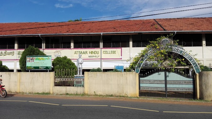
Athiyar Hindu College
AB20
School
read more
2.122 km
Kopay South R.C.T.M School
Jaffna
School
read more
2.461 km
J/ Koppai South Roman Catholic Tamil Kalavan School
Jaffna
School
read more
2.502 km
Irupalai Government Tamil Mixed School
Jaffna
School
read more
2.602 km
Neervely RCTM School
Neervely Cross Road
School
read more
2.629 km
Neervely Kaamaadshi Amman Kovil.
Neervely Cross Road
School
read more
3.01 km
Neervely Kandaswamy Kovil
Neervely Cross Road, Neervelly West
School
read more
3.01 km
J/Siruppiddy G.T.M School
Siruppiddy West, Neervely.
School
read more
3.098 km
Kopay maha vidiyalaiyam
Jaffna
School
read more
3.152 km
Mathuram Institute
Jaffna
School
read more
3.182 km
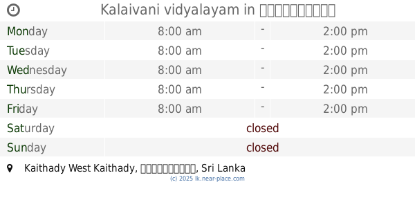
Kalaivani vidyalayam
Kaithady West Kaithady
School
read more
3.215 km
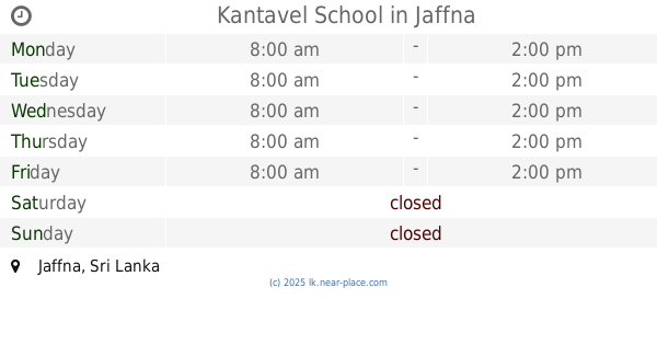
Kantavel School
Jaffna
School
read more
3.253 km
St.Michael's CC
Dżafna
School
read more
3.276 km
Urumpirai R.C.T.M School
st.michael church lane, AB18
School
read more
3.489 km
Hindu College Urumpirai
Jaffna
School
read more
3.489 km
Hindu College Urumpirai
Dżafna
School
read more
3.496 km
Urumpirai Hindu College
Urumpirai North
School
read more
3.734 km
The Express institutte
AB20, Jaffna
School
read more
3.749 km
Siruppiddy Saiva Vidya Salai
Siruppiddy
School
read more
📑
all categories
Accounting
Administrative area level 1
Administrative area level 2
Airport
Amusement park
Aquarium
Art gallery
Atm
Bakery
Bank
Bar
Beauty salon
Bicycle store
Book store
Bowling alley
Bus station
Cafe
Campground
Car dealer
Car rental
Car repair
Car wash
Casino
Cemetery
Church
City hall
Clothing store
Colloquial area
Convenience store
Country
Courthouse
Dentist
Department store
Doctor
Electrician
Electronics store
Embassy
Finance
Fire station
Florist
Food
Funeral home
Furniture store
Gas station
General contractor
Grocery or supermarket
Gym
Hair care
Hardware store
Health
Hindu Temple
Home goods store
Hospital
Insurance agency
Intersection
Jewelry store
Laundry
Lawyer
Library
Light rail station
Liquor store
Local government office
Locality
Locksmith
Lodging
Meal delivery
Meal takeaway
Mosque
Movie rental
Movie theater
Moving company
Museum
Natural feature
Neighborhood
Night club
Painter
Park
Parking
Pet store
Pharmacy
Physiotherapist
Place of worship
Plumber
Point of interest
Police
Political
Post office
Premise
Real estate agency
Restaurant
Roofing contractor
Route
Rv park, camping
School
Shoe store
Shopping mall
Spa
Stadium
Storage
Store
Subpremise
Supermarket
Synagogue
Taxi stand
Train station
Transit station
Travel agency
University
Veterinary care
Zoo
administrative area level 3
sublocality level 1
sublocality level 2
↑