School nearby Uduwella Primary College
Sri Lanka
School nearby Uduwella Primary College
Uduwella Primary College
Sri Lanka
contacts phone
:
+94
Latitude:
6.0877331
, Longitude:
80.411371
larger map & directions
read more
nearest School
1.232 km
Ella Ihala Dharmodaya Kanishta Vidyalaya
Galle
School
read more
2.177 km
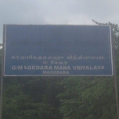
Magedara Maha Vidyalaya
akurassa road, magedara
School
read more
2.191 km
Minuwandeniya Kanishta Vidyalaya
Minuwandeniya Karagoda Galle
School
read more
2.209 km
Magedara Primary School
Magedara Yakkalamulla
School
read more
3.138 km
Bopitiya Vidyalaya
Bopitiya Manikgoda Road
School
read more
3.146 km
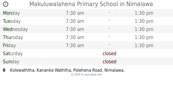
Makuluwalahena Primary School
Kolewaththa, Kananke Waththa, Polehena Road, Nimalawa
School
read more
3.852 km
Kaluwalagala Junior School
Magedara Galle
School
read more
4.379 km
Walpola Gunathilaka Kanishta Vidyalaya
Walpola Imaduwa
School
read more
4.654 km
Maliduwa Kanitu Vidyalaya
Matara
School
read more
4.75 km
Karaagoda Kanishta Vidyalaya
B480
School
read more
4.891 km
maliduwa maha vidyalaya
Eramudugoda Weliketiya Road
School
read more
5.177 km
Gunathilaka Vidyalaya
Sri Lanka
School
read more
5.238 km
DIYALAPE JUNIOR SCHOOL
Akuressa - Ketanwila Road
School
read more
5.245 km
Diyalape Vdyalaya
Sri Lanka
School
read more
5.838 km
Siri Vijaya Dham Pasala
Sri Lanka
School
read more
5.847 km
Wathogala Kanishta Vidyalaya
Wathogala Road, Yakkalamulla
School
read more
5.966 km
Nimalawa school
nimawala school
School
read more
6.363 km
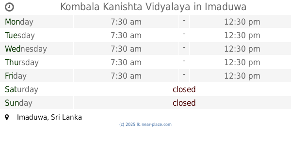
Kombala Kanishta Vidyalaya
Imaduwa
School
read more
6.391 km
Kobala kanishta vidyalaya
Sri Lanka
School
read more
7.425 km
Instar Higher Education Institute
Akuressa
School
read more
9.582 km
G/PANCHALIYA PRIMARY SCHOOL
Panchaliya - Borala Road
School
read more
12.234 km
අකුරුගොඩ රජයේ විද්යාලය
Malimboda-Akurugoda-Welihinda Road, Matara
School
read more
12.421 km
Arafa School
Weligama
School
read more
12.956 km
Siddhartha College
Weligama
School
read more
13.809 km
Thalahagama Junior School
Akuressa - Thalahagama - Makandura Road
School
read more
📑
all categories
Accounting
Administrative area level 1
Administrative area level 2
Airport
Amusement park
Aquarium
Art gallery
Atm
Bakery
Bank
Bar
Beauty salon
Bicycle store
Book store
Bowling alley
Bus station
Cafe
Campground
Car dealer
Car rental
Car repair
Car wash
Casino
Cemetery
Church
City hall
Clothing store
Colloquial area
Convenience store
Country
Courthouse
Dentist
Department store
Doctor
Electrician
Electronics store
Embassy
Finance
Fire station
Florist
Food
Funeral home
Furniture store
Gas station
General contractor
Grocery or supermarket
Gym
Hair care
Hardware store
Health
Hindu Temple
Home goods store
Hospital
Insurance agency
Intersection
Jewelry store
Laundry
Lawyer
Library
Light rail station
Liquor store
Local government office
Locality
Locksmith
Lodging
Meal delivery
Meal takeaway
Mosque
Movie rental
Movie theater
Moving company
Museum
Natural feature
Neighborhood
Night club
Painter
Park
Parking
Pet store
Pharmacy
Physiotherapist
Place of worship
Plumber
Point of interest
Police
Political
Post office
Premise
Real estate agency
Restaurant
Roofing contractor
Route
Rv park, camping
School
Shoe store
Shopping mall
Spa
Stadium
Storage
Store
Subpremise
Supermarket
Synagogue
Taxi stand
Train station
Transit station
Travel agency
University
Veterinary care
Zoo
administrative area level 3
sublocality level 1
sublocality level 2
↑