Atm nearby Commercial ATM
Sri Lanka
Atm nearby Commercial ATM
Commercial ATM
Peliyagoda, Sri Lanka
contacts phone
:
+94
Latitude:
6.9470665
, Longitude:
79.9392046
larger map & directions
read more
nearest Atm
1.432 km
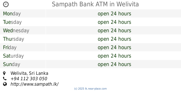
Sampath Bank ATM
Welivita
Atm
read more
1.91 km
Commercial Bank ATM
8th Mile Post Wellivitta, Kaduwela, B214
Atm
read more
2.038 km
BOC ATM
Belagama, Angoda
Atm
read more
2.051 km
Bank of Ceylon
314/R2, B435, Angoda
Atm
read more
2.336 km
National Savings Bank ATM (NSB ATM)
56/2 B231, Angoda
Atm
read more
2.359 km
HNB ATM
Kelaniya, Peliyagoda
Atm
read more
2.376 km
Commercial bank Kotikawatte Branch
No 895, Avissawella Road, Kotikawatte
Atm
read more
2.484 km
Peoples Bank ATM
1017 Biyagama Road, Peliyagoda
Atm
read more
2.554 km
Sampath Bank ATM
1017 Biyagama Road, Peliyagoda
Atm
read more
2.612 km
HNB ATM
Orugodawatte - Ambatale Road
Atm
read more
3.206 km
Seylan Bank ATM
Oil Refinery Junction - Free Trade Zone Road, Gonawala
Atm
read more
3.233 km
Seylan Bank Off Site ATM Yoshida Makola
Sapugaskanda, Makola Road
Atm
read more
3.533 km
Sampath Bank ATM
Dalugama
Atm
read more
3.533 km
Sampath Bank ATM,CDM
Dalugama
Atm
read more
3.65 km
Sampath Bank ATM
Colombo - Kandy Road, Kelaniya
Atm
read more
3.657 km
HNB Cash Line
Oil Refinery Junction - Free Trade Zone Road
Atm
read more
3.667 km
Seylan Bank ATM
Dalugama
Atm
read more
3.732 km
Commercial Bank ATM
Welivita Road, Malabe
Atm
read more
3.749 km
Pepole's Bank ATM
Dalugama, Kelaniya
Atm
read more
3.75 km
People's Bank ATM
Sarasavi Mawatha
Atm
read more
3.768 km
HNB ATM
Chandrika Kumaratunga Mawatha, Sri Jayawardenepura Kotte
Atm
read more
3.783 km
People's Bank ATM 2
Weweldoowa
Atm
read more
3.797 km
Sampath Bank ATM
54/13A Buthgamuwa Road
Atm
read more
3.899 km
Bank of Ceylon
No: 33,Gothatuwa New Town
Atm
read more
3.909 km
BOC ATM
Gothatuwa New Town
Atm
read more
📑
all categories
Accounting
Administrative area level 1
Administrative area level 2
Airport
Amusement park
Aquarium
Art gallery
Atm
Bakery
Bank
Bar
Beauty salon
Bicycle store
Book store
Bowling alley
Bus station
Cafe
Campground
Car dealer
Car rental
Car repair
Car wash
Casino
Cemetery
Church
City hall
Clothing store
Colloquial area
Convenience store
Country
Courthouse
Dentist
Department store
Doctor
Electrician
Electronics store
Embassy
Finance
Fire station
Florist
Food
Funeral home
Furniture store
Gas station
General contractor
Grocery or supermarket
Gym
Hair care
Hardware store
Health
Hindu Temple
Home goods store
Hospital
Insurance agency
Intersection
Jewelry store
Laundry
Lawyer
Library
Light rail station
Liquor store
Local government office
Locality
Locksmith
Lodging
Meal delivery
Meal takeaway
Mosque
Movie rental
Movie theater
Moving company
Museum
Natural feature
Neighborhood
Night club
Painter
Park
Parking
Pet store
Pharmacy
Physiotherapist
Place of worship
Plumber
Point of interest
Police
Political
Post office
Premise
Real estate agency
Restaurant
Roofing contractor
Route
Rv park, camping
School
Shoe store
Shopping mall
Spa
Stadium
Storage
Store
Subpremise
Supermarket
Synagogue
Taxi stand
Train station
Transit station
Travel agency
University
Veterinary care
Zoo
administrative area level 3
sublocality level 1
sublocality level 2
↑