Atm nearby Union Bank ATM
Sri Lanka
Atm nearby Union Bank ATM
Union Bank ATM
Colombo - Batticaloa Highway, Homagama, Colombo, LK Sri Lanka
contacts phone
:
+94 115 800 800
website:
www.unionb.com
Latitude:
6.8392548
, Longitude:
79.9874747
larger map & directions
read more
nearest Atm
416 m
Sampath Bank Mobile ATM
Vidharshana Mawatha, Homagama
Atm
read more
418 m
Sampath Bank ATM
Colombo - Batticaloa Highway, Pannipitiya
Atm
read more
989 m
BOC ATM
Homagama South, Homagama
Atm
read more
1.303 km
Pan Asia ATM
Avissawella Road, Homagama
Atm
read more
1.394 km
NSB ATM
Colombo - Batticaloa Highway, Homagama
Atm
read more
1.437 km
NDB ATM
Avissawella Road, Homagama
Atm
read more
1.745 km
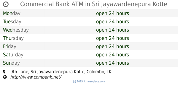
Commercial Bank ATM
6°50'22. 79°58'18.0"E, 9th Lane, Sri Jayawardenepura Kotte
Atm
read more
1.936 km
Hatton National Bank ATM
71-75 Colombo - Batticaloa Highway, Homagama
Atm
read more
1.961 km
Katuwana Bus stop
B452, Homagama
Atm
read more
1.994 km
Sampath Bank
No. 46, 1st Lane, Station Road, Homagama
Atm
read more
1.994 km
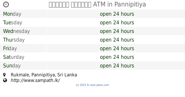
සම්පත් බැංකුව ATM
Pannipitiya
Atm
read more
2.045 km
Commercial Bank ATM
8 Avissawella Road, Homagama
Atm
read more
2.045 km
Bank of Ceylon
No. 93, High Level Road, Homagama
Atm
read more
2.446 km
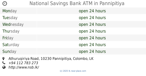
National Savings Bank ATM
Athurugiriya Road, Pannipitiya
Atm
read more
2.447 km
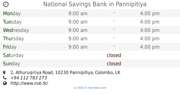
National Savings Bank
2 Athurugiriya Road, Pannipitiya
Atm
read more
2.479 km
Nations Trust Bank (ATM Only)
193/a/6 Polgasowita Road, Pannipitiya
Atm
read more
2.494 km
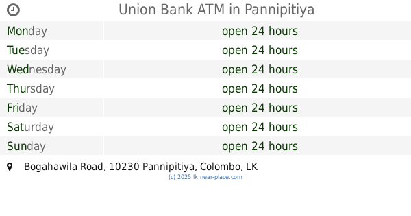
Union Bank ATM
Bogahawila Road, Pannipitiya
Atm
read more
2.589 km
People's Bank ATM
27 Pannipitiya Old Road, Pannipitiya
Atm
read more
2.694 km
HNB ATM
Kottawa Town, Pannipitiya
Atm
read more
2.712 km
Sampath Bank
Avissawella Road, Pannipitiya
Atm
read more
2.916 km
Bank Of Ceylon ATM
Pannipitiya
Atm
read more
2.926 km
Bank of Ceylon
Kottawa Town, Pannipitiya
Atm
read more
2.961 km
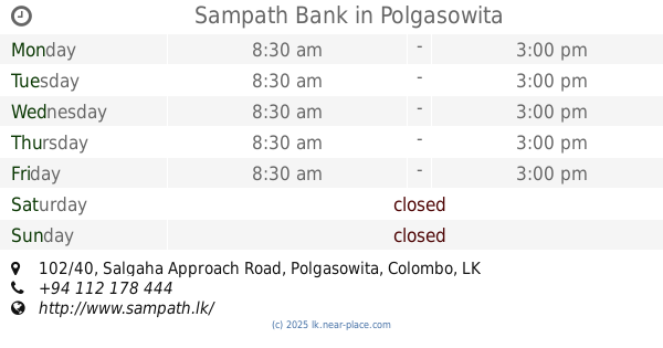
Sampath Bank
102/40 Salgaha Approach Road, Polgasowita
Atm
read more
2.966 km
Sampath Bank ATM
Polgasowita
Atm
read more
4.06 km
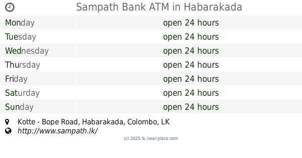
Sampath Bank ATM
Kotte - Bope Road, Habarakada
Atm
read more
📑
all categories
Accounting
Administrative area level 1
Administrative area level 2
Airport
Amusement park
Aquarium
Art gallery
Atm
Bakery
Bank
Bar
Beauty salon
Bicycle store
Book store
Bowling alley
Bus station
Cafe
Campground
Car dealer
Car rental
Car repair
Car wash
Casino
Cemetery
Church
City hall
Clothing store
Colloquial area
Convenience store
Country
Courthouse
Dentist
Department store
Doctor
Electrician
Electronics store
Embassy
Finance
Fire station
Florist
Food
Funeral home
Furniture store
Gas station
General contractor
Grocery or supermarket
Gym
Hair care
Hardware store
Health
Hindu Temple
Home goods store
Hospital
Insurance agency
Intersection
Jewelry store
Laundry
Lawyer
Library
Light rail station
Liquor store
Local government office
Locality
Locksmith
Lodging
Meal delivery
Meal takeaway
Mosque
Movie rental
Movie theater
Moving company
Museum
Natural feature
Neighborhood
Night club
Painter
Park
Parking
Pet store
Pharmacy
Physiotherapist
Place of worship
Plumber
Point of interest
Police
Political
Post office
Premise
Real estate agency
Restaurant
Roofing contractor
Route
Rv park, camping
School
Shoe store
Shopping mall
Spa
Stadium
Storage
Store
Subpremise
Supermarket
Synagogue
Taxi stand
Train station
Transit station
Travel agency
University
Veterinary care
Zoo
administrative area level 3
sublocality level 1
sublocality level 2
↑