Bakery nearby රෑ කඩේ මහවිල
Sri Lanka
Bakery nearby රෑ කඩේ මහවිල
රෑ කඩේ මහවිල
Modarawila Road, Panadura, Kalutara, LK Sri Lanka
contacts phone
:
+94
Latitude:
6.706682
, Longitude:
79.9336766
larger map & directions
read more
nearest Bakery
784 m
Perera Bakers
299/B/1 pinkotuwa junction pamunugama alubomulla
Bakery
read more
1.121 km
Rasilco Bakers
277/4 Horana Road, Panadura
Bakery
read more
1.219 km
Nonis Beakers
Panadura
Bakery
read more
1.501 km
Prima Cakes
පිංවල පාර, Panadura
Bakery
read more
2.095 km
Dinali Bakers
A8, Panadura
Bakery
read more
2.594 km
Demel&sons bakery
Horana Road, Panadura
Bakery
read more
2.616 km
The Cake Arts
650/18, Elsi Mawatha, Nalluruwa, Panadura
Bakery
read more
2.824 km
Bread Line
Sri Mahavihara Road, Panadura
Bakery
read more
2.837 km
My Dream Cake
Center Road, Wadduwa
Bakery
read more
2.872 km
Tiana Cupcakes
455 M3, Polkiriya watte,Malamulla, Galpoththa Road, Panadura
Bakery
read more
2.912 km
Baker's world
A2, Panadura
Bakery
read more
2.926 km
Jayoda Bakers
Bazaar West, Panadura
Bakery
read more
2.968 km
Angeerasa Bake House
Panadura
Bakery
read more
3.137 km
Salgado Bakers
Bazaar North, Panadura
Bakery
read more
3.205 km
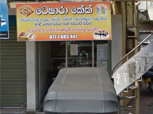
Teshara Cake Shop
Bazaar North, Panadura
Bakery
read more
3.309 km
Wijesiri Bakery
Arthur V. Dias Mawatha, Panadura
Bakery
read more
3.317 km
De Mel & Sons Bakers
322 Galle Road, Panadura
Bakery
read more
3.618 km
Bihara Food Corner
Mahanama Road, Panadura
Bakery
read more
3.663 km
De Mel Bakery
Arthur V. Dias Mawatha, Panadura
Bakery
read more
3.663 km
De Mel Bakery
Old Colombo - Galle Road, Panadura
Bakery
read more
3.665 km
The Cake Bake
Colombo - Galle Main Road, Wadduwa
Bakery
read more
3.813 km
Bunny cake shop
Jaya Sri Place, Panadura
Bakery
read more
5.846 km
Wazeem Cake Stall
Diggala Road, Panadura
Bakery
read more
6.116 km
NAWARA DISTRIBUTORS
No 11/126 A, ST Anne's Lane, Katukurunda, Moratuwa
Bakery
read more
6.484 km
Delicacies and Concept Flora
24/1 B235, Moratuwa
Bakery
read more
📑
all categories
Accounting
Administrative area level 1
Administrative area level 2
Airport
Amusement park
Aquarium
Art gallery
Atm
Bakery
Bank
Bar
Beauty salon
Bicycle store
Book store
Bowling alley
Bus station
Cafe
Campground
Car dealer
Car rental
Car repair
Car wash
Casino
Cemetery
Church
City hall
Clothing store
Colloquial area
Convenience store
Country
Courthouse
Dentist
Department store
Doctor
Electrician
Electronics store
Embassy
Finance
Fire station
Florist
Food
Funeral home
Furniture store
Gas station
General contractor
Grocery or supermarket
Gym
Hair care
Hardware store
Health
Hindu Temple
Home goods store
Hospital
Insurance agency
Intersection
Jewelry store
Laundry
Lawyer
Library
Light rail station
Liquor store
Local government office
Locality
Locksmith
Lodging
Meal delivery
Meal takeaway
Mosque
Movie rental
Movie theater
Moving company
Museum
Natural feature
Neighborhood
Night club
Painter
Park
Parking
Pet store
Pharmacy
Physiotherapist
Place of worship
Plumber
Point of interest
Police
Political
Post office
Premise
Real estate agency
Restaurant
Roofing contractor
Route
Rv park, camping
School
Shoe store
Shopping mall
Spa
Stadium
Storage
Store
Subpremise
Supermarket
Synagogue
Taxi stand
Train station
Transit station
Travel agency
University
Veterinary care
Zoo
administrative area level 3
sublocality level 1
sublocality level 2
↑