places in Balangoda
Sri Lanka
Balangoda
Balangoda
Administrative Region:
Sabaragamuwa Province
population:
13 589
calling code:
+94-45
postcode:
70100
Location on the map of Sri Lanka
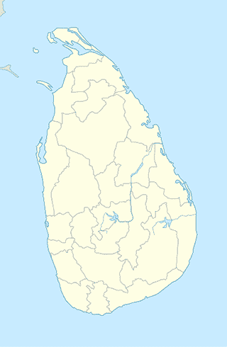
Balangoda
Cemetery
Pinnawala Cemetry
Balangoda-Bogawanthalawa Road
Cemetery
read more
Cemetery
Kirimetitenna - Galgoda Road
Cemetery
read more
Balangoda Public Cemetery
Rassagala Road, Balangoda
Cemetery
read more
Church
St. Joseph's Church
A4, Balangoda
Church
read more
Holy Emmanuel Church Balangoda
Barns Rathwathta Mawatha, Balangoda
Church
read more
Dentist
Peoples dental
48 Barns Rathwathta Mawatha, Balangoda
Dentist
read more
Doctor
Kirimetithenna Medical Centre
95 Kirimetitenna - Galgoda Road, Balangoda
Doctor
read more
සහන ඔසුස¿ල ආයුර්වේද
Pettigala Road, Balangoda
Doctor
read more
Electronics store
AUTO DEKHO
B38, Balangoda
Electronics store
read more
New Best And Fast Technologies
48 Barns Rathwathta Mawatha, Balangoda
Electronics store
read more
Sampath electricals
Balangoda
Electronics store
read more
Softolgic Branch
Balangoda
Electronics store
read more
JMC electromart
Balangoda
Electronics store
read more
Weligama Electrocity
No 88, Main Street A4, Balangoda
Electronics store
read more
LG Abans showroom
Balangoda
Electronics store
read more
Samsung showroom
Balangoda
Electronics store
read more
Drive Green Emision Testing Centre
Balangoda
Electronics store
read more
B-SOFT Solutions
285 "KUMARIE", Balangoda
Electronics store
read more
Feel Computers
Colombo - Batticaloa Highway, Balangoda
Electronics store
read more
Sisil
Balangoda
Electronics store
read more
Trio electronics
48 Barns Rathwathta Mawatha, Balangoda
Electronics store
read more
CS Computer Shop
Balangoda
Electronics store
read more
Weligama Trade Center
No 120, A4, Balangoda
Electronics store
read more
📑
Balangoda all categories
Art gallery
Atm
Bakery
Bank
Bar
Beauty salon
Bicycle store
Book store
Bus station
Cafe
Car rental
Car repair
Car wash
Cemetery
Church
City hall
Clothing store
Dentist
Doctor
Electronics store
Finance
Florist
Food
Furniture store
Gas station
General contractor
Grocery or supermarket
Gym
Hair care
Hardware store
Health
Hindu Temple
Home goods store
Hospital
Insurance agency
Jewelry store
Library
Liquor store
Local government office
Locality
Lodging
Mosque
Museum
Natural feature
Neighborhood
Park
Pharmacy
Place of worship
Point of interest
Police
Post office
Premise
Restaurant
Route
School
Shoe store
Shopping mall
Store
Supermarket
Travel agency
University
sublocality level 1
↑