Bank nearby Bank of Ceylon
Sri Lanka
Bank nearby Bank of Ceylon
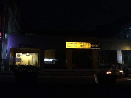
Bank of Ceylon
A1, Galigamuwa, Kegalle, LK Sri Lanka
contacts phone
:
+94 352 282 050
website:
www.boc.lk
Latitude:
7.2357113
, Longitude:
80.3097595
larger map & directions
read more
nearest Bank
33 m
People's Bank Galigamuwa
Galigamuwa
Bank
read more
203 m
Sanasa
Galigamuwa
Bank
read more
2.042 km
LOLC Ruwanwella
No 35 kegalla road Ruwanwella
Bank
read more
3.821 km
Seylan Bank
143 Colombo - Kandy Road, Kegalla
Bank
read more
3.834 km
BOC Super Grade Branch
Kegalle
Bank
read more
4.048 km
Sampath Bank
A1, Kegalle
Bank
read more
4.253 km
Savidana Bank(SCB)
Perera Buiding, A1, Kegalle
Bank
read more
4.261 km
SCB(Savidana Bank)
Kegalle
Bank
read more
4.323 km
Sanasa
Colombo - Kandy Road, Kegalla
Bank
read more
4.445 km
Peoples Bank Kegalle Main Branch
Main Street, Kegalla
Bank
read more
4.47 km
Sampath Bank
A1, Kegalla
Bank
read more
4.49 km
CDB Bank
Kegalle
Bank
read more
4.5 km
Hatton National Bank
Kegalla
Bank
read more
4.514 km
Bank Of Ceylon
681/5 Main Street, Kegalle
Bank
read more
4.514 km
Bank Of Ceylon- Kegalle City
681/5 Main Street, Kegalla
Bank
read more
4.58 km
NDB Bank
261/1 A1, Kegalle
Bank
read more
4.614 km
Golden Goll Holding Pvt Ltd
Kegalle
Bank
read more
4.674 km
Nations Trust Bank
Kegalle
Bank
read more
4.679 km
Nations Trust Bank
No. 176, Walawwa Watta
Bank
read more
4.701 km
Commercial Bank
No 186, Main Street, Kegalla
Bank
read more
4.743 km
MBSL
Kegalle
Bank
read more
4.799 km
National Savings Bank
A1, Kegalla
Bank
read more
4.946 km
Orient Finance PLC
Colombo - Kandy Road, Kegalla
Bank
read more
4.969 km
Union Bank
Colombo - Kandy Road, Kegalla
Bank
read more
5.334 km
BOC kegalle Branch
Nilwakka Road, Kegalle
Bank
read more
📑
all categories
Accounting
Administrative area level 1
Administrative area level 2
Airport
Amusement park
Aquarium
Art gallery
Atm
Bakery
Bank
Bar
Beauty salon
Bicycle store
Book store
Bowling alley
Bus station
Cafe
Campground
Car dealer
Car rental
Car repair
Car wash
Casino
Cemetery
Church
City hall
Clothing store
Colloquial area
Convenience store
Country
Courthouse
Dentist
Department store
Doctor
Electrician
Electronics store
Embassy
Finance
Fire station
Florist
Food
Funeral home
Furniture store
Gas station
General contractor
Grocery or supermarket
Gym
Hair care
Hardware store
Health
Hindu Temple
Home goods store
Hospital
Insurance agency
Intersection
Jewelry store
Laundry
Lawyer
Library
Light rail station
Liquor store
Local government office
Locality
Locksmith
Lodging
Meal delivery
Meal takeaway
Mosque
Movie rental
Movie theater
Moving company
Museum
Natural feature
Neighborhood
Night club
Painter
Park
Parking
Pet store
Pharmacy
Physiotherapist
Place of worship
Plumber
Point of interest
Police
Political
Post office
Premise
Real estate agency
Restaurant
Roofing contractor
Route
Rv park, camping
School
Shoe store
Shopping mall
Spa
Stadium
Storage
Store
Subpremise
Supermarket
Synagogue
Taxi stand
Train station
Transit station
Travel agency
University
Veterinary care
Zoo
administrative area level 3
sublocality level 1
sublocality level 2
↑