Bank nearby Co-operative Rural Bank
Sri Lanka
Bank nearby Co-operative Rural Bank
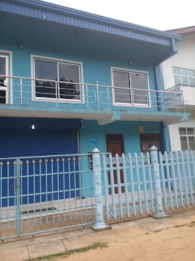
Co-operative Rural Bank
Pitipana - Thalagala Road, Colombo, Western Province, LK Sri Lanka
contacts phone
:
+94
Latitude:
6.8147002
, Longitude:
80.035446
larger map & directions
read more
nearest Bank
246 m
Sanasa Bank
No: 392/2, Pitipana South,, Delgahakanda -Govijanapadaya Road
Bank
read more
1.198 km
Sanasa Bank - Pitipana North, සණස බැංකුව - පිටිපන උතුර
Pitipana North
Bank
read more
1.891 km
හොරගල සමූපකාරය සහ ග්රාමීය බැංකුව
Horagala West
Bank
read more
2.326 km
Kiriwattuduwa Rural Bank
Ankuttawala Road, Talagala
Bank
read more
2.562 km
Sanasa Bank - Halgahadeniya
Kiriberiyakele
Bank
read more
3.068 km
Sanasa - Mawathgama
Sanasa, Road,, හෝමාගම
Bank
read more
3.161 km
Sanasa Rural Development Bank
Sri Lanka
Bank
read more
3.162 km
Sanasa Development Bank
Mahinda Mawatha
Bank
read more
3.433 km
Coporative Rural Bank-kiriwaththuduwa-special
Sri Lanka
Bank
read more
3.463 km
Seylan Bank
Kurunduwatta
Bank
read more
3.483 km
Sanasa Bank Uduwana
Uduwana
Bank
read more
3.8 km
Rural Bank
Horagala
Bank
read more
4.091 km
Sanasa Bank - Watareka
Watareka
Bank
read more
4.463 km
Commercial Bank Homagama Branch
No 100, Avissawella Road, Homagama
Bank
read more
4.474 km
Bimputh Finance PLC Homagama Branch
Colombo - Batticaloa Highway, Homagama
Bank
read more
4.513 km
People's Bank
No.15, High Level Rd, Homagama
Bank
read more
4.514 km
Nations Trust Bank
113 A හයිලෙවල් පාර, Homagama
Bank
read more
4.806 km
Samurdhi Bank - Homagama
Homagama
Bank
read more
4.839 km
NSB Bank
Avissawella Road, Homagama
Bank
read more
4.839 km
National Savings Bank
Avissawella Road, Homagama
Bank
read more
4.861 km
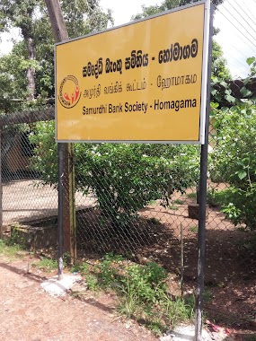
Samurdhi Bank Society
Homagama Town, Homagama
Bank
read more
4.918 km
Regional Development Bank - Homagama Branch
Colombo - Batticaloa Highway, Homagama
Bank
read more
4.96 km
Pan Asia Bank
Avissawella Road, Homagama
Bank
read more
5.004 km
Sanasa Development Bank
Homagama
Bank
read more
5.017 km
Sanasa Bank
B123, Millewa
Bank
read more
📑
all categories
Accounting
Administrative area level 1
Administrative area level 2
Airport
Amusement park
Aquarium
Art gallery
Atm
Bakery
Bank
Bar
Beauty salon
Bicycle store
Book store
Bowling alley
Bus station
Cafe
Campground
Car dealer
Car rental
Car repair
Car wash
Casino
Cemetery
Church
City hall
Clothing store
Colloquial area
Convenience store
Country
Courthouse
Dentist
Department store
Doctor
Electrician
Electronics store
Embassy
Finance
Fire station
Florist
Food
Funeral home
Furniture store
Gas station
General contractor
Grocery or supermarket
Gym
Hair care
Hardware store
Health
Hindu Temple
Home goods store
Hospital
Insurance agency
Intersection
Jewelry store
Laundry
Lawyer
Library
Light rail station
Liquor store
Local government office
Locality
Locksmith
Lodging
Meal delivery
Meal takeaway
Mosque
Movie rental
Movie theater
Moving company
Museum
Natural feature
Neighborhood
Night club
Painter
Park
Parking
Pet store
Pharmacy
Physiotherapist
Place of worship
Plumber
Point of interest
Police
Political
Post office
Premise
Real estate agency
Restaurant
Roofing contractor
Route
Rv park, camping
School
Shoe store
Shopping mall
Spa
Stadium
Storage
Store
Subpremise
Supermarket
Synagogue
Taxi stand
Train station
Transit station
Travel agency
University
Veterinary care
Zoo
administrative area level 3
sublocality level 1
sublocality level 2
↑