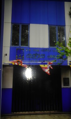
Bank nearby Peoples Bank
Sri Lanka
Bank nearby Peoples Bank
Peoples Bank
Kaduwela, Sri Lanka
contacts phone
:
+94 112 537 408
website:
www.peoplesbank.lk
Latitude:
6.9371658
, Longitude:
79.9807698
larger map & directions
read more
nearest Bank
29 m
Sanasa Development Bank
Kaduwela
Bank
read more
58 m
NDB Bank
AB10, Kaduwela
Bank
read more
62 m
NSB Bank
513 AB10, Kaduwela
Bank
read more
62 m
National Savings Bank
513 AB10, Kaduwela
Bank
read more
75 m
Hatton National Bank
AB10, Kaduwela
Bank
read more
92 m
CDB Finance PLC
No. 102, Colombo - Hanwella Low Level Road, Kaduwela
Bank
read more
102 m
DFCC Bank
Colombo - Hanwella Low Level Road, Kaduwela
Bank
read more
102 m
DFCC Bank
AB10, Kaduwela
Bank
read more
114 m
Bank of Ceylon
Kaduwela
Bank
read more
119 m
DFCC Bank - Kaduwela
506 G, Colombo Road, Kaduwela
Bank
read more
145 m
Commercial Bank Kaduwela Branch
Kaduwela
Bank
read more
145 m
Commercial Bank Kaduwela
commercial bank, Kaduwela
Bank
read more
194 m
Nation's Trust Bank PLC
510 Malabe - Kaduwela Road, Kaduwela
Bank
read more
206 m
Bimputh Finance PLC
AB10, Kaduwela
Bank
read more
213 m
National Savings Bank
514/4, AB10, Kaduwela
Bank
read more
432 m
HNB Grameen Kaduwela Branch
Kaduwela
Bank
read more
801 m
Pan Asia Bank
Kaduwela
Bank
read more
904 m
People's Bank
New Kandy Road
Bank
read more
932 m
AIA Bank
Kaduwela
Bank
read more
1.396 km
Kothalawala Sanasa Bank
121 B263, Kaduwela
Bank
read more
2.418 km
Sanasa Societies Ltd
383 Athurugiriya Road, Kaduwela
Bank
read more
2.645 km
Nations Trust Bank - SLIIT Branch
Malabe North, Malabe
Bank
read more
2.983 km
cooperate bank
Kaduwela - Athurugiriya Road, Kaduwela
Bank
read more
3.992 km
Bank Of Ceylon
Korathota
Bank
read more
4.736 km
Sampath Bank
Udawaththa Road, Malabe
Bank
read more
📑
all categories
Accounting
Administrative area level 1
Administrative area level 2
Airport
Amusement park
Aquarium
Art gallery
Atm
Bakery
Bank
Bar
Beauty salon
Bicycle store
Book store
Bowling alley
Bus station
Cafe
Campground
Car dealer
Car rental
Car repair
Car wash
Casino
Cemetery
Church
City hall
Clothing store
Colloquial area
Convenience store
Country
Courthouse
Dentist
Department store
Doctor
Electrician
Electronics store
Embassy
Finance
Fire station
Florist
Food
Funeral home
Furniture store
Gas station
General contractor
Grocery or supermarket
Gym
Hair care
Hardware store
Health
Hindu Temple
Home goods store
Hospital
Insurance agency
Intersection
Jewelry store
Laundry
Lawyer
Library
Light rail station
Liquor store
Local government office
Locality
Locksmith
Lodging
Meal delivery
Meal takeaway
Mosque
Movie rental
Movie theater
Moving company
Museum
Natural feature
Neighborhood
Night club
Painter
Park
Parking
Pet store
Pharmacy
Physiotherapist
Place of worship
Plumber
Point of interest
Police
Political
Post office
Premise
Real estate agency
Restaurant
Roofing contractor
Route
Rv park, camping
School
Shoe store
Shopping mall
Spa
Stadium
Storage
Store
Subpremise
Supermarket
Synagogue
Taxi stand
Train station
Transit station
Travel agency
University
Veterinary care
Zoo
administrative area level 3
sublocality level 1
sublocality level 2
↑