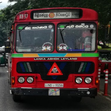
Bus station nearby Halpita Bus Stop
Sri Lanka
Bus station nearby Halpita Bus Stop
Halpita Bus Stop
B84, Piliyandala, Colombo, LK Sri Lanka
contacts phone
:
+94
Latitude:
6.7901337
, Longitude:
79.9551809
larger map & directions
read more
nearest Bus station
48 m
Halpita Bus Stop
B84, Polgasowita
Bus station
read more
353 m
14 Kanuva Bus Stop
B84, Piliyandala
Bus station
read more
637 m
Halpita Bar Bus Stop
B84, Polgasowita
Bus station
read more
852 m
Kesbawa CTB Depot
Piliyandala
Bus station
read more
874 m
CTB Depot Bus Stop
B84, Piliyandala
Bus station
read more
1.297 km
Court Complex Bus Stop
B84, Piliyandala
Bus station
read more
1.374 km
Thoranawila Junction Bus Stop
Kesbewa-Kindelpitiya-Bandaragama Road, Piliyandala
Bus station
read more
1.374 km
Thoranawila Junction Bus Stop
Bandaragama Road, Piliyandala
Bus station
read more
1.406 km
Bakeriya Junction Bus Stop
Makandana Road, Piliyandala
Bus station
read more
1.681 km
Kesbewa Main Bus Stand
Kesbewa-Kindelpitiya-Bandaragama Road, Piliyandala
Bus station
read more
1.681 km
Kesbewa Main Bus Stand
Bandaragama Road, Piliyandala
Bus station
read more
2.133 km
Kudamaduwa Junction Bus Stop
B267
Bus station
read more
2.664 km
Nampamunuwa Bus Stop
Nampamunuwa
Bus station
read more
2.709 km
Mac Pack Bus Stop
Nampamunuwa
Bus station
read more
2.738 km
Gewalpaha Junction
sineth printing
Bus station
read more
2.772 km
Siddamulla Bus Stop
B267, Pannipitiya
Bus station
read more
3.212 km
Alpha Bus Stop
Mattegoda West, Polgasowita
Bus station
read more
3.236 km
Mattegoda Bus Station
Polgasowita
Bus station
read more
3.264 km
Palagama Bus Station
Bus station
read more
3.352 km
Supermarket Bus Stop
Salgaha Approach Road, Polgasowita
Bus station
read more
3.385 km
Mattegoda Temple Bus Stop
Mattegoda Central A, Polgasowita
Bus station
read more
3.4 km
Vishwakalawa Bus Stop
B367, Piliyandala
Bus station
read more
3.512 km
Palagama Junction
79/a Alabama polgasovita
Bus station
read more
3.573 km
Makuluduwa Junction Bus Stop
Makuluduwa Road, Piliyandala
Bus station
read more
4.12 km
Diyakada Bus Station
Weediyagoda Road
Bus station
read more
📑
all categories
Accounting
Administrative area level 1
Administrative area level 2
Airport
Amusement park
Aquarium
Art gallery
Atm
Bakery
Bank
Bar
Beauty salon
Bicycle store
Book store
Bowling alley
Bus station
Cafe
Campground
Car dealer
Car rental
Car repair
Car wash
Casino
Cemetery
Church
City hall
Clothing store
Colloquial area
Convenience store
Country
Courthouse
Dentist
Department store
Doctor
Electrician
Electronics store
Embassy
Finance
Fire station
Florist
Food
Funeral home
Furniture store
Gas station
General contractor
Grocery or supermarket
Gym
Hair care
Hardware store
Health
Hindu Temple
Home goods store
Hospital
Insurance agency
Intersection
Jewelry store
Laundry
Lawyer
Library
Light rail station
Liquor store
Local government office
Locality
Locksmith
Lodging
Meal delivery
Meal takeaway
Mosque
Movie rental
Movie theater
Moving company
Museum
Natural feature
Neighborhood
Night club
Painter
Park
Parking
Pet store
Pharmacy
Physiotherapist
Place of worship
Plumber
Point of interest
Police
Political
Post office
Premise
Real estate agency
Restaurant
Roofing contractor
Route
Rv park, camping
School
Shoe store
Shopping mall
Spa
Stadium
Storage
Store
Subpremise
Supermarket
Synagogue
Taxi stand
Train station
Transit station
Travel agency
University
Veterinary care
Zoo
administrative area level 3
sublocality level 1
sublocality level 2
↑