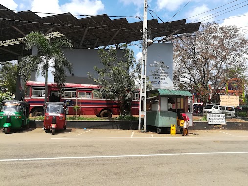
Bus station nearby Hospital Bus Stop
Sri Lanka
Bus station nearby Hospital Bus Stop
Hospital Bus Stop
Kandy-Jaffna Highway, Vavuniya, Vavuniya, LK Sri Lanka
contacts phone
:
+94
Latitude:
8.760641
, Longitude:
80.4994845
larger map & directions
read more
nearest Bus station
287 m
Iluppayadi
Horowpotana Road, Vavuniya
Bus station
read more
630 m
Horowapothana Bus Stop
Horowpotana Road, Vavuniya
Bus station
read more
798 m
Vavuniya Central Bus Station
Station Road, Vavuniya
Bus station
read more
3.881 km
Kulumaddu Juction Bus Stop
Vavuniya-Parayanalankulam Highway, Vavuniya
Bus station
read more
13.886 km
Ellamaruthankulam Junction Bus Stop
Bus station
read more
24.646 km
Madawachchiya Bus Stand
Medawachchiya-Talaimannar Highway, Medawachchiya
Bus station
read more
35.463 km
Rambewa
Kandy-Jaffna Highway, Rambewa
Bus station
read more
39.058 km
Parasangasweva Junction Bus Stop
Anuradhapura-Rambewa Highway
Bus station
read more
43.304 km
Seeppukalama Bus Stop
Samaya home, seeppukulama
Bus station
read more
44.669 km
Bus Station Mihintale
Mihintale
Bus station
read more
46.977 km
Mallavi Bus Stand
Mankulam-Vellankulam Road
Bus station
read more
47.514 km
Mawatha Bus Stop
Sri Maha Bodhi Mawatha, Anuradhapura
Bus station
read more
47.615 km
Old Bus Stand
Anuradhapura
Bus station
read more
48.202 km
Clock Tower Bus Stop
Maithripala Senanayake Mawatha, Anuradhapura
Bus station
read more
48.607 km
Central Bank Bus Stop
Maithripala Senanayake Mawatha, Anuradhapura
Bus station
read more
49.28 km
Library Bus Stop
Maithripala Senanayake Mawatha, Anuradhapura
Bus station
read more
49.335 km
Hospital Bus Stop
Harischandra Mawatha, Anuradhapura
Bus station
read more
49.451 km
Kada Panaha Bus Stop
Bandaranaike Mawatha, Anuradhapura
Bus station
read more
50.111 km
Thunukkai Bus Stop
Bus station
read more
50.133 km
Pandulagama Bus Stop
Old Puttalam Road, Anuradhapura
Bus station
read more
50.35 km
Prison Bus Stop
Jayanthi Mawatha, Anuradhapura
Bus station
read more
50.473 km
Dhaiyagama Junction Bus Stop
D S Senanayake Mawatha, Anuradhapura
Bus station
read more
50.59 km
2nd Mile Post Bus Stop
Anuradhapura-Padeniya Highway, Anuradhapura
Bus station
read more
51.028 km
SOS Bus Station
AB2, Anuradhapura
Bus station
read more
51.313 km
Alankulama Bus Stop
Alankulama
Bus station
read more
📑
all categories
Accounting
Administrative area level 1
Administrative area level 2
Airport
Amusement park
Aquarium
Art gallery
Atm
Bakery
Bank
Bar
Beauty salon
Bicycle store
Book store
Bowling alley
Bus station
Cafe
Campground
Car dealer
Car rental
Car repair
Car wash
Casino
Cemetery
Church
City hall
Clothing store
Colloquial area
Convenience store
Country
Courthouse
Dentist
Department store
Doctor
Electrician
Electronics store
Embassy
Finance
Fire station
Florist
Food
Funeral home
Furniture store
Gas station
General contractor
Grocery or supermarket
Gym
Hair care
Hardware store
Health
Hindu Temple
Home goods store
Hospital
Insurance agency
Intersection
Jewelry store
Laundry
Lawyer
Library
Light rail station
Liquor store
Local government office
Locality
Locksmith
Lodging
Meal delivery
Meal takeaway
Mosque
Movie rental
Movie theater
Moving company
Museum
Natural feature
Neighborhood
Night club
Painter
Park
Parking
Pet store
Pharmacy
Physiotherapist
Place of worship
Plumber
Point of interest
Police
Political
Post office
Premise
Real estate agency
Restaurant
Roofing contractor
Route
Rv park, camping
School
Shoe store
Shopping mall
Spa
Stadium
Storage
Store
Subpremise
Supermarket
Synagogue
Taxi stand
Train station
Transit station
Travel agency
University
Veterinary care
Zoo
administrative area level 3
sublocality level 1
sublocality level 2
↑