Cafe nearby Ceylon Cafe
Sri Lanka
Cafe nearby Ceylon Cafe
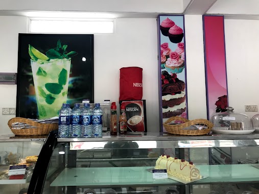
Ceylon Cafe
Susitha Pura, Malabe, Sri Lanka
contacts phone
:
+94
Latitude:
6.9040381
, Longitude:
79.9564602
larger map & directions
read more
nearest Cafe
235 m
Flavour (Highland Milk Shop Malabe)
No: 411/3A,, Athurugiriya Road, Malabe
Cafe
read more
546 m
The Fab
Kaduwela Road, Malabe
Cafe
read more
1.013 km
Perera & Sons
Sri Jayawardenepura Kotte
Cafe
read more
1.329 km
Bojunka Bakers
487/2A Thalahena Road
Cafe
read more
1.399 km
CINEC Cafeteria
Malabe
Cafe
read more
1.579 km
Gamini Grocery
I Jothipala Mawatha, Malabe
Cafe
read more
1.71 km
Susantha Foods
Malabe North, Malabe
Cafe
read more
1.725 km
Destino by A's Bakes
Pothuarawa Road, Sri Jayawardenepura Kotte
Cafe
read more
1.917 km
Athukorala Stores
Malabe East, Malabe
Cafe
read more
1.951 km
Oshin Bakers
New Kandy Road
Cafe
read more
2.014 km
Avanhala Malabe
Kaduwela Road, Malabe
Cafe
read more
2.056 km
Mid night Bakery
Malabe North, Malabe
Cafe
read more
2.079 km
Sliit View Hotel
Malabe
Cafe
read more
2.224 km
Sun Rich
B263, Malabe
Cafe
read more
2.256 km
Refresh Sliit Engineering Cafe
Malabe North, Malabe
Cafe
read more
2.262 km
Verginia Residancies play ground
Malabe - Kaduwela Road, Malabe
Cafe
read more
2.267 km
Auntys Rice shop
Malabe
Cafe
read more
2.282 km
Crimsons Bakery at Laugfes Super
B240, Sri Jayawardenepura Kotte
Cafe
read more
2.526 km
Dushan Stores
Jayagath Mawatha, Hokandara
Cafe
read more
2.565 km
Perera & Sons
386 B240, Sri Jayawardenepura Kotte
Cafe
read more
2.616 km
Diana Juice Bar
Arangala
Cafe
read more
3.108 km
Sugar Inc
713 D. P. Wijeshinghe Mawatha
Cafe
read more
3.293 km
Cafe 10th Athurugiriya Outlet
Athurugiriya Road
Cafe
read more
3.347 km
Divine Cakes
Battaramulla Road, Sri Jayawardenepura Kotte
Cafe
read more
3.41 km
Sweet Surrender
Pelawatte, Kumarage watta
Cafe
read more
📑
all categories
Accounting
Administrative area level 1
Administrative area level 2
Airport
Amusement park
Aquarium
Art gallery
Atm
Bakery
Bank
Bar
Beauty salon
Bicycle store
Book store
Bowling alley
Bus station
Cafe
Campground
Car dealer
Car rental
Car repair
Car wash
Casino
Cemetery
Church
City hall
Clothing store
Colloquial area
Convenience store
Country
Courthouse
Dentist
Department store
Doctor
Electrician
Electronics store
Embassy
Finance
Fire station
Florist
Food
Funeral home
Furniture store
Gas station
General contractor
Grocery or supermarket
Gym
Hair care
Hardware store
Health
Hindu Temple
Home goods store
Hospital
Insurance agency
Intersection
Jewelry store
Laundry
Lawyer
Library
Light rail station
Liquor store
Local government office
Locality
Locksmith
Lodging
Meal delivery
Meal takeaway
Mosque
Movie rental
Movie theater
Moving company
Museum
Natural feature
Neighborhood
Night club
Painter
Park
Parking
Pet store
Pharmacy
Physiotherapist
Place of worship
Plumber
Point of interest
Police
Political
Post office
Premise
Real estate agency
Restaurant
Roofing contractor
Route
Rv park, camping
School
Shoe store
Shopping mall
Spa
Stadium
Storage
Store
Subpremise
Supermarket
Synagogue
Taxi stand
Train station
Transit station
Travel agency
University
Veterinary care
Zoo
administrative area level 3
sublocality level 1
sublocality level 2
↑