Cafe nearby Krish cafe
Sri Lanka
Cafe nearby Krish cafe
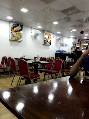
Krish cafe
Hendala South, Wattala, Sri Lanka
contacts phone
:
+94 77 204 4621
Latitude:
6.9916262
, Longitude:
79.8936436
larger map & directions
read more
nearest Cafe
139 m
Seeds Juice Station
520B Negombo-Colombo Main Road, Wattala
Cafe
read more
476 m
Mints Foods
129b Old Negombo Road, Wattala
Cafe
read more
548 m
Golden Cafe Pure Vegetarian Cafe
366 Negombo Road, Wattala
Cafe
read more
706 m
Sampath Foods
Hendala Road, Wattala
Cafe
read more
994 m
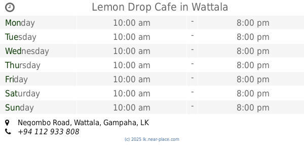
Lemon Drop Cafe
No. 305A, Negombo Road, Wattala
Cafe
read more
1.12 km
Lyceum Wattala Canteen
Wattala
Cafe
read more
1.277 km
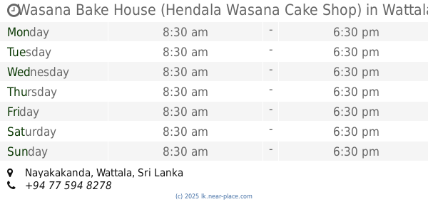
Wasana Bake House (Hendala Wasana Cake Shop)
Wattala
Cafe
read more
1.289 km
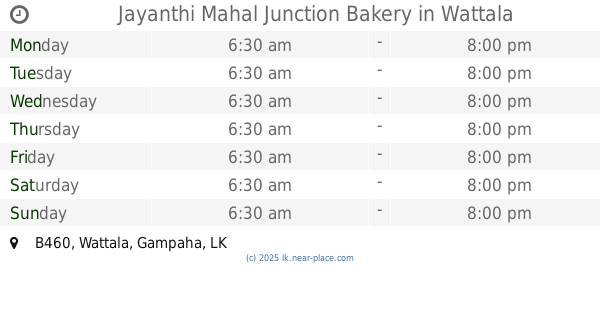
Jayanthi Mahal Junction Bakery
B460, Wattala
Cafe
read more
1.293 km
Xtreme Gaming Center
1st floor, 6B, Hekitha road, Wattala
Cafe
read more
1.402 km
Rancrisp Wattala
Negombo Road, Wattala
Cafe
read more
1.419 km
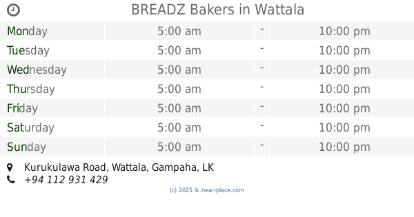
BREADZ Bakers
1190/4 11300, Kurukulawa Road, Wattala
Cafe
read more
1.454 km
Kapila Hotel
Wattala
Cafe
read more
1.454 km
Kapila Hotel
No:13 Averiwatta Road, Wattala
Cafe
read more
1.486 km
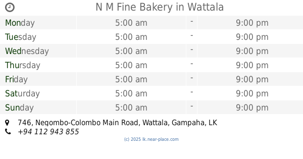
N M Fine Bakery
746 Negombo-Colombo Main Road, Wattala
Cafe
read more
1.503 km
Red Pepper
Old Negombo Road, Wattala
Cafe
read more
1.531 km
Jayamaha Bakery Road
Weliamuna Road, Wattala
Cafe
read more
1.566 km
Al Umma's
Magammana
Cafe
read more
1.613 km
trianglepix Gallery
Wattala
Cafe
read more
1.656 km
Pathum Bakery
Old Dispensary Road, Wattala
Cafe
read more
1.923 km
Hot Tea
Wanawasala - Wattala Road, Wattala
Cafe
read more
2.08 km
Perera & Sons
39, Hendala Road, Wattala
Cafe
read more
2.157 km
Ranmayura Bake House
Jambuwatta Road
Cafe
read more
2.556 km
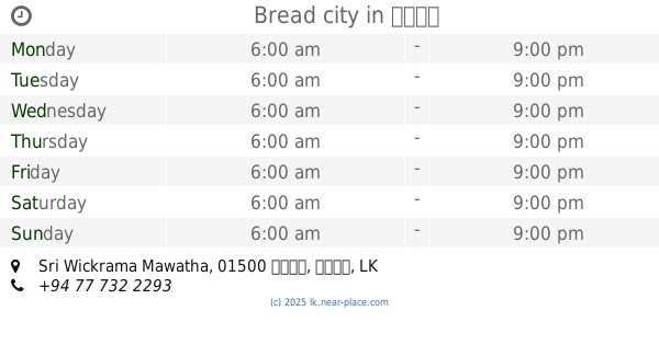
Bread city
01500, Sri Wickrama Mawatha, කොළඹ
Cafe
read more
2.763 km
vijaya
Wattala
Cafe
read more
2.802 km
Thish plaza
Meegahawatta Road, Wattala
Cafe
read more
📑
all categories
Accounting
Administrative area level 1
Administrative area level 2
Airport
Amusement park
Aquarium
Art gallery
Atm
Bakery
Bank
Bar
Beauty salon
Bicycle store
Book store
Bowling alley
Bus station
Cafe
Campground
Car dealer
Car rental
Car repair
Car wash
Casino
Cemetery
Church
City hall
Clothing store
Colloquial area
Convenience store
Country
Courthouse
Dentist
Department store
Doctor
Electrician
Electronics store
Embassy
Finance
Fire station
Florist
Food
Funeral home
Furniture store
Gas station
General contractor
Grocery or supermarket
Gym
Hair care
Hardware store
Health
Hindu Temple
Home goods store
Hospital
Insurance agency
Intersection
Jewelry store
Laundry
Lawyer
Library
Light rail station
Liquor store
Local government office
Locality
Locksmith
Lodging
Meal delivery
Meal takeaway
Mosque
Movie rental
Movie theater
Moving company
Museum
Natural feature
Neighborhood
Night club
Painter
Park
Parking
Pet store
Pharmacy
Physiotherapist
Place of worship
Plumber
Point of interest
Police
Political
Post office
Premise
Real estate agency
Restaurant
Roofing contractor
Route
Rv park, camping
School
Shoe store
Shopping mall
Spa
Stadium
Storage
Store
Subpremise
Supermarket
Synagogue
Taxi stand
Train station
Transit station
Travel agency
University
Veterinary care
Zoo
administrative area level 3
sublocality level 1
sublocality level 2
↑