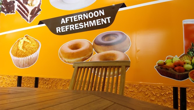
Cafe nearby Natural Lanka Printers
Sri Lanka
Cafe nearby Natural Lanka Printers
Natural Lanka Printers
Dankotuwa-Hettirrippuwa Road, Dankotuwa, Puttalam, LK Sri Lanka
contacts phone
:
+94 77 661 4906
Latitude:
7.3204194
, Longitude:
79.9147385
larger map & directions
read more
nearest Cafe
2.935 km
ආනන්ද අයියාගේ කඩය
Puttalam
Cafe
read more
3.02 km
Natural lanka Advertising
Puttalam
Cafe
read more
3.849 km
Ivan Tea Cafe
Dankotuwa
Cafe
read more
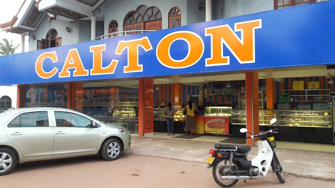
3.87 km
CALTON
Negombo-Kurunegala Road, Dankotuwa
Cafe
read more
3.908 km
Park And Drink
road, kurunagala, Minuwangoda
Cafe
read more
4.313 km
Natural Lanka Printers
Dankotuwa
Cafe
read more
4.421 km
SUSILA Hotel
Dankotuwa
Cafe
read more
4.727 km
Tulati Rice Cafe
Kirimatiyana Junction
Cafe
read more
5.075 km
Yasantha Cafe
Rata Mada Paara
Cafe
read more
6.438 km
J&J Cafe and Book shop
Puttalam; North West Province
Cafe
read more
7.641 km
Rosary Pastry & Juice Bar
Puttalam Road, Nainamadama
Cafe
read more
8.125 km
University Cafeteria
Wayamba University, Negombo-Kurunegala Road
Cafe
read more
8.173 km
T B E Chaturanga
Puttalam
Cafe
read more
8.687 km
Sky Media Internet Cafe
7.265365, 79.858846
Cafe
read more
10.455 km
Calton
Katuneriya
Cafe
read more
11.338 km
Bhagya Celluler
Puttalam Road, Nattandiya
Cafe
read more
11.766 km
Piumi Bake House
Negombo
Cafe
read more
11.795 km
H.M Juice Bar & Snack Corner
108 Porutota Road, Negombo
Cafe
read more
13.475 km
Cafe enviro
277 Lewis Place, Negombo
Cafe
read more
13.528 km
Ravidu Hotel
Thalammehera
Cafe
read more
14.012 km
Stollen
No 391/A Main Street, Negombo
Cafe
read more
14.306 km
The Fab, Negombo
Negombo
Cafe
read more
14.866 km
National Bake House
30 Greens Road, Negombo
Cafe
read more
15.078 km
Icebear Century Café
Negombo
Cafe
read more
16.88 km
Iwura Lagoon Guest House
907/A,, Pitipana South,, Negombo
Cafe
read more
📑
all categories
Accounting
Administrative area level 1
Administrative area level 2
Airport
Amusement park
Aquarium
Art gallery
Atm
Bakery
Bank
Bar
Beauty salon
Bicycle store
Book store
Bowling alley
Bus station
Cafe
Campground
Car dealer
Car rental
Car repair
Car wash
Casino
Cemetery
Church
City hall
Clothing store
Colloquial area
Convenience store
Country
Courthouse
Dentist
Department store
Doctor
Electrician
Electronics store
Embassy
Finance
Fire station
Florist
Food
Funeral home
Furniture store
Gas station
General contractor
Grocery or supermarket
Gym
Hair care
Hardware store
Health
Hindu Temple
Home goods store
Hospital
Insurance agency
Intersection
Jewelry store
Laundry
Lawyer
Library
Light rail station
Liquor store
Local government office
Locality
Locksmith
Lodging
Meal delivery
Meal takeaway
Mosque
Movie rental
Movie theater
Moving company
Museum
Natural feature
Neighborhood
Night club
Painter
Park
Parking
Pet store
Pharmacy
Physiotherapist
Place of worship
Plumber
Point of interest
Police
Political
Post office
Premise
Real estate agency
Restaurant
Roofing contractor
Route
Rv park, camping
School
Shoe store
Shopping mall
Spa
Stadium
Storage
Store
Subpremise
Supermarket
Synagogue
Taxi stand
Train station
Transit station
Travel agency
University
Veterinary care
Zoo
administrative area level 3
sublocality level 1
sublocality level 2
↑