Cafe nearby VTA Cafe
Sri Lanka
Cafe nearby VTA Cafe
VTA Cafe
Talalla Sri Lanka
contacts phone
:
+94
Latitude:
5.9483067
, Longitude:
80.6266733
read more
nearest Cafe
5.263 km
Yaalu
A2, Dondra
Cafe
read more
5.59 km
Science Faculty Cafe
Matara
Cafe
read more
5.682 km
Staff Canteen
A2, Matara
Cafe
read more
5.704 km
Staff-Cafe
A2, Matara
Cafe
read more
6.113 km
Tokyo,Kyoto
japan lanka hotel Road, Matara
Cafe
read more
7.084 km
Ranjani Cafe
welewatta,matara
Cafe
read more
7.989 km
FA Hotel
A2, Matara
Cafe
read more
8.225 km
Verse Collective
Pehebiya Road
Cafe
read more
8.433 km
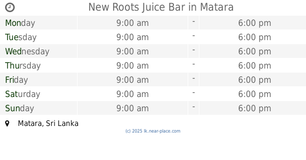
New Roots Juice Bar
Matara
Cafe
read more
8.943 km
D.E.N. New Jayasiri Hotel
Matara
Cafe
read more
9.046 km
Dots Surf Cafe
Nilwella Road, Dickwella
Cafe
read more
9.22 km
Nuga Sewana Foods
B535, Matara
Cafe
read more
9.22 km
Nuga Sewana Foods
Anagarika Dharmapala Mawatha, Matara
Cafe
read more
9.378 km
Harishchandra Cafe
Nilwala By pass, Matara
Cafe
read more
9.433 km
Mahen graphics & Advertising (PC)
Bathuta Road, Matara
Cafe
read more
9.731 km
Matara Hotel
Matara
Cafe
read more
10.634 km
Kajjuwatte Kade
7 Matara - Akuressa Highway, Matara
Cafe
read more
10.693 km
Perera & Sons
Matara - Akuressa Highway, Matara
Cafe
read more
11.34 km
damithtravels
Wellawatta - Pahalagoda Road, Kudawella
Cafe
read more
12.484 km
Gunawardhana Bakers
Asian Highway 43, Matara
Cafe
read more
14.496 km
Bonso
Chooty Muhuda Road, 154 Mile Post - Beach Access Road, Kamburugamuwa, Mirissa
Cafe
read more
14.502 km
Pathirana Shop
シハゴダ - カンバーウピティヤ=マワララ=コタポラ・ロード
Cafe
read more
14.684 km
Kasun Zone
Kamburugamuwa - Labima Road, Kamburugamuwa
Cafe
read more
17.459 km
Ambagahawatta Stores
Kadduwa Dammpella Road
Cafe
read more
17.486 km
Suranga Cafe
Kadduwa Dammpella Road
Cafe
read more
📑
all categories
Accounting
Administrative area level 1
Administrative area level 2
Airport
Amusement park
Aquarium
Art gallery
Atm
Bakery
Bank
Bar
Beauty salon
Bicycle store
Book store
Bowling alley
Bus station
Cafe
Campground
Car dealer
Car rental
Car repair
Car wash
Casino
Cemetery
Church
City hall
Clothing store
Colloquial area
Convenience store
Country
Courthouse
Dentist
Department store
Doctor
Electrician
Electronics store
Embassy
Finance
Fire station
Florist
Food
Funeral home
Furniture store
Gas station
General contractor
Grocery or supermarket
Gym
Hair care
Hardware store
Health
Hindu Temple
Home goods store
Hospital
Insurance agency
Intersection
Jewelry store
Laundry
Lawyer
Library
Light rail station
Liquor store
Local government office
Locality
Locksmith
Lodging
Meal delivery
Meal takeaway
Mosque
Movie rental
Movie theater
Moving company
Museum
Natural feature
Neighborhood
Night club
Painter
Park
Parking
Pet store
Pharmacy
Physiotherapist
Place of worship
Plumber
Point of interest
Police
Political
Post office
Premise
Real estate agency
Restaurant
Roofing contractor
Route
Rv park, camping
School
Shoe store
Shopping mall
Spa
Stadium
Storage
Store
Subpremise
Supermarket
Synagogue
Taxi stand
Train station
Transit station
Travel agency
University
Veterinary care
Zoo
administrative area level 3
sublocality level 1
sublocality level 2
↑