Cafe nearby Weerakoon Cafe
Sri Lanka
Cafe nearby Weerakoon Cafe
Weerakoon Cafe
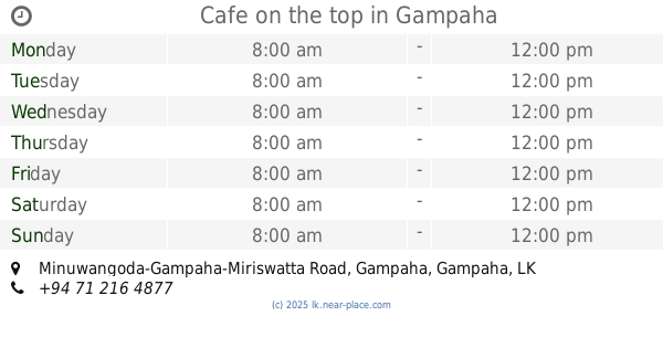
Minuwangoda-Gampaha-Miriswatta Road, Gampaha, Gampaha, LK Sri Lanka
contacts phone
:
+94 72 352 7435
Latitude:
7.0882275
, Longitude:
80.0064594
larger map & directions
read more
nearest Cafe
69 m
Perera & Sons
No.396/1 Brandiyamulla colombo Rd, Gampaha
Cafe
read more
281 m
BISTRO - CAFE - BAKERY
Siyane Road, Gampaha
Cafe
read more
460 m
College Canteen
Ihalagama West, Gampaha
Cafe
read more
594 m
More & More
Ja Ela-Ekala-Gampaha-Yakkala Hwy, Gampaha
Cafe
read more
594 m
More & More
A33, Gampaha
Cafe
read more
664 m
Tea Station
256 Colombo Road, Gampaha
Cafe
read more
790 m
Perera & Sons
Yakkala Road, Gampaha
Cafe
read more
833 m
JUC Cafe Arpico
Ja Ela-Ekala-Gampaha-Yakkala Highway, Gampaha
Cafe
read more
878 m
IDEAZ & Co.
No. 120, Johnkeells Housing Scheeme,, Enderamulla, Wattala,, Sri Lanka., Gampaha
Cafe
read more
893 m
Queen's Cafe
Marybiso Road, Gampaha
Cafe
read more
943 m
Amas Cafe
Marybiso Road, Gampaha
Cafe
read more
943 m
Amas Cafe
Queen Mary's Road, Gampaha
Cafe
read more
1.05 km
Fresh Bakes
Medagama 1, Gampaha
Cafe
read more
1.141 km
NLDB Milk stall
Medagama 4, Gampaha
Cafe
read more
1.239 km
Pink Cake Boutique | Cake Shops in Gampaha
No: 15, 15 Vijaya Road, Gampaha
Cafe
read more
1.286 km
Green Palace
24 Bauddhaloka Mawatha, Gampaha
Cafe
read more
1.349 km
Cafe T-Breeze
No 32, Courts Road, Gampaha
Cafe
read more
1.406 km
SEEDS - Juice Station
17 Marybiso Road, Gampaha
Cafe
read more
1.514 km
Nimaka Foods
Bus stop road, Gampaha
Cafe
read more
1.521 km
Isuru Caters Pvt Ltd
No 6 Oruthota Road (next to Gampaha railway Station
Cafe
read more
1.55 km
Cafe on the top
Minuwangoda-Gampaha-Miriswatta Road, Gampaha
Cafe
read more
1.669 km
Sharas Cafe
Medagama 2, Gampaha
Cafe
read more
1.721 km
Perera & Sons
112 Gampaha Fly Over, Gampaha
Cafe
read more
1.933 km
binoo Cafe & Juice bar...
Gampaha
Cafe
read more
1.984 km
Mom's Food
b292 Wathurugama Road, Gampaha
Cafe
read more
📑
all categories
Accounting
Administrative area level 1
Administrative area level 2
Airport
Amusement park
Aquarium
Art gallery
Atm
Bakery
Bank
Bar
Beauty salon
Bicycle store
Book store
Bowling alley
Bus station
Cafe
Campground
Car dealer
Car rental
Car repair
Car wash
Casino
Cemetery
Church
City hall
Clothing store
Colloquial area
Convenience store
Country
Courthouse
Dentist
Department store
Doctor
Electrician
Electronics store
Embassy
Finance
Fire station
Florist
Food
Funeral home
Furniture store
Gas station
General contractor
Grocery or supermarket
Gym
Hair care
Hardware store
Health
Hindu Temple
Home goods store
Hospital
Insurance agency
Intersection
Jewelry store
Laundry
Lawyer
Library
Light rail station
Liquor store
Local government office
Locality
Locksmith
Lodging
Meal delivery
Meal takeaway
Mosque
Movie rental
Movie theater
Moving company
Museum
Natural feature
Neighborhood
Night club
Painter
Park
Parking
Pet store
Pharmacy
Physiotherapist
Place of worship
Plumber
Point of interest
Police
Political
Post office
Premise
Real estate agency
Restaurant
Roofing contractor
Route
Rv park, camping
School
Shoe store
Shopping mall
Spa
Stadium
Storage
Store
Subpremise
Supermarket
Synagogue
Taxi stand
Train station
Transit station
Travel agency
University
Veterinary care
Zoo
administrative area level 3
sublocality level 1
sublocality level 2
↑