Cafe nearby Zion Fountain Cafe
Sri Lanka
Cafe nearby Zion Fountain Cafe
Zion Fountain Cafe
4, Vijaya Kumaratunge Mawatha, 00500, Colombo, Colombo, LK Sri Lanka
contacts phone
:
+94 77 751 0850
Latitude:
6.8867606
, Longitude:
79.8769533
larger map & directions
read more
nearest Cafe
293 m
TeaTalk
343 Park Road, Colombo
Cafe
read more
372 m
Cafe at Lanka Hospitals
Kirula, Colombo
Cafe
read more
507 m
Matara Tea Room
09, Anderson Flats, Park Road, Colombo
Cafe
read more
553 m
NLDB MILK BAR NAWALA
Colombo
Cafe
read more
562 m
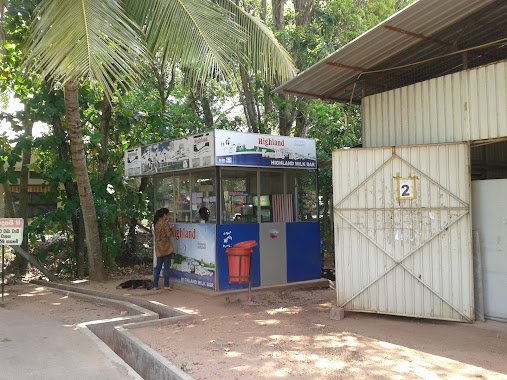
Highland Milk Bar Nawala
45 B307, Colombo
Cafe
read more
631 m
Café La Defence
124 Park Road, Colombo
Cafe
read more
816 m
Tasty Caterers
Fife Road, Colombo
Cafe
read more
825 m
Mr Baker
Kirimandala Mawatha, Colombo
Cafe
read more
831 m
Ice Cream Dhansal
Kirimandala Mawatha, Colombo
Cafe
read more
891 m
Open University Milk Bar
Nugegoda West, Colombo
Cafe
read more
892 m
Highland Shop
Colombo
Cafe
read more
907 m
The Vibe
Hotel Janaki, Fife Rd,, කොළඹ
Cafe
read more
936 m
Nito cab & Com
37A,, High Level Road, කොළඹ
Cafe
read more
964 m
Hansa Cafe
24 Fife Road, Colombo
Cafe
read more
977 m
Bombay Sweet City
00600, ශ්රී සම්බුද්ධත්ව ජයන්ති මාවත, කොළඹ
Cafe
read more
995 m
Bellissimo
15 Fife Road, Colombo
Cafe
read more
1.023 km
CAFE BLUEBERRY COLOMBO
Nawala Road, 27 D. M. Colombage Mawatha, Nugegoa
Cafe
read more
1.025 km
Cafe Blueberry
27, D. M. Colombage Mawatha, Colombo
Cafe
read more
1.055 km
Kopi Kade
15/3 Stratford Avenue, Colombo
Cafe
read more
1.073 km
The Regent - Hospital Outlet
Narahenpita, Colombo
Cafe
read more
1.099 km
Chocoholics
506 Havelock Road, Colombo
Cafe
read more
1.151 km
ROTI Cafe by the travelling KOMBI
Pamankada East, Colombo
Cafe
read more
1.222 km
Bubble Me Bubble Tea
106 Ven. Muruththettuwe Ananda Himi Mawatha, Colombo
Cafe
read more
2.025 km
Roo Snack Station
No. 15, Railway Avenue,, Nugegoda
Cafe
read more
2.282 km
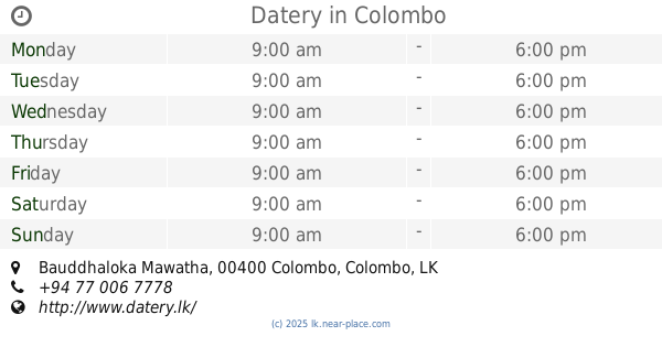
Datery
203C, Bauddhaloka Mawatha, Colombo
Cafe
read more
📑
all categories
Accounting
Administrative area level 1
Administrative area level 2
Airport
Amusement park
Aquarium
Art gallery
Atm
Bakery
Bank
Bar
Beauty salon
Bicycle store
Book store
Bowling alley
Bus station
Cafe
Campground
Car dealer
Car rental
Car repair
Car wash
Casino
Cemetery
Church
City hall
Clothing store
Colloquial area
Convenience store
Country
Courthouse
Dentist
Department store
Doctor
Electrician
Electronics store
Embassy
Finance
Fire station
Florist
Food
Funeral home
Furniture store
Gas station
General contractor
Grocery or supermarket
Gym
Hair care
Hardware store
Health
Hindu Temple
Home goods store
Hospital
Insurance agency
Intersection
Jewelry store
Laundry
Lawyer
Library
Light rail station
Liquor store
Local government office
Locality
Locksmith
Lodging
Meal delivery
Meal takeaway
Mosque
Movie rental
Movie theater
Moving company
Museum
Natural feature
Neighborhood
Night club
Painter
Park
Parking
Pet store
Pharmacy
Physiotherapist
Place of worship
Plumber
Point of interest
Police
Political
Post office
Premise
Real estate agency
Restaurant
Roofing contractor
Route
Rv park, camping
School
Shoe store
Shopping mall
Spa
Stadium
Storage
Store
Subpremise
Supermarket
Synagogue
Taxi stand
Train station
Transit station
Travel agency
University
Veterinary care
Zoo
administrative area level 3
sublocality level 1
sublocality level 2
↑