Cemetery nearby Public Cemetery
Sri Lanka
Cemetery nearby Public Cemetery
Public Cemetery
Sainthamaruthu 32300, Sri Lanka
contacts phone
:
+94
Latitude:
7.3921096
, Longitude:
81.8445423
larger map & directions
read more
nearest Cemetery
18 m
Common Cemetery 3
Sainthamaruthu
Cemetery
read more
546 m
Akbar Mosque Cemetery - 1
Sainthamaruthu
Cemetery
read more
600 m
Maligaikadu Muslim Cemetery
Karaitivu
Cemetery
read more
645 m
Akbar Mosque Cemetery - 2
Sainthamaruthu
Cemetery
read more
2.352 km
Kalmunai Muslim Burial Ground
Kalmunai
Cemetery
read more
2.621 km
General Cemetery
Kalmunai
Cemetery
read more
2.952 km
Karaitivu Hindu Cemntry
Ampara
Cemetery
read more
2.955 km
காரைதீவு இந்து மயானம்
Karaitivu
Cemetery
read more
4.224 km
Nintavur Muslim Burial Ground
Nintavur
Cemetery
read more
4.563 km
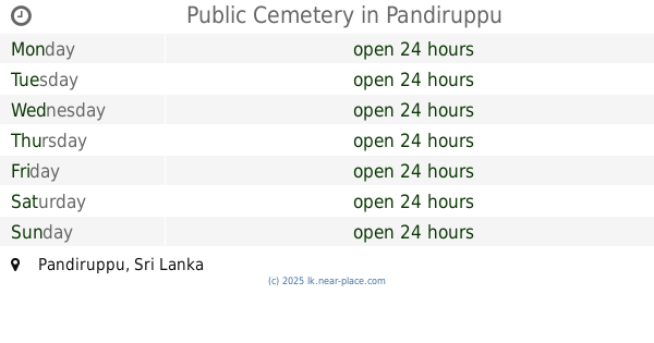
Public Cemetery
Pandiruppu
Cemetery
read more
4.569 km
Pandiruppu Cemetery
Pandiruppu
Cemetery
read more
5.104 km
Muslim Burial Ground
Sammanthurai
Cemetery
read more
5.289 km
Maruthamunai Cemetery
Maruthamunai
Cemetery
read more
5.4 km
Muslim Burial Ground, Nintaur
Nintavur
Cemetery
read more
5.672 km
Cemetery
Sri Lanka
Cemetery
read more
5.945 km
Akbar Mosque Cemetery
Maruthamunai
Cemetery
read more
13.808 km
Muslims Burial Ground
Palamunai
Cemetery
read more
13.834 km
Muslim Burial Ground
#32354, Palamunai
Cemetery
read more
13.96 km
கு௫மண்வெளி மயானம்
Kaluwanchikudy
Cemetery
read more
14.886 km
Kaluwanchikudy Cemetry
Batticaloa
Cemetery
read more
15.048 km
Konawatha Muslim Cemetery
Addalaichenai
Cemetery
read more
17.57 km
Thaikka Vaadi Burial Ground
Akkaraipattu
Cemetery
read more
19.646 km
Public Cemetery 2
Sri Lanka
Cemetery
read more
22.508 km
Public Cemetery Uhana
Sri Lanka
Cemetery
read more
22.53 km
Uhana Public Cemetery
Ampara
Cemetery
read more
📑
all categories
Accounting
Administrative area level 1
Administrative area level 2
Airport
Amusement park
Aquarium
Art gallery
Atm
Bakery
Bank
Bar
Beauty salon
Bicycle store
Book store
Bowling alley
Bus station
Cafe
Campground
Car dealer
Car rental
Car repair
Car wash
Casino
Cemetery
Church
City hall
Clothing store
Colloquial area
Convenience store
Country
Courthouse
Dentist
Department store
Doctor
Electrician
Electronics store
Embassy
Finance
Fire station
Florist
Food
Funeral home
Furniture store
Gas station
General contractor
Grocery or supermarket
Gym
Hair care
Hardware store
Health
Hindu Temple
Home goods store
Hospital
Insurance agency
Intersection
Jewelry store
Laundry
Lawyer
Library
Light rail station
Liquor store
Local government office
Locality
Locksmith
Lodging
Meal delivery
Meal takeaway
Mosque
Movie rental
Movie theater
Moving company
Museum
Natural feature
Neighborhood
Night club
Painter
Park
Parking
Pet store
Pharmacy
Physiotherapist
Place of worship
Plumber
Point of interest
Police
Political
Post office
Premise
Real estate agency
Restaurant
Roofing contractor
Route
Rv park, camping
School
Shoe store
Shopping mall
Spa
Stadium
Storage
Store
Subpremise
Supermarket
Synagogue
Taxi stand
Train station
Transit station
Travel agency
University
Veterinary care
Zoo
administrative area level 3
sublocality level 1
sublocality level 2
↑