Church nearby Church Of Perigreen
Sri Lanka
Church nearby Church Of Perigreen
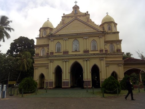
Church Of Perigreen
Rata Mada Paara Sri Lanka
contacts phone
:
+94
Latitude:
7.5340528
, Longitude:
79.900952
read more
nearest Church
3.998 km
Roman Catholic Church (Siyabalagasruppuwa)
Sri Lanka
Church
read more
4.875 km
Infant Of Jesus church
Dummalasuriya
Church
read more
4.875 km
Infant Of Jesuse church
Dummalasuriya
Church
read more
4.96 km
Methodistha Church Sembukattiya
Uraliyagara-Panirendawa-Villattewa Road
Church
read more
5.275 km
St.Jude Church Pothuvila.
Kurunegala, Narammala-Madampe Road, Pothuvila
Church
read more
6.374 km
Assembly of God, Madampe
Samagi Road, Madampe
Church
read more
7.742 km
නෙළුම්පොකුණ තණිවැල්ල පුරාණ දේවස්ථානය
Madampe
Church
read more
8.325 km
Gethsemane Church
pandiwela
Church
read more
9.544 km
Bandarawatta Church
Puttalam
Church
read more
11.643 km
Prasannagama Catholic Church
Sri Lanka
Church
read more
11.75 km
Ambakandawila Roman Catholic Church
Ambakandawila
Church
read more
12.36 km
St Anthony's Shrine
Thoduwawa
Church
read more
12.679 km
Jesus Statue
Chilaw
Church
read more
12.933 km
St. Jude Chatholic Church
Dunkannawa Dialog, Marawila-Udubaddawa Road
Church
read more
12.934 km
St. Sebastian Church
Chilaw
Church
read more
13.138 km
Kumarakattuwa Church
B45
Church
read more
13.155 km
Sadasarana Matha Church
Church
read more
13.202 km
St.Joseph Vaz Church
Chilaw
Church
read more
13.222 km
Sri Kurusa Church
Beach Road, Kudamaduwella
Church
read more
13.793 km
ST Sebastion Church
Egodawatta Road, Chilaw
Church
read more
14.378 km
Shrine of Lourdes
B272, Nattandiya
Church
read more
14.615 km
Thoduwawa Chatholic Church
Sri Lanka
Church
read more
15.052 km
St. Anthony's Church
Karukupone Road, Kottapitiya, Karukupone Road
Church
read more
15.959 km
Marawila Kanikkamatha Church
Marawila
Church
read more
16.72 km
Holy Cross Church කුරුස පල්ලිය
Marawila
Church
read more
📑
all categories
Accounting
Administrative area level 1
Administrative area level 2
Airport
Amusement park
Aquarium
Art gallery
Atm
Bakery
Bank
Bar
Beauty salon
Bicycle store
Book store
Bowling alley
Bus station
Cafe
Campground
Car dealer
Car rental
Car repair
Car wash
Casino
Cemetery
Church
City hall
Clothing store
Colloquial area
Convenience store
Country
Courthouse
Dentist
Department store
Doctor
Electrician
Electronics store
Embassy
Finance
Fire station
Florist
Food
Funeral home
Furniture store
Gas station
General contractor
Grocery or supermarket
Gym
Hair care
Hardware store
Health
Hindu Temple
Home goods store
Hospital
Insurance agency
Intersection
Jewelry store
Laundry
Lawyer
Library
Light rail station
Liquor store
Local government office
Locality
Locksmith
Lodging
Meal delivery
Meal takeaway
Mosque
Movie rental
Movie theater
Moving company
Museum
Natural feature
Neighborhood
Night club
Painter
Park
Parking
Pet store
Pharmacy
Physiotherapist
Place of worship
Plumber
Point of interest
Police
Political
Post office
Premise
Real estate agency
Restaurant
Roofing contractor
Route
Rv park, camping
School
Shoe store
Shopping mall
Spa
Stadium
Storage
Store
Subpremise
Supermarket
Synagogue
Taxi stand
Train station
Transit station
Travel agency
University
Veterinary care
Zoo
administrative area level 3
sublocality level 1
sublocality level 2
↑