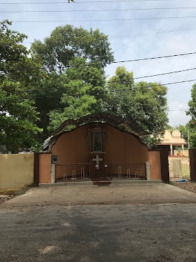
Church nearby Kingdom Hall of Jehovah's Witnesses
Sri Lanka
Church nearby Kingdom Hall of Jehovah's Witnesses
Kingdom Hall of Jehovah's Witnesses
Kovil Road, Jaffna, Jaffna, LK Sri Lanka
contacts phone
:
+94
website:
jw.org
Latitude:
9.6659737
, Longitude:
80.0271285
larger map & directions
read more
nearest Church
192 m
St.Theresa Church
Rakka Road, Jaffna
Church
read more
444 m
Trumpet Sound Church
Kachcheri Nallur Road, Jaffna
Church
read more
527 m
Allaipiddy Madha Church
word no 2 allaipiddi, Jaffna
Church
read more
550 m
Assembly Of God Church
Jaffna
Church
read more
603 m
Arul Matha Church
Jaffna
Church
read more
612 m
St John Baptist's
Hospital Street, Jaffna
Church
read more
643 m
Seventh Day Adventist Church Jaffna
850 Hospital Road, Jaffna
Church
read more
816 m
Ceylon Pentecostal Mission
Jaffna
Church
read more
855 m
St. Mary's Church, Sillalai
Sillalai Main Road, Jaffna
Church
read more
858 m
St Benedict's Church ශාන්ත බෙනඩික්ට්ස් පල්ලිය
Jaffna
Church
read more
875 m
St Martin's Seminary
Kovil Road, Jaffna
Church
read more
962 m
St John's Church
Chundukuli
Church
read more
1.01 km
BUDAN SARANAN GACHCHAMI BUDDHIST CENTRE
Jaffna
Church
read more
1.023 km
Our Lady of Refuge Church
4th Cross Street, Jaffna
Church
read more
1.125 km
Cathedral Mission House
Jaffna
Church
read more
1.191 km
Kantharmadam Annathaanasataram
Jaffna
Church
read more
1.333 km
St Ann's Church
Columbuthurai Road, Jaffna
Church
read more
1.372 km
Our lady of ava maria jaffna
Bankshall Street, Jaffna
Church
read more
1.552 km
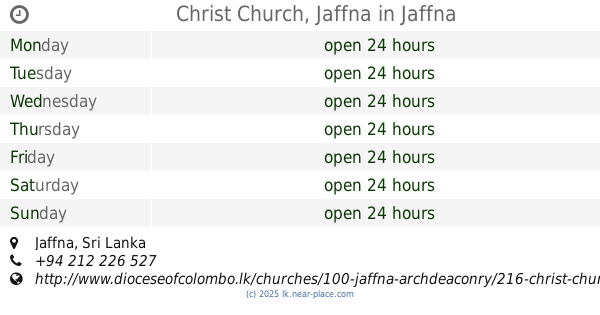
Christ Church, Jaffna
Jaffna
Church
read more
1.631 km
St.sebastian church
Beach Road, Jaffna
Church
read more
1.842 km
Mary church
Jaffna
Church
read more
1.861 km
King of Christ Church
Jaffna
Church
read more
1.953 km
St.John's Baptist Church
Hospital Road, Jaffna
Church
read more
2.125 km
Our Lady of Rosary Church
Jaffna
Church
read more
2.232 km
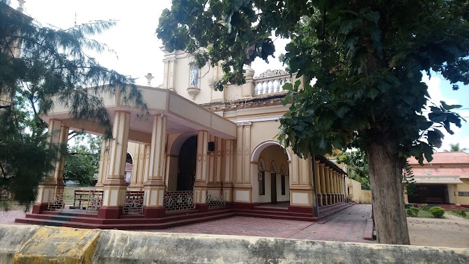
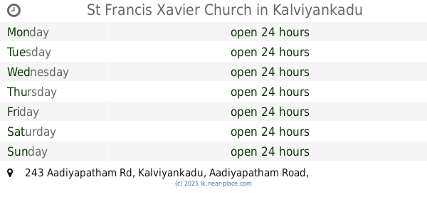
St Francis Xavier Church
243 Aadiyapatham Rd, Kalviyankadu Aadiyapatham Road, Kalviyankadu
Church
read more
📑
all categories
Accounting
Administrative area level 1
Administrative area level 2
Airport
Amusement park
Aquarium
Art gallery
Atm
Bakery
Bank
Bar
Beauty salon
Bicycle store
Book store
Bowling alley
Bus station
Cafe
Campground
Car dealer
Car rental
Car repair
Car wash
Casino
Cemetery
Church
City hall
Clothing store
Colloquial area
Convenience store
Country
Courthouse
Dentist
Department store
Doctor
Electrician
Electronics store
Embassy
Finance
Fire station
Florist
Food
Funeral home
Furniture store
Gas station
General contractor
Grocery or supermarket
Gym
Hair care
Hardware store
Health
Hindu Temple
Home goods store
Hospital
Insurance agency
Intersection
Jewelry store
Laundry
Lawyer
Library
Light rail station
Liquor store
Local government office
Locality
Locksmith
Lodging
Meal delivery
Meal takeaway
Mosque
Movie rental
Movie theater
Moving company
Museum
Natural feature
Neighborhood
Night club
Painter
Park
Parking
Pet store
Pharmacy
Physiotherapist
Place of worship
Plumber
Point of interest
Police
Political
Post office
Premise
Real estate agency
Restaurant
Roofing contractor
Route
Rv park, camping
School
Shoe store
Shopping mall
Spa
Stadium
Storage
Store
Subpremise
Supermarket
Synagogue
Taxi stand
Train station
Transit station
Travel agency
University
Veterinary care
Zoo
administrative area level 3
sublocality level 1
sublocality level 2
↑