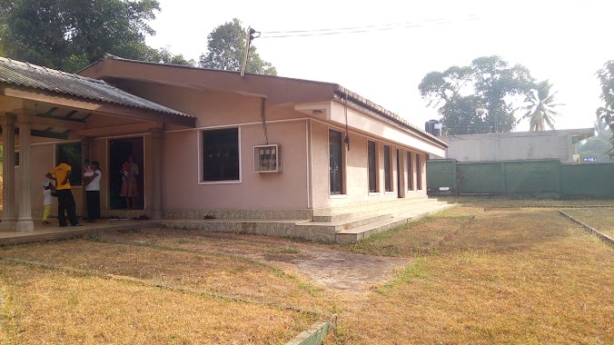
Doctor nearby Pallegama Kadum Bidum Ayuruweda Center
Sri Lanka
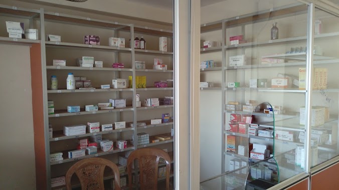
Doctor nearby Pallegama Kadum Bidum Ayuruweda Center
Pallegama Kadum Bidum Ayuruweda Center
Gampaha, Sri Lanka
contacts phone
:
+94 71 633 5135
Latitude:
7.2265738
, Longitude:
80.0059769
larger map & directions
read more
nearest Doctor
6.81 km
SahasSri Medical Center
Negombo - Mirigama Road, Banduragoda
Doctor
read more
7.357 km
Medical center
Sri Lanka
Doctor
read more
8.253 km
Balabowa Meditation Center
Gampaha
Doctor
read more
8.264 km
Doctor Clinic For Children
Minuwangoda
Doctor
read more
8.55 km
Family Dental Clinic
Minuwangoda
Doctor
read more
8.897 km
Dr. Roy Rajapaksha
Katunayake-Veyangoda Road, Minuwangoda
Doctor
read more
9.042 km
Medical Center
Minuwangoda
Doctor
read more
9.108 km
Dundeniya weda
Gampaha
Doctor
read more
9.544 km
Dr. Piyasena
B445, Veyangoda
Doctor
read more
9.597 km
medi care
Ekala-Kotadeniyawa Road, Minuwangoda
Doctor
read more
11.081 km
Dr. Dilan Sydney Fernando's Clinic
Gorden City, Katana
Doctor
read more
11.618 km
Sominiwasa
Bemmulla Aluthgama Road, Bemmulla
Doctor
read more
12.015 km
Suwaya Medical Center
Kaleliya
Doctor
read more
12.854 km
Rangiri Suwa Madura
Sri Lanka
Doctor
read more
13.044 km
Sidhdhayurveda Vaidya Madyasthanaya
Kalagedihena
Doctor
read more
13.095 km
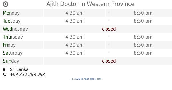
Ajith Doctor
Sri Lanka
Doctor
read more
13.646 km
Swasthika Ayurweda
Welpalla-Makandura Road, Eliwila
Doctor
read more
13.664 km
Kaththota Ayurveda center
Daham Mawatha, Kalagedihena
Doctor
read more
13.948 km
Asgiriya Clinic
Minuwangoda-Gampaha-Miriswatta Road, Gampaha
Doctor
read more
14.574 km
Medical Clinc Dermatologist
Kotugoda
Doctor
read more
14.998 km
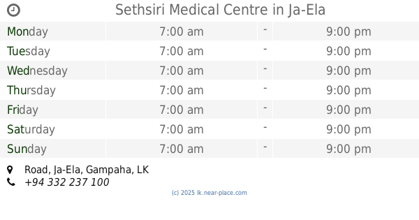
Sethsiri Medical Centre
11/A, Road, Ja-Ela
Doctor
read more
15.251 km
Dr. Senevirathne
Srimath Ranasinghe Premadasa Mawatha, Katunayake
Doctor
read more
15.836 km
Niwasi Medical Center
Nivasie Pura
Doctor
read more
17.169 km
Medical Center ( Dr. Nikujani Widisinghe )
Sri Lanka
Doctor
read more
18.2 km
Ekala Medicare
Ja-Ela
Doctor
read more
📑
all categories
Accounting
Administrative area level 1
Administrative area level 2
Airport
Amusement park
Aquarium
Art gallery
Atm
Bakery
Bank
Bar
Beauty salon
Bicycle store
Book store
Bowling alley
Bus station
Cafe
Campground
Car dealer
Car rental
Car repair
Car wash
Casino
Cemetery
Church
City hall
Clothing store
Colloquial area
Convenience store
Country
Courthouse
Dentist
Department store
Doctor
Electrician
Electronics store
Embassy
Finance
Fire station
Florist
Food
Funeral home
Furniture store
Gas station
General contractor
Grocery or supermarket
Gym
Hair care
Hardware store
Health
Hindu Temple
Home goods store
Hospital
Insurance agency
Intersection
Jewelry store
Laundry
Lawyer
Library
Light rail station
Liquor store
Local government office
Locality
Locksmith
Lodging
Meal delivery
Meal takeaway
Mosque
Movie rental
Movie theater
Moving company
Museum
Natural feature
Neighborhood
Night club
Painter
Park
Parking
Pet store
Pharmacy
Physiotherapist
Place of worship
Plumber
Point of interest
Police
Political
Post office
Premise
Real estate agency
Restaurant
Roofing contractor
Route
Rv park, camping
School
Shoe store
Shopping mall
Spa
Stadium
Storage
Store
Subpremise
Supermarket
Synagogue
Taxi stand
Train station
Transit station
Travel agency
University
Veterinary care
Zoo
administrative area level 3
sublocality level 1
sublocality level 2
↑