Gas station nearby Boyawalana Stores
Sri Lanka
Gas station nearby Boyawalana Stores
Boyawalana Stores
Alawwa-Maharagama Road, Boyawalana, Kurunegala, LK Sri Lanka
contacts phone
:
+94 77 267 8987
Latitude:
7.3349014
, Longitude:
80.1762438
larger map & directions
read more
nearest Gas station
44 m
Fuel Station
Alawwa-Maharagama Road, Alawwa
Gas station
read more
2.458 km
Jayam Tex
Alawwa-Maharagama Road
Gas station
read more
3.544 km
Ceylon Oill Mart
Alawwa-Maharagama Road, Giriulla
Gas station
read more
3.804 km
CEPETCO Fuel Station
Giriulla
Gas station
read more
4.608 km
Gas Station
Dambadeniya
Gas station
read more
4.951 km
Sudarshana Oil Mart, & Sudarshana Auto International
Negombo Road, Dambadeniya
Gas station
read more
4.975 km
Ceypetco Filling Station
Negombo Road, Dambadeniya
Gas station
read more
4.983 km
Nalinda Filling Station
Dambadeniya
Gas station
read more
5.957 km
Fuel Station
AB29, Giriulla
Gas station
read more
6.298 km
Cooperative Fuel Station
Giriulla
Gas station
read more
6.686 km
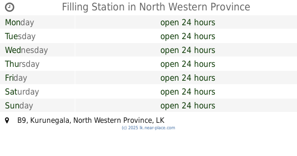
Filling Station
B9
Gas station
read more
7.764 km
CEYPETCO Samansiri Enterprises
Kurunegala
Gas station
read more
8.295 km
Peramuna Filling Station
Gas station
read more
8.493 km
Cepetco Fual Station
Kandalama Junction
Gas station
read more
10.393 km
Ambepussa Fuel Mart
Sri Lanka
Gas station
read more
10.751 km
Mirigama CEYPETCO Filling Station
Mirigama
Gas station
read more
11.62 km
Gas Station
Narammala
Gas station
read more
11.951 km
Cepetco Filling Station
Warakapola
Gas station
read more
11.99 km
Lanka Filling Station.
Negombo-Kurunegala Road, Bopitiya
Gas station
read more
11.991 km
Wijayarathna Filling Station
Mirigama
Gas station
read more
12.928 km
Jayathilake Filling Station
Kurunegala
Gas station
read more
13.189 km
Ceypetco Fuel Station
Kurunegala Road, Polgahawela
Gas station
read more
13.189 km
IOC Fuel Station
Kurunegala Road, Polgahawela
Gas station
read more
14.656 km
Fuel Mart
Nelundeniya
Gas station
read more
16.793 km
Jayakodi Fuel Station
B111
Gas station
read more
📑
all categories
Accounting
Administrative area level 1
Administrative area level 2
Airport
Amusement park
Aquarium
Art gallery
Atm
Bakery
Bank
Bar
Beauty salon
Bicycle store
Book store
Bowling alley
Bus station
Cafe
Campground
Car dealer
Car rental
Car repair
Car wash
Casino
Cemetery
Church
City hall
Clothing store
Colloquial area
Convenience store
Country
Courthouse
Dentist
Department store
Doctor
Electrician
Electronics store
Embassy
Finance
Fire station
Florist
Food
Funeral home
Furniture store
Gas station
General contractor
Grocery or supermarket
Gym
Hair care
Hardware store
Health
Hindu Temple
Home goods store
Hospital
Insurance agency
Intersection
Jewelry store
Laundry
Lawyer
Library
Light rail station
Liquor store
Local government office
Locality
Locksmith
Lodging
Meal delivery
Meal takeaway
Mosque
Movie rental
Movie theater
Moving company
Museum
Natural feature
Neighborhood
Night club
Painter
Park
Parking
Pet store
Pharmacy
Physiotherapist
Place of worship
Plumber
Point of interest
Police
Political
Post office
Premise
Real estate agency
Restaurant
Roofing contractor
Route
Rv park, camping
School
Shoe store
Shopping mall
Spa
Stadium
Storage
Store
Subpremise
Supermarket
Synagogue
Taxi stand
Train station
Transit station
Travel agency
University
Veterinary care
Zoo
administrative area level 3
sublocality level 1
sublocality level 2
↑