Gym nearby Absolute Gym
Sri Lanka
Gym nearby Absolute Gym
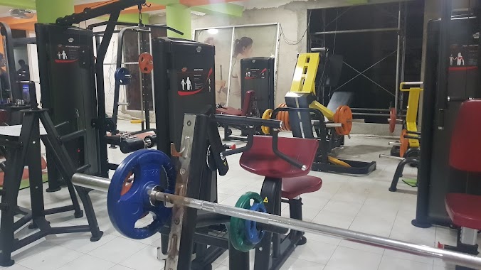
Absolute Gym
Nuwara Eliya 22200, Sri Lanka
contacts phone
:
+94
Latitude:
6.9728206
, Longitude:
80.7667945
larger map & directions
read more
nearest Gym
202 m
Rocky gym
Nuwara Eliya
Gym
read more
350 m
Lions Fitness
80, නුවර පාර, නාවලපිටිය
Gym
read more
3.558 km
thanajeyan
no 53 sripura bogawantalawa, hatton, Nuwara Eliya
Gym
read more
10.136 km
Henfold Estate
Henfold Estate, Lindula, Sri Lanka
Gym
read more
12.264 km
Rookwood Resort
Nuwara Eliya
Gym
read more
17.929 km
sun Gym
B48, Welimada
Gym
read more
20.612 km
Gym
Sri Lanka
Gym
read more
22.687 km
Eager
Hanguranketa
Gym
read more
23.097 km
Wewa play ground
Hanguranketa
Gym
read more
23.317 km
Mount view
L120, Muslim Colony Road, Deltota
Gym
read more
23.452 km
Sangarajagama play Ground
Sangarajagama Road, Hanguranketa
Gym
read more
23.92 km
Ilham’s friends zone
Hapugastalawa
Gym
read more
26.841 km
One Tree Hill
Badulla
Gym
read more
27.983 km
Greystone Villa
Diyatalawa
Gym
read more
27.983 km
Greystone Villa
Diyathalawa
Gym
read more
28.795 km
Children's Park - Bandarawela
32/9 Esplanade Road, Bandarawela
Gym
read more
29.113 km
Welimada Gym
Welimada Road, Bandarawela
Gym
read more
30.071 km
Gampola futsal club
42 A ferry lane ferry lane, Gampola
Gym
read more
30.102 km
powerzone gym
Gampola Bridge Approach Road, Gampola
Gym
read more
30.445 km
Spartan Fitnes Centre
Malabar Street, Gampola
Gym
read more
30.487 km
Thusitha Fitness Center
Kandy Road, Gampola
Gym
read more
30.557 km
Royal Health Club
420, Peradeniya - Badulla - Chenkaladi Highway, Gampola
Gym
read more
30.615 km
Shyam Fitness centre
Gampola
Gym
read more
31.152 km
Health 1st Fitness Center
Rathmalkaduwa Road, Gampola
Gym
read more
40.245 km
Vaaj Fitness Centre Kandy
20000, 202 Katugastota Road, මහනුවර
Gym
read more
📑
all categories
Accounting
Administrative area level 1
Administrative area level 2
Airport
Amusement park
Aquarium
Art gallery
Atm
Bakery
Bank
Bar
Beauty salon
Bicycle store
Book store
Bowling alley
Bus station
Cafe
Campground
Car dealer
Car rental
Car repair
Car wash
Casino
Cemetery
Church
City hall
Clothing store
Colloquial area
Convenience store
Country
Courthouse
Dentist
Department store
Doctor
Electrician
Electronics store
Embassy
Finance
Fire station
Florist
Food
Funeral home
Furniture store
Gas station
General contractor
Grocery or supermarket
Gym
Hair care
Hardware store
Health
Hindu Temple
Home goods store
Hospital
Insurance agency
Intersection
Jewelry store
Laundry
Lawyer
Library
Light rail station
Liquor store
Local government office
Locality
Locksmith
Lodging
Meal delivery
Meal takeaway
Mosque
Movie rental
Movie theater
Moving company
Museum
Natural feature
Neighborhood
Night club
Painter
Park
Parking
Pet store
Pharmacy
Physiotherapist
Place of worship
Plumber
Point of interest
Police
Political
Post office
Premise
Real estate agency
Restaurant
Roofing contractor
Route
Rv park, camping
School
Shoe store
Shopping mall
Spa
Stadium
Storage
Store
Subpremise
Supermarket
Synagogue
Taxi stand
Train station
Transit station
Travel agency
University
Veterinary care
Zoo
administrative area level 3
sublocality level 1
sublocality level 2
↑