Gym nearby Muscle Max
Sri Lanka
Gym nearby Muscle Max
Muscle Max
Peliyagoda Pattiya East, Peliyagoda, Sri Lanka
contacts phone
:
+94 77 279 3893
Latitude:
6.9658272
, Longitude:
79.8979085
larger map & directions
read more
nearest Gym
233 m
Fitness Kingdom Kelaniya
26/1 waragoda road, thorana junction, kelaniya, Waragoda Road
Gym
read more
503 m
Power Gym
Wattala
Gym
read more
1.446 km
Power world fitness center
152/1, 2nd floor, Dippitigoda Road
Gym
read more
1.536 km
Homeopathic Treatment Center
Kandy Road, Wattala
Gym
read more
1.61 km
Lifeline Fitness
267/10 Negombo-Colombo Main Road, Wattala
Gym
read more
1.657 km
IRONHIDE FITNESS CENTER
114C Negombo Road, Wattala
Gym
read more
1.694 km
Dynasty Dancing Classes
134/1 Negombo Road, Above Don & Sons), වත්තල
Gym
read more
1.752 km
Universal Gym
29/1,Tyre junction, Kandy Road, ,kiribathgoda,, Colombo
Gym
read more
1.804 km
fitness Center
410 A1, Peliyagoda
Gym
read more
1.823 km
Slim & Tone Fitness Centre
120 Negombo-Colombo Main Road, Wattala
Gym
read more
1.975 km
ESER Marketing
Gampaha
Gym
read more
2.073 km
Fitness Routine
205/1/1 Negombo-Colombo Main Road, Wattala
Gym
read more
2.1 km
Santhosh Shotgraphy
Mattakkuliya, 45/8b/111 kalani ganga, mill's road
Gym
read more
2.11 km
Fitness Genesis
Hunupitiya Road
Gym
read more
2.14 km
Super Gym Wattala
Hunupitiya East
Gym
read more
2.219 km
Royality Lanka
Colombo
Gym
read more
2.251 km
Lifeline Fitness Centre
267/10 Negombo-Colombo Main Road, Wattala
Gym
read more
2.714 km
Fitness Plannet
Wattala
Gym
read more
2.786 km
Bryans Studio of Zumba Dance Fitness
Colombo - Kandy Road
Gym
read more
2.985 km
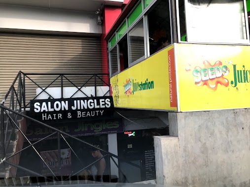
Salon Jingle
520A Negombo-Colombo Main Road, Wattala
Gym
read more
3 km
Musclen
Biyagama Road, Peliyagoda
Gym
read more
3.337 km
Bellatrix Fitness Center
Mahawela Gardens, Colombo
Gym
read more
3.462 km
Virtusa Gym
Kopiawatta, Colombo
Gym
read more
3.476 km
Iron Arm Gym
Sri Lanka
Gym
read more
3.701 km
Arnold Fitness Center
Vihara Maha Devi Road, Kiribathgoda
Gym
read more
📑
all categories
Accounting
Administrative area level 1
Administrative area level 2
Airport
Amusement park
Aquarium
Art gallery
Atm
Bakery
Bank
Bar
Beauty salon
Bicycle store
Book store
Bowling alley
Bus station
Cafe
Campground
Car dealer
Car rental
Car repair
Car wash
Casino
Cemetery
Church
City hall
Clothing store
Colloquial area
Convenience store
Country
Courthouse
Dentist
Department store
Doctor
Electrician
Electronics store
Embassy
Finance
Fire station
Florist
Food
Funeral home
Furniture store
Gas station
General contractor
Grocery or supermarket
Gym
Hair care
Hardware store
Health
Hindu Temple
Home goods store
Hospital
Insurance agency
Intersection
Jewelry store
Laundry
Lawyer
Library
Light rail station
Liquor store
Local government office
Locality
Locksmith
Lodging
Meal delivery
Meal takeaway
Mosque
Movie rental
Movie theater
Moving company
Museum
Natural feature
Neighborhood
Night club
Painter
Park
Parking
Pet store
Pharmacy
Physiotherapist
Place of worship
Plumber
Point of interest
Police
Political
Post office
Premise
Real estate agency
Restaurant
Roofing contractor
Route
Rv park, camping
School
Shoe store
Shopping mall
Spa
Stadium
Storage
Store
Subpremise
Supermarket
Synagogue
Taxi stand
Train station
Transit station
Travel agency
University
Veterinary care
Zoo
administrative area level 3
sublocality level 1
sublocality level 2
↑