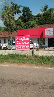
Health nearby Baunseth Maanasika Suwa Sewana
Sri Lanka
Health nearby Baunseth Maanasika Suwa Sewana
Baunseth Maanasika Suwa Sewana
Demalagamae, Sri Lanka
contacts phone
:
+94
Latitude:
6.9874771
, Longitude:
80.0403554
larger map & directions
read more
nearest Health
1.625 km
ශ්රී ජය නාථ ජීව අසපුව
Delgoda Delgoda-Pugoda Road
Health
read more
1.625 km
ශ්රී ජය නාථ ජීව අසපුව
Delgoda Delgoda-Pugoda-Girdara Road
Health
read more
1.686 km
CENTRAL Pharmacy
355 b, Delgoda Delgoda-Pugoda Road
Health
read more
1.686 km
CENTRAL Pharmacy
355 b, Delgoda Delgoda-Pugoda-Girdara Road
Health
read more
1.781 km
Kaduboda Maternity And Child Clinic
Sri Lanka
Health
read more
1.935 km
Thanoja Pharmacy
Delgoda-Pugoda Road
Health
read more
2.067 km
Sumathipala Meditation Central
Sri Lanka
Health
read more
2.067 km
Sumathipala Meditation Centre
Sri Lanka
Health
read more
2.067 km
Sumathipala Nahimi Senasun Arana
Heelbathgoda Road, Kanduboda, Delgoda
Health
read more
2.174 km
Pharmacy
Kanduboda East
Health
read more
2.89 km
Delgoda Medical Center
New Kandy Road, Weliweriya
Health
read more
3 km
Central Pharmacy
Central Pharmacy near Delgoda
Health
read more
3.04 km
Phamacy
Sri Lanka
Health
read more
3.238 km
Lanka Hospital Collection Center
Sri Lanka
Health
read more
3.277 km
Dr. K Mahesh M Perera
Sri Lanka
Health
read more
4.245 km
Welgama Medical Centre
559/B
Health
read more
4.272 km
Dr. M. R. J. G. Vidyarathne
Kalukondayawa West,, Kalukodayawa
Health
read more
4.427 km
Mookku Kannaadi Shop
Malwana Town
Health
read more
4.665 km
Kiyamudeen Dispensary
Malwana Town
Health
read more
4.668 km
Ayurwedhaya Dome
Aluth para Dompe
Health
read more
4.824 km
Ronim Nursing Home
605/5 DARANAGAMA, DELGODA
Health
read more
4.994 km
Ronim Nursing(pvt)Ltd
Daranagama
Health
read more
5.002 km
Ronim Nursing(pvt)Ltd.
605/5,, Daranagama Road
Health
read more
5.11 km
Kottayawatta Veda Gedara
82C1 Webada Road
Health
read more
5.113 km
Life Health Care
Weliweriya
Health
read more
📑
all categories
Accounting
Administrative area level 1
Administrative area level 2
Airport
Amusement park
Aquarium
Art gallery
Atm
Bakery
Bank
Bar
Beauty salon
Bicycle store
Book store
Bowling alley
Bus station
Cafe
Campground
Car dealer
Car rental
Car repair
Car wash
Casino
Cemetery
Church
City hall
Clothing store
Colloquial area
Convenience store
Country
Courthouse
Dentist
Department store
Doctor
Electrician
Electronics store
Embassy
Finance
Fire station
Florist
Food
Funeral home
Furniture store
Gas station
General contractor
Grocery or supermarket
Gym
Hair care
Hardware store
Health
Hindu Temple
Home goods store
Hospital
Insurance agency
Intersection
Jewelry store
Laundry
Lawyer
Library
Light rail station
Liquor store
Local government office
Locality
Locksmith
Lodging
Meal delivery
Meal takeaway
Mosque
Movie rental
Movie theater
Moving company
Museum
Natural feature
Neighborhood
Night club
Painter
Park
Parking
Pet store
Pharmacy
Physiotherapist
Place of worship
Plumber
Point of interest
Police
Political
Post office
Premise
Real estate agency
Restaurant
Roofing contractor
Route
Rv park, camping
School
Shoe store
Shopping mall
Spa
Stadium
Storage
Store
Subpremise
Supermarket
Synagogue
Taxi stand
Train station
Transit station
Travel agency
University
Veterinary care
Zoo
administrative area level 3
sublocality level 1
sublocality level 2
↑