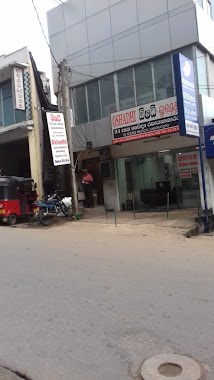
Health nearby OPD X-Ray Department
Sri Lanka
Health nearby OPD X-Ray Department
OPD X-Ray Department
Kandy, Sri Lanka
contacts phone
:
+94 812 222 261
Latitude:
7.2875177
, Longitude:
80.6319317
larger map & directions
read more
nearest Health
31 m
O.P.D.
General Hospital, Kandy
Health
read more
55 m
ENT Clinic
Kandy
Health
read more
59 m
Neuro/Medical Clinic
Unnamed Road, Kandy
Health
read more
68 m
Nuro Surgical Unit
Kandy
Health
read more
131 m
Sri Lanka Cancer Society- Kandy Branch
Kandy
Health
read more
137 m
Blood Bank Hospital Kandy
Teaching Hospital, William Gopallawa Mawatha, Kandy
Health
read more
190 m
Oshadhi Medical Laboratory Kandy
Kandy
Health
read more
194 m
Medical ward complex
Kandy
Health
read more
196 m
Oshadhi Laboratory-Kandy Branch
Kandy
Health
read more
277 m
Rajya Osusala
Kandy
Health
read more
283 m
AYFHS center Kandy
Kandy
Health
read more
304 m
Somasiri pharmacy
20000, Hunnasgiriya - Meemure Road
Health
read more
327 m
Asiri Laboratories
208 Peradeniya Road, Kandy
Health
read more
334 m
sadeepa nursing service office
Kandy
Health
read more
345 m
Durdans Laboratory Services
233 Kandy Hwy, Kandy 20000, Colombo
Health
read more
476 m
Harcourts Pharmacy
Kandy
Health
read more
492 m
CCC Channelled Consultation Centre
82 Colombo - Kandy Road, Kandy
Health
read more
498 m
Kumaran Pharmacy
219/A Peradeniya Road, Kandy
Health
read more
538 m
Sahana Laboratory, Kandy
Katukele, Kandy
Health
read more
622 m
Spc
12 Lamagaraya Road, Kandy
Health
read more
739 m
Durdens Medical Laboratory
Wadugodapitiya Lane, Kandy
Health
read more
744 m
Petro Medical Clinic
Kandy
Health
read more
886 m
Walk Aid
473/1 Peradeniya Road, Kandy
Health
read more
1.067 km
Kandy Eye Clinic - Dr. Abeysinghe
Kandy
Health
read more
1.111 km
Kandy Medicals
96 D S Senanayake Veediya, Kandy
Health
read more
📑
all categories
Accounting
Administrative area level 1
Administrative area level 2
Airport
Amusement park
Aquarium
Art gallery
Atm
Bakery
Bank
Bar
Beauty salon
Bicycle store
Book store
Bowling alley
Bus station
Cafe
Campground
Car dealer
Car rental
Car repair
Car wash
Casino
Cemetery
Church
City hall
Clothing store
Colloquial area
Convenience store
Country
Courthouse
Dentist
Department store
Doctor
Electrician
Electronics store
Embassy
Finance
Fire station
Florist
Food
Funeral home
Furniture store
Gas station
General contractor
Grocery or supermarket
Gym
Hair care
Hardware store
Health
Hindu Temple
Home goods store
Hospital
Insurance agency
Intersection
Jewelry store
Laundry
Lawyer
Library
Light rail station
Liquor store
Local government office
Locality
Locksmith
Lodging
Meal delivery
Meal takeaway
Mosque
Movie rental
Movie theater
Moving company
Museum
Natural feature
Neighborhood
Night club
Painter
Park
Parking
Pet store
Pharmacy
Physiotherapist
Place of worship
Plumber
Point of interest
Police
Political
Post office
Premise
Real estate agency
Restaurant
Roofing contractor
Route
Rv park, camping
School
Shoe store
Shopping mall
Spa
Stadium
Storage
Store
Subpremise
Supermarket
Synagogue
Taxi stand
Train station
Transit station
Travel agency
University
Veterinary care
Zoo
administrative area level 3
sublocality level 1
sublocality level 2
↑